Hamlin Topo Map New York
To zoom in, hover over the map of Hamlin
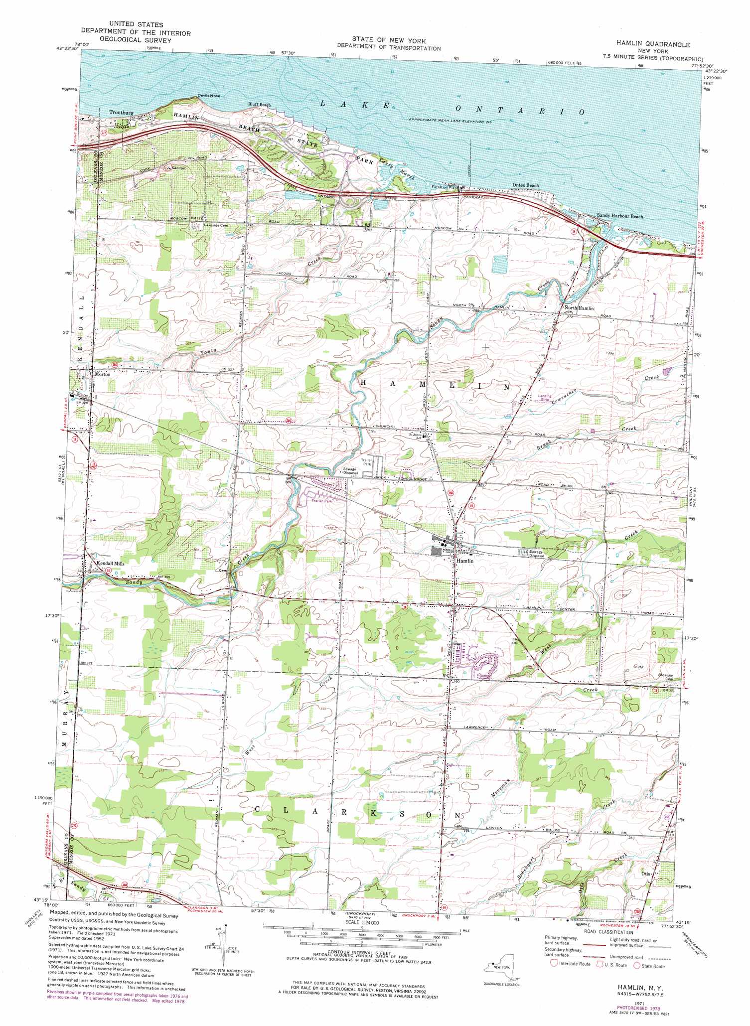
USGS Topo Quad 43077c8 - 1:24,000 scale
| Topo Map Name: | Hamlin |
| USGS Topo Quad ID: | 43077c8 |
| Print Size: | ca. 21 1/4" wide x 27" high |
| Southeast Coordinates: | 43.25° N latitude / 77.875° W longitude |
| Map Center Coordinates: | 43.3125° N latitude / 77.9375° W longitude |
| U.S. State: | NY |
| Filename: | o43077c8.jpg |
| Download Map JPG Image: | Hamlin topo map 1:24,000 scale |
| Map Type: | Topographic |
| Topo Series: | 7.5´ |
| Map Scale: | 1:24,000 |
| Source of Map Images: | United States Geological Survey (USGS) |
| Alternate Map Versions: |
Hamlin NY 1932 Download PDF Buy paper map Hamlin NY 1935 Download PDF Buy paper map Hamlin NY 1935, updated 1950 Download PDF Buy paper map Hamlin NY 1952, updated 1953 Download PDF Buy paper map Hamlin NY 1952, updated 1965 Download PDF Buy paper map Hamlin NY 1971, updated 1973 Download PDF Buy paper map Hamlin NY 1978, updated 1978 Download PDF Buy paper map Hamlin NY 2010 Download PDF Buy paper map Hamlin NY 2013 Download PDF Buy paper map Hamlin NY 2016 Download PDF Buy paper map |
1:24,000 Topo Quads surrounding Hamlin
Kent |
Kendall |
Hamlin |
Hilton |
Braddock Heights |
Albion |
Holley |
Brockport |
Spencerport |
Rochester West |
Batavia North |
Byron |
Churchville |
Clifton |
West Henrietta |
> Back to 43077a1 at 1:100,000 scale
> Back to 43076a1 at 1:250,000 scale
> Back to U.S. Topo Maps home
Hamlin topo map: Gazetteer
Hamlin: Airports
Para-Tech Airport elevation 121m 396′Hamlin: Capes
Devils Nose elevation 81m 265′Hamlin: Parks
Hamlin Beach State Park elevation 80m 262′Hamlin: Populated Places
Hamlin elevation 95m 311′Harper Park elevation 95m 311′
Kendall Mills elevation 108m 354′
Morton elevation 96m 314′
North Hamlin elevation 81m 265′
Onteo Beach elevation 77m 252′
Otis elevation 102m 334′
Sandy Harbour Beach elevation 76m 249′
Troutburg elevation 81m 265′
Hamlin: Streams
Sandy Creek elevation 75m 246′Yanty Creek elevation 75m 246′
Hamlin: Swamps
Yanty Marsh elevation 75m 246′Hamlin digital topo map on disk
Buy this Hamlin topo map showing relief, roads, GPS coordinates and other geographical features, as a high-resolution digital map file on DVD:
New York, Vermont, Connecticut & Western Massachusetts
Buy digital topo maps: New York, Vermont, Connecticut & Western Massachusetts