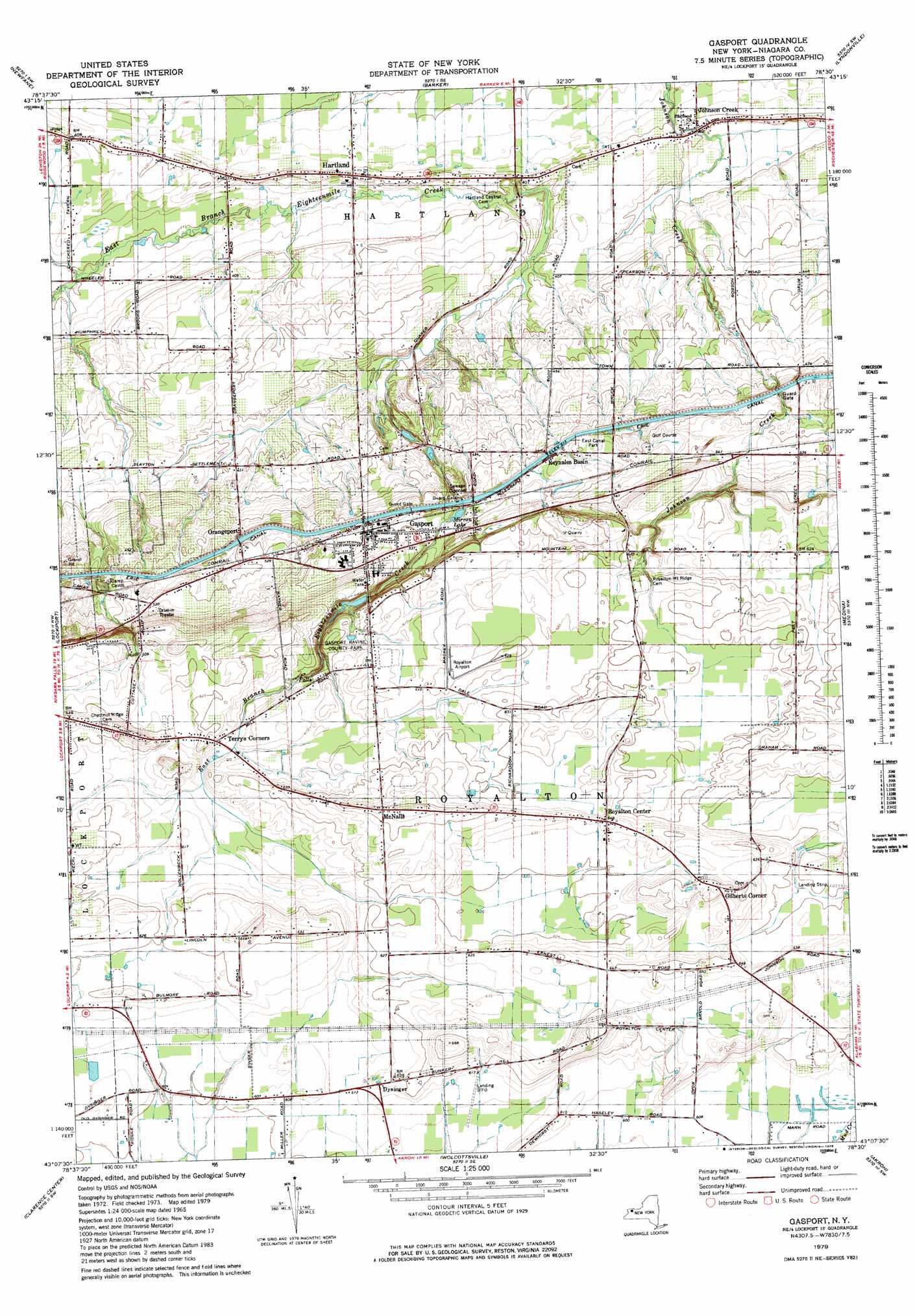
Gasport Topo Map New York
To zoom in, hover over the map of Gasport
USGS Topo Quad 43078b5 - 1:25,000 scale
| Topo Map Name: | Gasport |
| USGS Topo Quad ID: | 43078b5 |
| Print Size: | ca. 21 1/4" wide x 27" high |
| Southeast Coordinates: | 43.125° N latitude / 78.5° W longitude |
| Map Center Coordinates: | 43.1875° N latitude / 78.5625° W longitude |
| U.S. State: | NY |
| Filename: | l43078b5.jpg |
| Download Map JPG Image: | Gasport topo map 1:25,000 scale |
| Map Type: | Topographic |
| Topo Series: | 7.5´ |
| Map Scale: | 1:25,000 |
| Source of Map Images: | United States Geological Survey (USGS) |
| Alternate Map Versions: |
Gasport NY 1979, updated 1979 Download PDF Buy paper map Gasport NY 1979, updated 1979 Download PDF Buy paper map |
1:24,000 Topo Quads surrounding Gasport
Wilson |
Newfane |
Barker |
Lyndonville |
Ashwood |
Cambria |
Lockport |
Gasport |
Medina |
Knowlesville |
Tonawanda East |
Clarence Center |
Wolcottsville |
Akron |
Oakfield |
Buffalo Ne |
Clarence |
Alexander |
> Back to 43078a1 at 1:100,000 scale
> Back to 43078a1 at 1:250,000 scale
> Back to U.S. Topo Maps home
Gasport topo map: Gazetteer
Gasport: Airports
Royalton Airport elevation 189m 620′Gasport: Lakes
Mirror Lake elevation 157m 515′Gasport: Populated Places
Dysinger elevation 190m 623′Gasport elevation 157m 515′
Gilberts Corner elevation 201m 659′
Hartland elevation 123m 403′
Johnson Creek elevation 125m 410′
McNalls elevation 200m 656′
Orangeport elevation 158m 518′
Reynales Basin elevation 156m 511′
Royalton Center elevation 196m 643′
Terrys Corners elevation 186m 610′
Gasport digital topo map on disk
Buy this Gasport topo map showing relief, roads, GPS coordinates and other geographical features, as a high-resolution digital map file on DVD:
 map DVD")