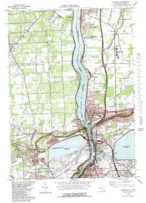
Lewiston Topo Map New York
To zoom in, hover over the map of Lewiston
USGS Topo Quad 43079b1 - 1:25,000 scale
| Topo Map Name: | Lewiston |
| USGS Topo Quad ID: | 43079b1 |
| Print Size: | ca. 21 1/4" wide x 27" high |
| Southeast Coordinates: | 43.125° N latitude / 79° W longitude |
| Map Center Coordinates: | 43.1875° N latitude / 79.0625° W longitude |
| U.S. State: | NY |
| Filename: | l43079b1.jpg |
| Download Map JPG Image: | Lewiston topo map 1:25,000 scale |
| Map Type: | Topographic |
| Topo Series: | 7.5´ |
| Map Scale: | 1:25,000 |
| Source of Map Images: | United States Geological Survey (USGS) |
| Alternate Map Versions: |
Lewiston NY 1980, updated 1981 Download PDF Buy paper map |
1:24,000 Topo Quads surrounding Lewiston
Fort Niagara |
Six Mile Creek |
Wilson |
||
Lewiston |
Ransomville |
Cambria |
||
Niagara Falls |
Tonawanda West |
Tonawanda East |
||
Buffalo Nw |
Buffalo Ne |
> Back to 43079a1 at 1:100,000 scale
> Back to 43078a1 at 1:250,000 scale
> Back to U.S. Topo Maps home
Lewiston topo map: Gazetteer
Lewiston: Airports
Dolansky Landing Strip elevation 92m 301′Saint Marys Heliport elevation 185m 606′
Lewiston: Bridges
Lewiston-Queenston Bridge elevation 85m 278′Lewiston: Gaps
Devils Hole elevation 134m 439′Lewiston: Parks
Brydges State Park elevation 155m 508′Devils Hole State Park elevation 157m 515′
Joseph Davis State Park elevation 95m 311′
Lower Niagara River State Park elevation 96m 314′
Niagara Falls Memorial Park elevation 186m 610′
Reservoir Park elevation 182m 597′
Lewiston: Populated Places
Blairville elevation 94m 308′Collingwood Estates elevation 93m 305′
Escarpment elevation 188m 616′
Lewiston elevation 116m 380′
Lewiston Heights elevation 186m 610′
Riverside Manors elevation 101m 331′
Rumsey Ridge elevation 186m 610′
Stella Niagara elevation 97m 318′
Varsity Village elevation 181m 593′
Youngstown elevation 90m 295′
Youngstown Estates elevation 92m 301′
Lewiston: Rapids
Devils Hole Rapids elevation 81m 265′Devils Holes elevation 99m 324′
Lewiston: Streams
Fish Creek elevation 77m 252′Lewiston digital topo map on disk
Buy this Lewiston topo map showing relief, roads, GPS coordinates and other geographical features, as a high-resolution digital map file on DVD:


