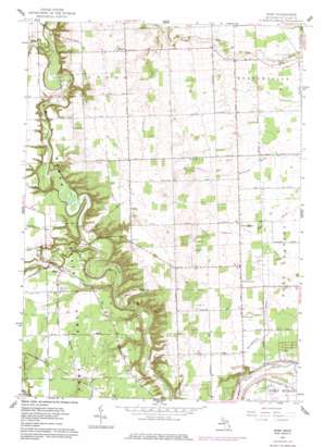
Ruby Topo Map Michigan
To zoom in, hover over the map of Ruby
USGS Topo Quad 43082a5 - 1:24,000 scale
| Topo Map Name: | Ruby |
| USGS Topo Quad ID: | 43082a5 |
| Print Size: | ca. 21 1/4" wide x 27" high |
| Southeast Coordinates: | 43° N latitude / 82.5° W longitude |
| Map Center Coordinates: | 43.0625° N latitude / 82.5625° W longitude |
| U.S. State: | MI |
| Filename: | o43082a5.jpg |
| Download Map JPG Image: | Ruby topo map 1:24,000 scale |
| Map Type: | Topographic |
| Topo Series: | 7.5´ |
| Map Scale: | 1:24,000 |
| Source of Map Images: | United States Geological Survey (USGS) |
| Alternate Map Versions: |
Ruby MI 1961, updated 1963 Download PDF Buy paper map Ruby MI 1961, updated 1978 Download PDF Buy paper map Ruby MI 1961, updated 1978 Download PDF Buy paper map Ruby MI 2011 Download PDF Buy paper map Ruby MI 2014 Download PDF Buy paper map Ruby MI 2016 Download PDF Buy paper map |
1:24,000 Topo Quads surrounding Ruby
Peck |
Applegate |
Croswell |
||
Yale |
Roseburg |
Jeddo |
||
Brockway |
Avoca |
Ruby |
Lakeport |
|
Memphis |
Goodells |
Smiths Creek |
Port Huron |
|
Richmond |
Adair |
Rattle Run |
Saint Clair |
> Back to 43082a1 at 1:100,000 scale
> Back to 43082a1 at 1:250,000 scale
> Back to U.S. Topo Maps home
Ruby topo map: Gazetteer
Ruby: Airports
BPS Heliport elevation 207m 679′Ruby: Canals
Brace Drain elevation 187m 613′Brandymore Drain elevation 187m 613′
Glyshaw Drain elevation 214m 702′
O'Dette Drain elevation 215m 705′
Ruby: Populated Places
Atkins elevation 224m 734′Blaine elevation 221m 725′
Ruby elevation 213m 698′
Ruby: Post Offices
Atkins Post Office (historical) elevation 224m 734′Blaine Post Office (historical) elevation 221m 725′
North Street Post Office elevation 195m 639′
Ruby Post Office (historical) elevation 213m 698′
Vincent Post Office (historical) elevation 195m 639′
Zion Post Office (historical) elevation 229m 751′
Ruby: Streams
Mill Creek elevation 181m 593′O'Loughlin Drain elevation 201m 659′
Plum Creek elevation 194m 636′
Ruby digital topo map on disk
Buy this Ruby topo map showing relief, roads, GPS coordinates and other geographical features, as a high-resolution digital map file on DVD:


