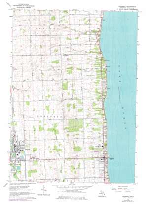
Croswell Topo Map Michigan
To zoom in, hover over the map of Croswell
USGS Topo Quad 43082c5 - 1:24,000 scale
| Topo Map Name: | Croswell |
| USGS Topo Quad ID: | 43082c5 |
| Print Size: | ca. 21 1/4" wide x 27" high |
| Southeast Coordinates: | 43.25° N latitude / 82.5° W longitude |
| Map Center Coordinates: | 43.3125° N latitude / 82.5625° W longitude |
| U.S. State: | MI |
| Filename: | o43082c5.jpg |
| Download Map JPG Image: | Croswell topo map 1:24,000 scale |
| Map Type: | Topographic |
| Topo Series: | 7.5´ |
| Map Scale: | 1:24,000 |
| Source of Map Images: | United States Geological Survey (USGS) |
| Alternate Map Versions: |
Croswell MI 1963, updated 1964 Download PDF Buy paper map Croswell MI 1963, updated 1977 Download PDF Buy paper map Croswell MI 2011 Download PDF Buy paper map Croswell MI 2014 Download PDF Buy paper map Croswell MI 2016 Download PDF Buy paper map |
1:24,000 Topo Quads surrounding Croswell
Palms |
Deckerville |
Richmondville |
||
Sandusky |
Carsonville |
Port Sanilac |
||
Peck |
Applegate |
Croswell |
||
Yale |
Roseburg |
Jeddo |
||
Brockway |
Avoca |
Ruby |
Lakeport |
> Back to 43082a1 at 1:100,000 scale
> Back to 43082a1 at 1:250,000 scale
> Back to U.S. Topo Maps home
Croswell topo map: Gazetteer
Croswell: Airports
Arnold Field elevation 237m 777′Arnold Lunding Field elevation 236m 774′
Croswell: Bridges
Harrington Bridge elevation 219m 718′Croswell: Harbors
Lexington State Harbor elevation 176m 577′Croswell: Parks
Charles H Moore Library Historical Marker elevation 189m 620′Harrington Street Park elevation 222m 728′
Lexington County Park elevation 178m 583′
Old Town Hall and Masonic Temple Historical Marker elevation 189m 620′
Riverbend Park elevation 222m 728′
Tierney Park elevation 178m 583′
Trinity Church Historical Marker elevation 188m 616′
Trinity Church Historical Marker (historical) elevation 223m 731′
Truman Park elevation 224m 734′
Croswell: Populated Places
Croswell elevation 223m 731′Lexington elevation 188m 616′
Lexington Mobile Home Park elevation 187m 613′
Pine Hill (historical) elevation 194m 636′
Sandpiper Estates Cooperative Mobile Home Park elevation 188m 616′
Croswell: Post Offices
Croswell Post Office elevation 223m 731′Falcon Post Office (historical) elevation 225m 738′
Lexington Post Office elevation 187m 613′
Pine Hill Post Office (historical) elevation 194m 636′
Croswell: Streams
Mills Creek elevation 218m 715′Pine Hill Stream elevation 176m 577′
Croswell digital topo map on disk
Buy this Croswell topo map showing relief, roads, GPS coordinates and other geographical features, as a high-resolution digital map file on DVD:


