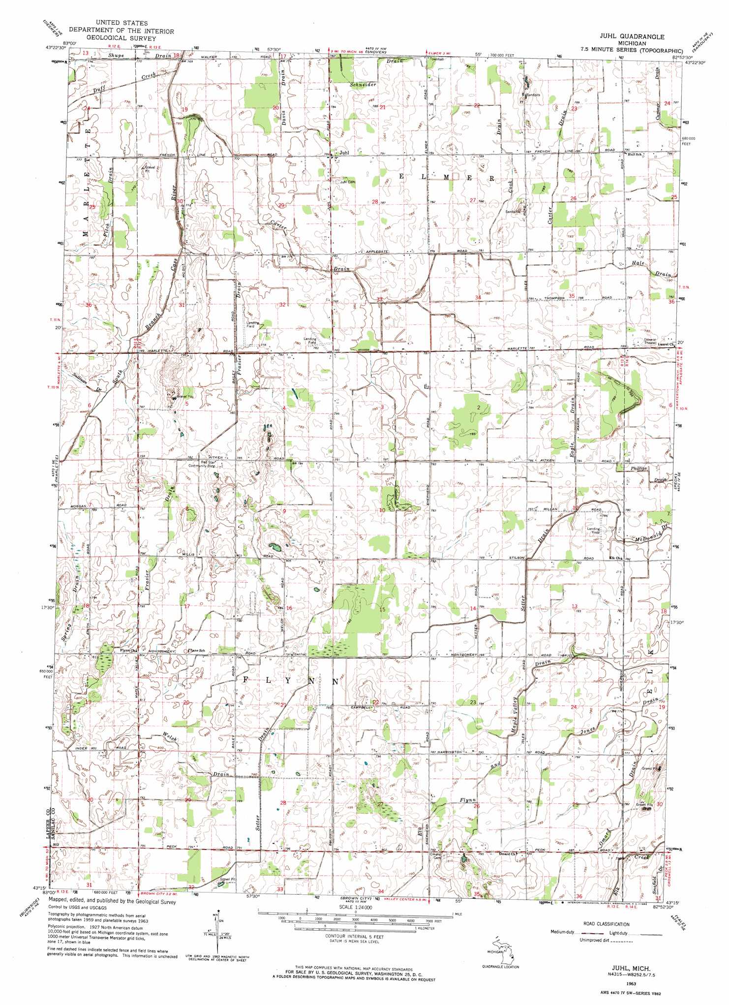
Juhl Topo Map Michigan
To zoom in, hover over the map of Juhl
USGS Topo Quad 43082c8 - 1:24,000 scale
| Topo Map Name: | Juhl |
| USGS Topo Quad ID: | 43082c8 |
| Print Size: | ca. 21 1/4" wide x 27" high |
| Southeast Coordinates: | 43.25° N latitude / 82.875° W longitude |
| Map Center Coordinates: | 43.3125° N latitude / 82.9375° W longitude |
| U.S. State: | MI |
| Filename: | o43082c8.jpg |
| Download Map JPG Image: | Juhl topo map 1:24,000 scale |
| Map Type: | Topographic |
| Topo Series: | 7.5´ |
| Map Scale: | 1:24,000 |
| Source of Map Images: | United States Geological Survey (USGS) |
| Alternate Map Versions: |
Juhl MI 1963, updated 1964 Download PDF Buy paper map Juhl MI 2011 Download PDF Buy paper map Juhl MI 2014 Download PDF Buy paper map Juhl MI 2016 Download PDF Buy paper map |
1:24,000 Topo Quads surrounding Juhl
Cass City |
Shabbona |
Argyle |
Palms |
Deckerville |
Kingston |
Decker |
Snover |
Sandusky |
Carsonville |
Clifford |
Marlette |
Juhl |
Peck |
Applegate |
North Branch |
Burnside |
Brown City |
Yale |
Roseburg |
Attica |
Imlay City |
Capac |
Brockway |
Avoca |
> Back to 43082a1 at 1:100,000 scale
> Back to 43082a1 at 1:250,000 scale
> Back to U.S. Topo Maps home
Juhl topo map: Gazetteer
Juhl: Canals
Carter Drain elevation 236m 774′Cook Drain elevation 239m 784′
Eagle Drain elevation 238m 780′
Elk Flynn and Maple Valley Drain elevation 236m 774′
Fitch Drain elevation 235m 770′
Frasier Drain elevation 239m 784′
Jones Drain elevation 235m 770′
Omard Drain elevation 237m 777′
Schneider Drain elevation 238m 780′
Setter Drain elevation 239m 784′
Shupe Drain elevation 233m 764′
Spring Drain elevation 239m 784′
Welch Drain elevation 240m 787′
Juhl: Populated Places
Juhl elevation 239m 784′Juhl: Post Offices
Juhl Post Office (historical) elevation 239m 784′Omard Post Office (historical) elevation 244m 800′
Juhl: Streams
Duff Creek elevation 233m 764′Juhl digital topo map on disk
Buy this Juhl topo map showing relief, roads, GPS coordinates and other geographical features, as a high-resolution digital map file on DVD:
 map DVD")