Port Sanilac Topo Map Michigan
To zoom in, hover over the map of Port Sanilac
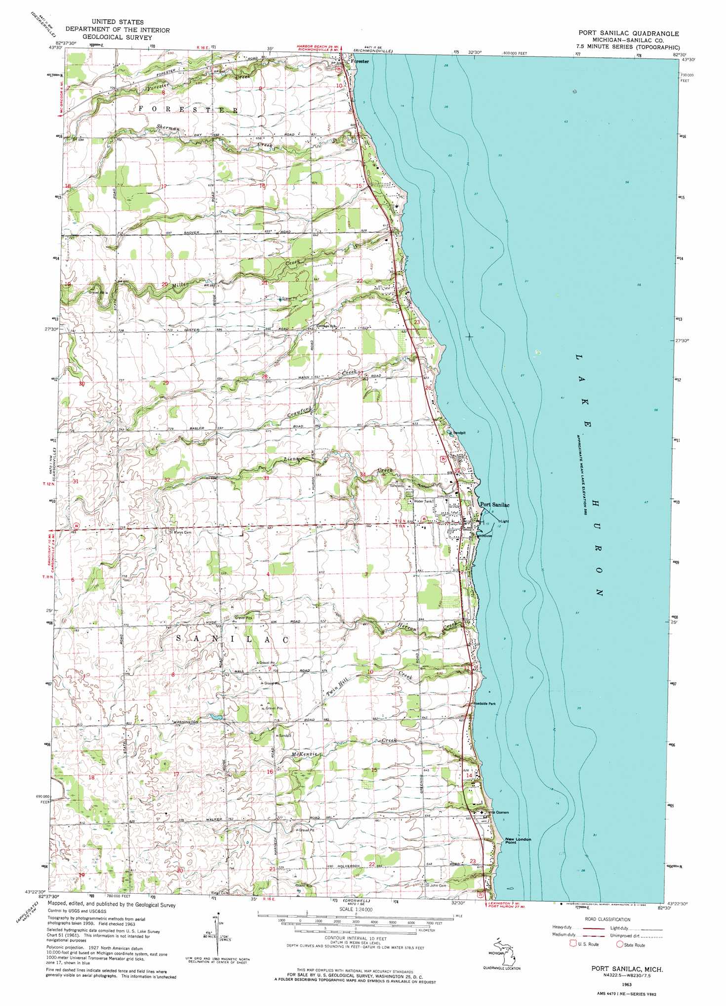
USGS Topo Quad 43082d5 - 1:24,000 scale
| Topo Map Name: | Port Sanilac |
| USGS Topo Quad ID: | 43082d5 |
| Print Size: | ca. 21 1/4" wide x 27" high |
| Southeast Coordinates: | 43.375° N latitude / 82.5° W longitude |
| Map Center Coordinates: | 43.4375° N latitude / 82.5625° W longitude |
| U.S. State: | MI |
| Filename: | o43082d5.jpg |
| Download Map JPG Image: | Port Sanilac topo map 1:24,000 scale |
| Map Type: | Topographic |
| Topo Series: | 7.5´ |
| Map Scale: | 1:24,000 |
| Source of Map Images: | United States Geological Survey (USGS) |
| Alternate Map Versions: |
Port Sanilac MI 1963, updated 1964 Download PDF Buy paper map Port Sanilac MI 2011 Download PDF Buy paper map Port Sanilac MI 2014 Download PDF Buy paper map Port Sanilac MI 2016 Download PDF Buy paper map |
1:24,000 Topo Quads surrounding Port Sanilac
Minden City |
Ruth |
Forestville |
||
Palms |
Deckerville |
Richmondville |
||
Sandusky |
Carsonville |
Port Sanilac |
||
Peck |
Applegate |
Croswell |
||
Yale |
Roseburg |
Jeddo |
> Back to 43082a1 at 1:100,000 scale
> Back to 43082a1 at 1:250,000 scale
> Back to U.S. Topo Maps home
Port Sanilac topo map: Gazetteer
Port Sanilac: Capes
New London Point elevation 177m 580′Port Sanilac: Parks
Great Storm of 1913 Historical Marker elevation 188m 616′Loop-Harrison House Historical Marker elevation 187m 613′
Masonic and Town Hall Historical Marker elevation 186m 610′
Port Sanilac: Populated Places
Forester elevation 186m 610′Huron Shores Estates Mobile Home Park elevation 182m 597′
Port Sanilac elevation 186m 610′
Port Sanilac: Post Offices
Forester Post Office (historical) elevation 186m 610′Port Sanilac Post Office elevation 186m 610′
Port Sanilac: Streams
Crawford Creek elevation 176m 577′Forester Creek elevation 177m 580′
Herron Creek elevation 176m 577′
Liens Creek elevation 176m 577′
McKenzie Creek elevation 176m 577′
Miller Creek elevation 177m 580′
Sherman Creek elevation 176m 577′
Twin Hill Creek elevation 176m 577′
Port Sanilac digital topo map on disk
Buy this Port Sanilac topo map showing relief, roads, GPS coordinates and other geographical features, as a high-resolution digital map file on DVD:
 map DVD")