Minden City Topo Map Michigan
To zoom in, hover over the map of Minden City
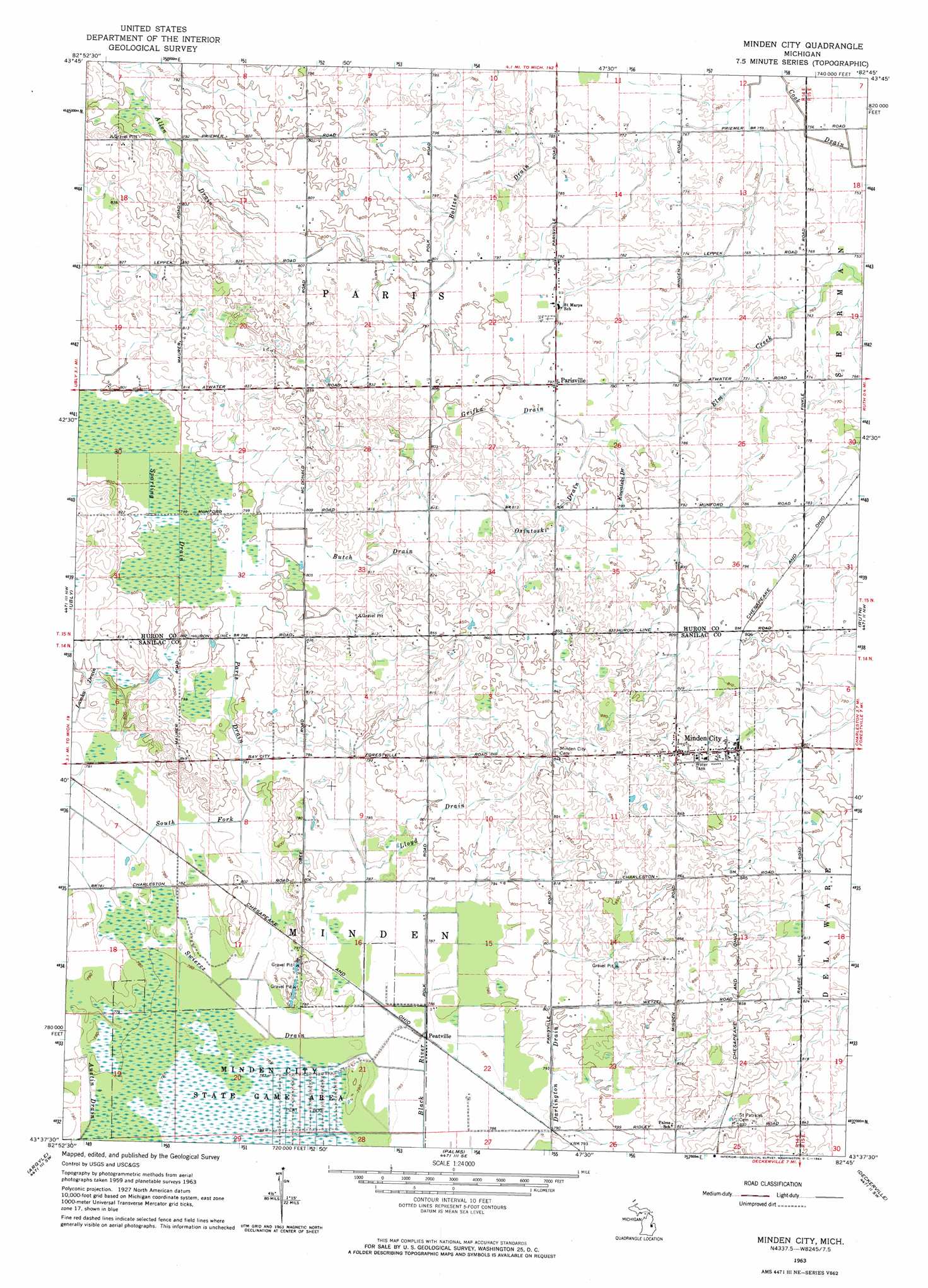
USGS Topo Quad 43082f7 - 1:24,000 scale
| Topo Map Name: | Minden City |
| USGS Topo Quad ID: | 43082f7 |
| Print Size: | ca. 21 1/4" wide x 27" high |
| Southeast Coordinates: | 43.625° N latitude / 82.75° W longitude |
| Map Center Coordinates: | 43.6875° N latitude / 82.8125° W longitude |
| U.S. State: | MI |
| Filename: | o43082f7.jpg |
| Download Map JPG Image: | Minden City topo map 1:24,000 scale |
| Map Type: | Topographic |
| Topo Series: | 7.5´ |
| Map Scale: | 1:24,000 |
| Source of Map Images: | United States Geological Survey (USGS) |
| Alternate Map Versions: |
Minden City MI 1963, updated 1964 Download PDF Buy paper map Minden City MI 2011 Download PDF Buy paper map Minden City MI 2014 Download PDF Buy paper map Minden City MI 2016 Download PDF Buy paper map |
1:24,000 Topo Quads surrounding Minden City
Kinde West |
Kinde East |
Redman |
Port Hope |
|
Bad Axe West |
Bad Axe East |
Bad Axe Se |
Harbor Beach |
|
New Greenleaf |
Ubly |
Minden City |
Ruth |
Forestville |
Shabbona |
Argyle |
Palms |
Deckerville |
Richmondville |
Decker |
Snover |
Sandusky |
Carsonville |
Port Sanilac |
> Back to 43082e1 at 1:100,000 scale
> Back to 43082a1 at 1:250,000 scale
> Back to U.S. Topo Maps home
Minden City topo map: Gazetteer
Minden City: Canals
Boltzer Drain elevation 235m 770′Butch Drain elevation 248m 813′
Cook Drain elevation 229m 751′
Darlington Drain elevation 238m 780′
Grifka Drain elevation 244m 800′
Kowalski Drain elevation 242m 793′
Lamka Drain elevation 241m 790′
Lloyd Drain elevation 244m 800′
Osintoski Drain elevation 246m 807′
Paris Drain elevation 240m 787′
Swiercz Drain elevation 238m 780′
Minden City: Populated Places
Minden City elevation 259m 849′Parisville elevation 242m 793′
Peatville elevation 238m 780′
Minden City: Post Offices
Minden City Post Office elevation 253m 830′Parisville Post Office (historical) elevation 242m 793′
Pawlowski Post Office (historical) elevation 241m 790′
Minden City digital topo map on disk
Buy this Minden City topo map showing relief, roads, GPS coordinates and other geographical features, as a high-resolution digital map file on DVD:
 map DVD")