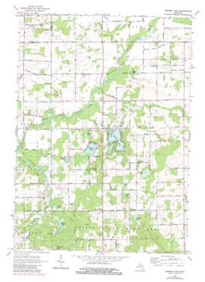
Barnes Lake Topo Map Michigan
To zoom in, hover over the map of Barnes Lake
USGS Topo Quad 43083b3 - 1:24,000 scale
| Topo Map Name: | Barnes Lake |
| USGS Topo Quad ID: | 43083b3 |
| Print Size: | ca. 21 1/4" wide x 27" high |
| Southeast Coordinates: | 43.125° N latitude / 83.25° W longitude |
| Map Center Coordinates: | 43.1875° N latitude / 83.3125° W longitude |
| U.S. State: | MI |
| Filename: | o43083b3.jpg |
| Download Map JPG Image: | Barnes Lake topo map 1:24,000 scale |
| Map Type: | Topographic |
| Topo Series: | 7.5´ |
| Map Scale: | 1:24,000 |
| Source of Map Images: | United States Geological Survey (USGS) |
| Alternate Map Versions: |
Barnes Lake MI 1963, updated 1964 Download PDF Buy paper map Barnes Lake MI 1963, updated 1980 Download PDF Buy paper map Barnes Lake MI 2011 Download PDF Buy paper map Barnes Lake MI 2014 Download PDF Buy paper map Barnes Lake MI 2016 Download PDF Buy paper map |
1:24,000 Topo Quads surrounding Barnes Lake
> Back to 43083a1 at 1:100,000 scale
> Back to 43082a1 at 1:250,000 scale
> Back to U.S. Topo Maps home
Barnes Lake topo map: Gazetteer
Barnes Lake: Canals
Degrow Drain elevation 244m 800′Fitch Drain elevation 247m 810′
Fostoria Drain elevation 241m 790′
Maxwell Drain elevation 238m 780′
Sutter and Eight Line Drain elevation 238m 780′
Barnes Lake: Lakes
Barnes Lake elevation 240m 787′Bass Lake elevation 244m 800′
Corbin Lake elevation 246m 807′
Dipper Lake elevation 236m 774′
Guaddey Lake elevation 248m 813′
Hortin Lake elevation 235m 770′
Littlefield Lake elevation 237m 777′
Margret Lake elevation 249m 816′
Millers Lake elevation 239m 784′
Norway Lake elevation 252m 826′
Riddle Lake elevation 246m 807′
Sawdel Lake elevation 236m 774′
Selders Lake elevation 240m 787′
Sutter Lake elevation 237m 777′
Trune Lake elevation 241m 790′
Barnes Lake: Parks
Lapeer State Game Area elevation 240m 787′Barnes Lake: Populated Places
Deerfield Pines Mobile Home Park elevation 243m 797′Barnes Lake: Streams
Crystal Creek elevation 232m 761′Degrow Branch elevation 244m 800′
Forest Drain elevation 234m 767′
Kester Drain elevation 241m 790′
Sand Hill Drain elevation 236m 774′
Squaw Creek elevation 235m 770′
Barnes Lake: Swamps
Bear Swamp elevation 256m 839′Barnes Lake digital topo map on disk
Buy this Barnes Lake topo map showing relief, roads, GPS coordinates and other geographical features, as a high-resolution digital map file on DVD:


