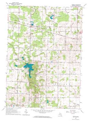
Juniata Topo Map Michigan
To zoom in, hover over the map of Juniata
USGS Topo Quad 43083c4 - 1:24,000 scale
| Topo Map Name: | Juniata |
| USGS Topo Quad ID: | 43083c4 |
| Print Size: | ca. 21 1/4" wide x 27" high |
| Southeast Coordinates: | 43.25° N latitude / 83.375° W longitude |
| Map Center Coordinates: | 43.3125° N latitude / 83.4375° W longitude |
| U.S. State: | MI |
| Filename: | o43083c4.jpg |
| Download Map JPG Image: | Juniata topo map 1:24,000 scale |
| Map Type: | Topographic |
| Topo Series: | 7.5´ |
| Map Scale: | 1:24,000 |
| Source of Map Images: | United States Geological Survey (USGS) |
| Alternate Map Versions: |
Juniata MI 1963, updated 1964 Download PDF Buy paper map Juniata MI 1963, updated 1964 Download PDF Buy paper map Juniata MI 2011 Download PDF Buy paper map Juniata MI 2014 Download PDF Buy paper map Juniata MI 2017 Download PDF Buy paper map |
1:24,000 Topo Quads surrounding Juniata
> Back to 43083a1 at 1:100,000 scale
> Back to 43082a1 at 1:250,000 scale
> Back to U.S. Topo Maps home
Juniata topo map: Gazetteer
Juniata: Airports
Miller Field elevation 212m 695′Juniata: Canals
Beach Drain elevation 237m 777′Bodies Drain elevation 229m 751′
Goodrich Mill Drain elevation 256m 839′
Krueger Drain elevation 227m 744′
McNeil Drain elevation 266m 872′
Taylor Drain elevation 220m 721′
Vassar and Fremont Drain elevation 214m 702′
Juniata: Lakes
Cedar Lake elevation 258m 846′Murphy Lake elevation 228m 748′
Juniata: Parks
Murphy Lake State Game Area elevation 241m 790′Juniata: Populated Places
Juniata elevation 228m 748′Juniata: Post Offices
Juniata Post Office (historical) elevation 228m 748′Markell Post Office (historical) elevation 237m 777′
Juniata: Streams
Houghton Creek elevation 224m 734′Juniata digital topo map on disk
Buy this Juniata topo map showing relief, roads, GPS coordinates and other geographical features, as a high-resolution digital map file on DVD:


