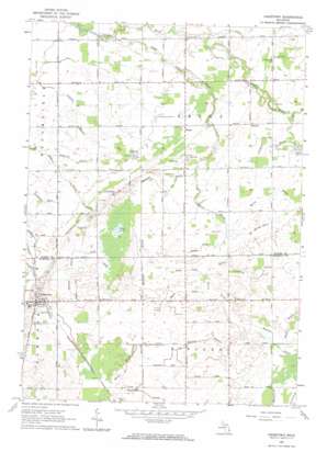
Gagetown Topo Map Michigan
To zoom in, hover over the map of Gagetown
USGS Topo Quad 43083f2 - 1:24,000 scale
| Topo Map Name: | Gagetown |
| USGS Topo Quad ID: | 43083f2 |
| Print Size: | ca. 21 1/4" wide x 27" high |
| Southeast Coordinates: | 43.625° N latitude / 83.125° W longitude |
| Map Center Coordinates: | 43.6875° N latitude / 83.1875° W longitude |
| U.S. State: | MI |
| Filename: | o43083f2.jpg |
| Download Map JPG Image: | Gagetown topo map 1:24,000 scale |
| Map Type: | Topographic |
| Topo Series: | 7.5´ |
| Map Scale: | 1:24,000 |
| Source of Map Images: | United States Geological Survey (USGS) |
| Alternate Map Versions: |
Gagetown MI 1963, updated 1964 Download PDF Buy paper map Gagetown MI 2011 Download PDF Buy paper map Gagetown MI 2014 Download PDF Buy paper map Gagetown MI 2017 Download PDF Buy paper map |
1:24,000 Topo Quads surrounding Gagetown
> Back to 43083e1 at 1:100,000 scale
> Back to 43082a1 at 1:250,000 scale
> Back to U.S. Topo Maps home
Gagetown topo map: Gazetteer
Gagetown: Canals
Battle Drain elevation 228m 748′Boulton Drain elevation 226m 741′
Columbia Exit elevation 202m 662′
Cooley Drain elevation 204m 669′
Crawford Drain elevation 229m 751′
Huron Drain elevation 219m 718′
Jameson Drain elevation 207m 679′
Jordan Drain elevation 222m 728′
Knight Drain elevation 223m 731′
Marsh Drain elevation 228m 748′
Mathews Drain elevation 222m 728′
McComb Drain elevation 225m 738′
Moore Drain elevation 225m 738′
Muntz Drain elevation 225m 738′
Puroy Drain elevation 222m 728′
Rawson Drain elevation 222m 728′
Shebeon Drain elevation 212m 695′
Westerby Drain elevation 228m 748′
Gagetown: Lakes
Mud Lake elevation 224m 734′Gagetown: Populated Places
Gagetown elevation 229m 751′Gagetown: Post Offices
Canboro Post Office (historical) elevation 206m 675′Elkland Post Office (historical) elevation 227m 744′
Gagetown Post Office elevation 229m 751′
Rescue Post Office (historical) elevation 217m 711′
Gagetown: Streams
Little Pigeon River elevation 198m 649′Gagetown digital topo map on disk
Buy this Gagetown topo map showing relief, roads, GPS coordinates and other geographical features, as a high-resolution digital map file on DVD:


