Standish Ne Topo Map Michigan
To zoom in, hover over the map of Standish Ne
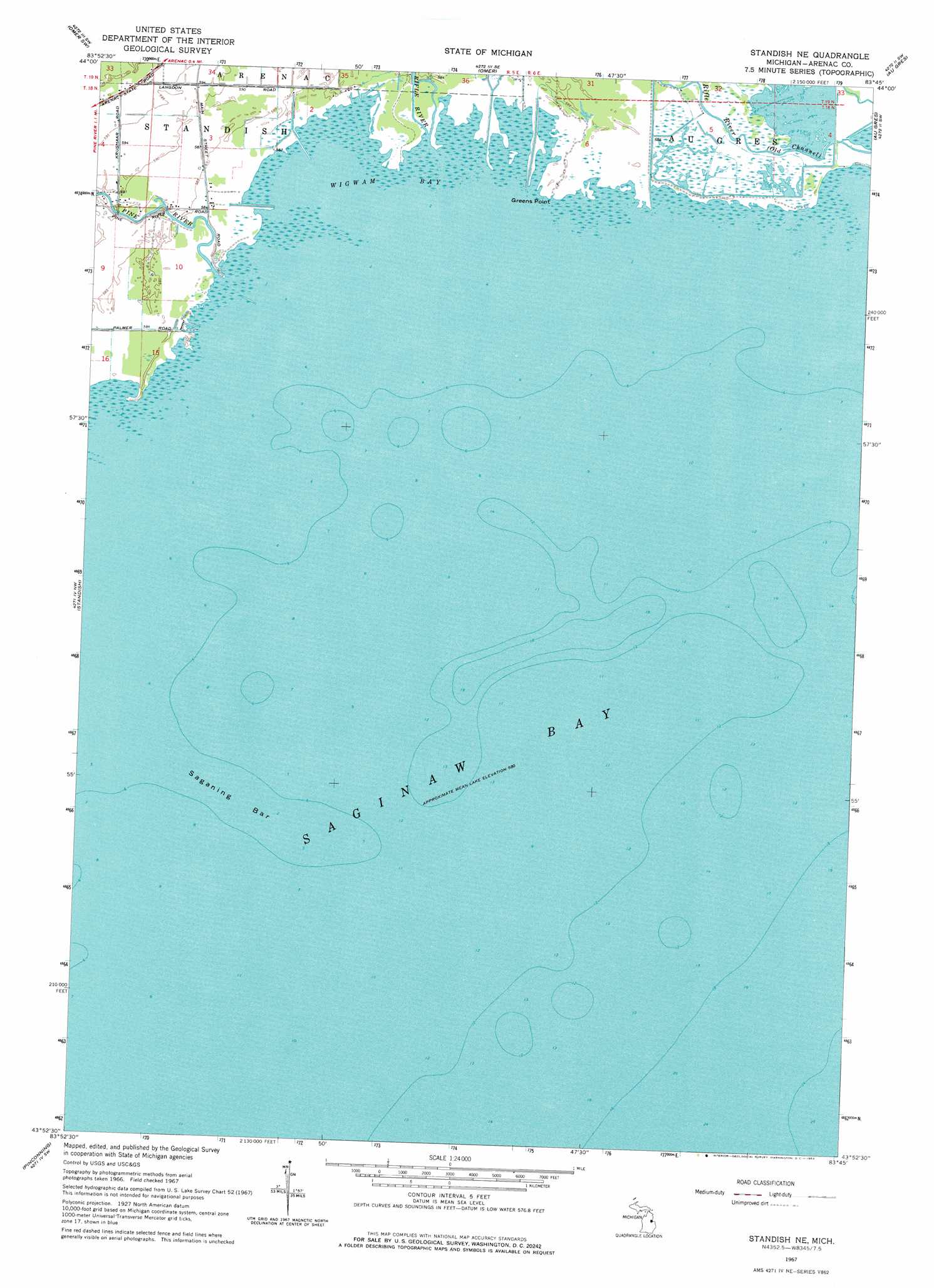
USGS Topo Quad 43083h7 - 1:24,000 scale
| Topo Map Name: | Standish Ne |
| USGS Topo Quad ID: | 43083h7 |
| Print Size: | ca. 21 1/4" wide x 27" high |
| Southeast Coordinates: | 43.875° N latitude / 83.75° W longitude |
| Map Center Coordinates: | 43.9375° N latitude / 83.8125° W longitude |
| U.S. State: | MI |
| Filename: | o43083h7.jpg |
| Download Map JPG Image: | Standish Ne topo map 1:24,000 scale |
| Map Type: | Topographic |
| Topo Series: | 7.5´ |
| Map Scale: | 1:24,000 |
| Source of Map Images: | United States Geological Survey (USGS) |
| Alternate Map Versions: |
Standish NE MI 1967, updated 1969 Download PDF Buy paper map Standish NE MI 2011 Download PDF Buy paper map Standish NE MI 2014 Download PDF Buy paper map Standish NE MI 2016 Download PDF Buy paper map |
1:24,000 Topo Quads surrounding Standish Ne
Skidway Lake |
Prescott |
Whittemore |
National City |
Alabaster |
Sterling |
Omer Sw |
Omer |
Au Gres |
Point Lookout |
Mount Forest |
Standish |
Standish Ne |
Au Gres |
|
Crump |
Pinconning |
|||
Willard |
Kawkawlin |
Bay City Ne |
Fish Point |
> Back to 43083e1 at 1:100,000 scale
> Back to 43082a1 at 1:250,000 scale
> Back to U.S. Topo Maps home
Standish Ne topo map: Gazetteer
Standish Ne: Bars
Saganing Bar elevation 177m 580′Standish Ne: Bays
Wigwam Bay elevation 177m 580′Standish Ne: Capes
Greens Point elevation 178m 583′Standish Ne: Parks
Wigwam Bay Wildlife Area elevation 177m 580′Standish Ne: Streams
Big Creek elevation 177m 580′Pine River elevation 177m 580′
Rifle River elevation 177m 580′
Rifle River elevation 177m 580′
Standish Ne digital topo map on disk
Buy this Standish Ne topo map showing relief, roads, GPS coordinates and other geographical features, as a high-resolution digital map file on DVD:
 map DVD")