Pompeii Topo Map Michigan
To zoom in, hover over the map of Pompeii
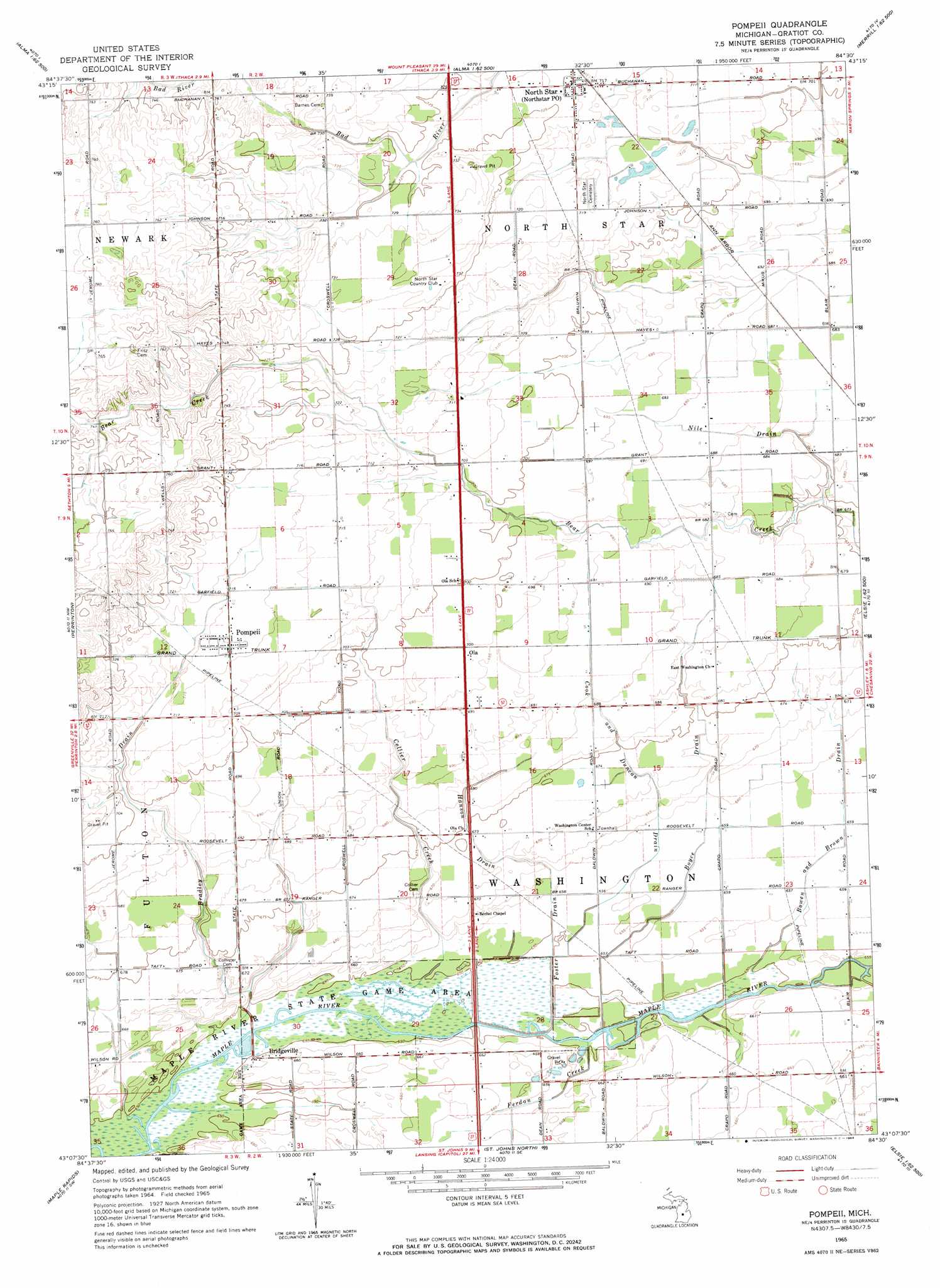
USGS Topo Quad 43084b5 - 1:24,000 scale
| Topo Map Name: | Pompeii |
| USGS Topo Quad ID: | 43084b5 |
| Print Size: | ca. 21 1/4" wide x 27" high |
| Southeast Coordinates: | 43.125° N latitude / 84.5° W longitude |
| Map Center Coordinates: | 43.1875° N latitude / 84.5625° W longitude |
| U.S. State: | MI |
| Filename: | o43084b5.jpg |
| Download Map JPG Image: | Pompeii topo map 1:24,000 scale |
| Map Type: | Topographic |
| Topo Series: | 7.5´ |
| Map Scale: | 1:24,000 |
| Source of Map Images: | United States Geological Survey (USGS) |
| Alternate Map Versions: |
Pompeii MI 1965, updated 1966 Download PDF Buy paper map Pompeii MI 2011 Download PDF Buy paper map Pompeii MI 2014 Download PDF Buy paper map Pompeii MI 2016 Download PDF Buy paper map |
1:24,000 Topo Quads surrounding Pompeii
Riverdale |
Alma North |
Saint Louis |
Breckenridge |
Merrill |
Sumner |
Alma South |
Ithaca |
Rathbone |
Lakefield |
Carson City |
Perrinton |
Pompeii |
Ashley |
Chapin |
Hubbardston |
Maple Rapids |
Saint Johns North |
Ovid West |
Ovid East |
Wasphalia |
Riley |
Saint Johns South |
Price |
Laingsburg |
> Back to 43084a1 at 1:100,000 scale
> Back to 43084a1 at 1:250,000 scale
> Back to U.S. Topo Maps home
Pompeii topo map: Gazetteer
Pompeii: Canals
Bowen and Brown Drain elevation 200m 656′Boyce Drain elevation 200m 656′
Bradley Drain elevation 211m 692′
Cook and Duncan Drain elevation 204m 669′
Foster Drain elevation 198m 649′
Hanson Drain elevation 204m 669′
Nile Drain elevation 208m 682′
Pompeii: Parks
Reed Park elevation 218m 715′Pompeii: Populated Places
Bridgeville elevation 201m 659′North Star elevation 219m 718′
Ola elevation 213m 698′
Pompeii elevation 218m 715′
Pompeii: Post Offices
Bridgeville Post Office (historical) elevation 201m 659′North Star Post Office elevation 219m 718′
Ola Post Office (historical) elevation 213m 698′
Pompeii Post Office elevation 218m 715′
Pompeii: Streams
Collier Creek elevation 198m 649′Ferdon Creek elevation 198m 649′
Pompeii digital topo map on disk
Buy this Pompeii topo map showing relief, roads, GPS coordinates and other geographical features, as a high-resolution digital map file on DVD: