Butternut Topo Map Michigan
To zoom in, hover over the map of Butternut
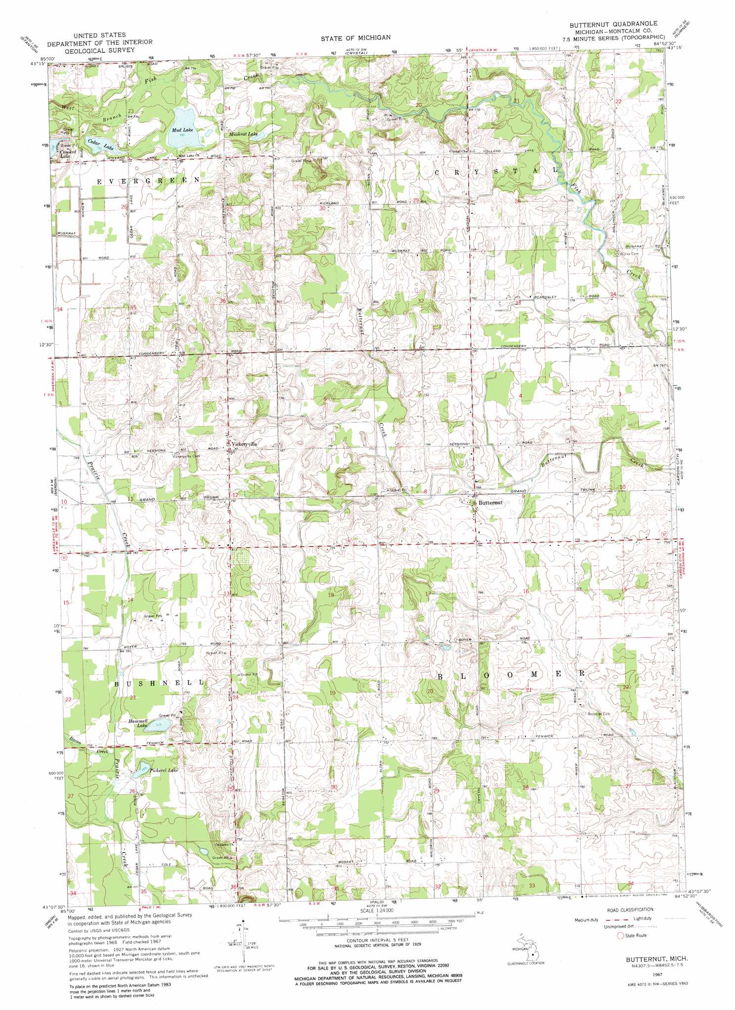
USGS Topo Quad 43084b8 - 1:24,000 scale
| Topo Map Name: | Butternut |
| USGS Topo Quad ID: | 43084b8 |
| Print Size: | ca. 21 1/4" wide x 27" high |
| Southeast Coordinates: | 43.125° N latitude / 84.875° W longitude |
| Map Center Coordinates: | 43.1875° N latitude / 84.9375° W longitude |
| U.S. State: | MI |
| Filename: | o43084b8.jpg |
| Download Map JPG Image: | Butternut topo map 1:24,000 scale |
| Map Type: | Topographic |
| Topo Series: | 7.5´ |
| Map Scale: | 1:24,000 |
| Source of Map Images: | United States Geological Survey (USGS) |
| Alternate Map Versions: |
Butternut MI 1967, updated 1969 Download PDF Buy paper map Butternut MI 1967, updated 1982 Download PDF Buy paper map Butternut MI 2011 Download PDF Buy paper map Butternut MI 2014 Download PDF Buy paper map Butternut MI 2016 Download PDF Buy paper map |
1:24,000 Topo Quads surrounding Butternut
Six Lakes |
Edmore |
Vestaburg |
Riverdale |
Alma North |
Langston |
Stanton |
Crystal |
Sumner |
Alma South |
Greenville East |
Sheridan |
Butternut |
Carson City |
Perrinton |
Belding |
Shiloh |
Palo |
Hubbardston |
Maple Rapids |
Saranac |
Ionia |
Portland North |
Wasphalia |
Riley |
> Back to 43084a1 at 1:100,000 scale
> Back to 43084a1 at 1:250,000 scale
> Back to U.S. Topo Maps home
Butternut topo map: Gazetteer
Butternut: Airports
Mayes Airport elevation 239m 784′Butternut: Lakes
Cedar Lake elevation 242m 793′Hammell Lake elevation 235m 770′
Mud Lake elevation 241m 790′
Muskrat Lake elevation 240m 787′
Pickerel Lake elevation 234m 767′
Butternut: Populated Places
Butternut elevation 235m 770′Vickeryville elevation 251m 823′
Butternut: Post Offices
Bloomer Post Office (historical) elevation 236m 774′Butternut Post Office (historical) elevation 235m 770′
Vickeryville Post Office (historical) elevation 251m 823′
Butternut: Streams
Bacon Creek elevation 235m 770′West Branch Fish Creek elevation 243m 797′
Butternut digital topo map on disk
Buy this Butternut topo map showing relief, roads, GPS coordinates and other geographical features, as a high-resolution digital map file on DVD: