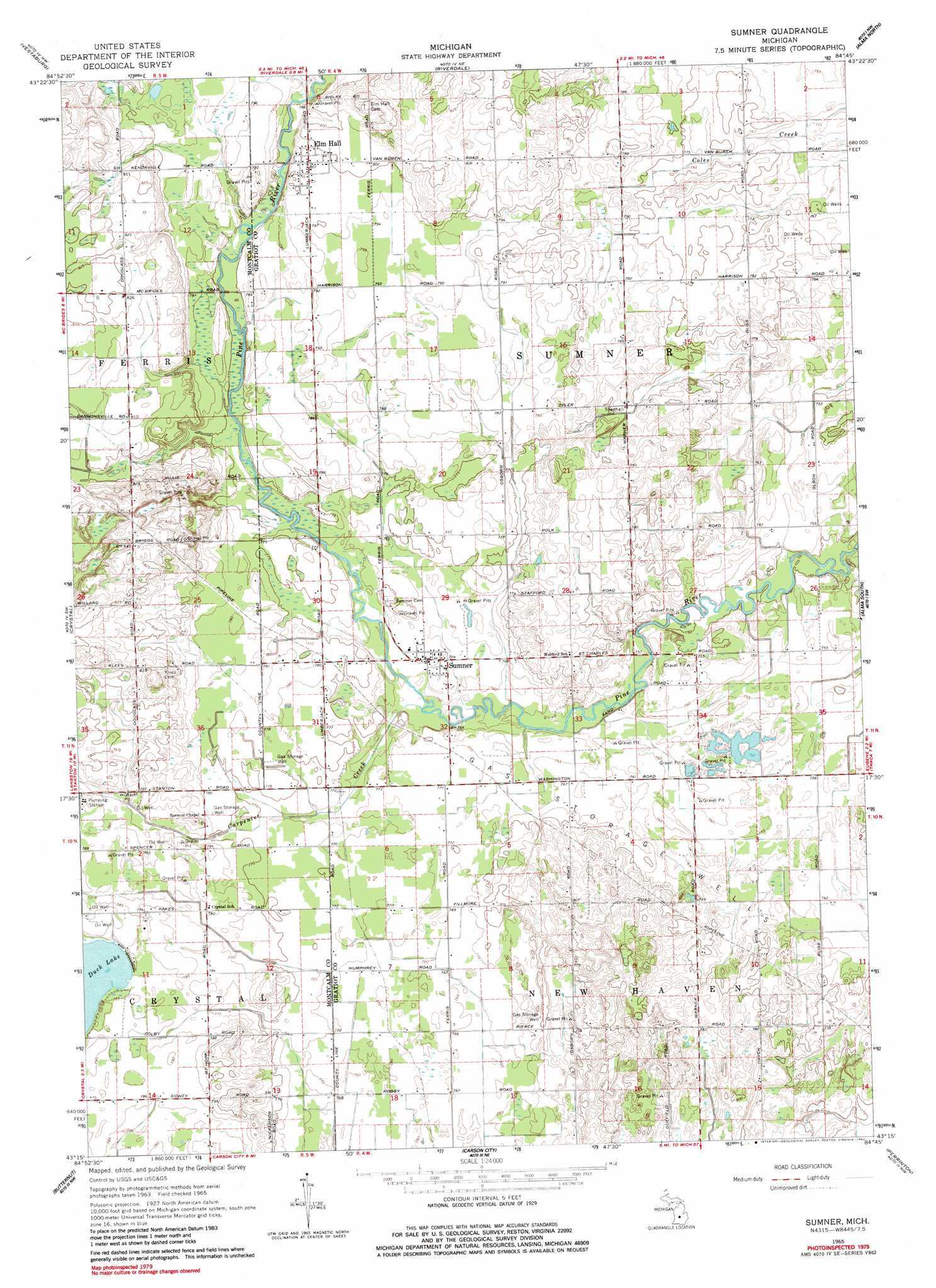
Sumner Topo Map Michigan
To zoom in, hover over the map of Sumner
USGS Topo Quad 43084c7 - 1:24,000 scale
| Topo Map Name: | Sumner |
| USGS Topo Quad ID: | 43084c7 |
| Print Size: | ca. 21 1/4" wide x 27" high |
| Southeast Coordinates: | 43.25° N latitude / 84.75° W longitude |
| Map Center Coordinates: | 43.3125° N latitude / 84.8125° W longitude |
| U.S. State: | MI |
| Filename: | o43084c7.jpg |
| Download Map JPG Image: | Sumner topo map 1:24,000 scale |
| Map Type: | Topographic |
| Topo Series: | 7.5´ |
| Map Scale: | 1:24,000 |
| Source of Map Images: | United States Geological Survey (USGS) |
| Alternate Map Versions: |
Sumner MI 1965, updated 1966 Download PDF Buy paper map Sumner MI 1965, updated 1982 Download PDF Buy paper map Sumner MI 2011 Download PDF Buy paper map Sumner MI 2014 Download PDF Buy paper map Sumner MI 2016 Download PDF Buy paper map |
1:24,000 Topo Quads surrounding Sumner
Blanchard |
Winn |
Mount Pleasant |
Shepherd |
Pleasant Valley |
Edmore |
Vestaburg |
Riverdale |
Alma North |
Saint Louis |
Stanton |
Crystal |
Sumner |
Alma South |
Ithaca |
Sheridan |
Butternut |
Carson City |
Perrinton |
Pompeii |
Shiloh |
Palo |
Hubbardston |
Maple Rapids |
Saint Johns North |
> Back to 43084a1 at 1:100,000 scale
> Back to 43084a1 at 1:250,000 scale
> Back to U.S. Topo Maps home
Sumner topo map: Gazetteer
Sumner: Parks
West Park elevation 233m 764′Sumner: Populated Places
Elm Hall elevation 244m 800′Sumner elevation 232m 761′
Sumner: Post Offices
Elm Hall Post Office elevation 244m 800′Sumner Post Office elevation 233m 764′
Sumner: Streams
Carpenter Creek elevation 231m 757′Sumner digital topo map on disk
Buy this Sumner topo map showing relief, roads, GPS coordinates and other geographical features, as a high-resolution digital map file on DVD: