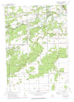
Gordonville Topo Map Michigan
To zoom in, hover over the map of Gordonville
USGS Topo Quad 43084e3 - 1:24,000 scale
| Topo Map Name: | Gordonville |
| USGS Topo Quad ID: | 43084e3 |
| Print Size: | ca. 21 1/4" wide x 27" high |
| Southeast Coordinates: | 43.5° N latitude / 84.25° W longitude |
| Map Center Coordinates: | 43.5625° N latitude / 84.3125° W longitude |
| U.S. State: | MI |
| Filename: | o43084e3.jpg |
| Download Map JPG Image: | Gordonville topo map 1:24,000 scale |
| Map Type: | Topographic |
| Topo Series: | 7.5´ |
| Map Scale: | 1:24,000 |
| Source of Map Images: | United States Geological Survey (USGS) |
| Alternate Map Versions: |
Gordonville MI 1973, updated 1976 Download PDF Buy paper map Gordonville MI 2011 Download PDF Buy paper map Gordonville MI 2014 Download PDF Buy paper map Gordonville MI 2016 Download PDF Buy paper map |
1:24,000 Topo Quads surrounding Gordonville
> Back to 43084e1 at 1:100,000 scale
> Back to 43084a1 at 1:250,000 scale
> Back to U.S. Topo Maps home
Gordonville topo map: Gazetteer
Gordonville: Canals
Dice Drain elevation 192m 629′Duncan Drain elevation 194m 636′
Franklin Drain elevation 195m 639′
Freeland Drain elevation 196m 643′
Frost Drain elevation 192m 629′
Knapp Drain elevation 193m 633′
Gordonville: Parks
Arbury Park elevation 187m 613′Chippewa Nature Center elevation 187m 613′
Chippewassee Park elevation 184m 603′
Chippewassee School Park elevation 185m 606′
Dow Gardens elevation 185m 606′
Emerson Park elevation 183m 600′
Revere Park elevation 184m 603′
Riverside Golfside Park elevation 184m 603′
Thrune Park elevation 184m 603′
Towsley Dike Park elevation 184m 603′
Upper Bridge Historical Marker elevation 187m 613′
Gordonville: Populated Places
Country Side Mobile Home Park elevation 195m 639′Dice Corners elevation 195m 639′
Gordonville elevation 196m 643′
Gordonville: Post Offices
Barnes Post Office (historical) elevation 191m 626′Crane Post Office (historical) elevation 192m 629′
Gordonville Post Office (historical) elevation -1m -4′
Gordonville: Streams
Pine River elevation 183m 600′Prairie Creek elevation 186m 610′
Snake Creek elevation 183m 600′
Gordonville digital topo map on disk
Buy this Gordonville topo map showing relief, roads, GPS coordinates and other geographical features, as a high-resolution digital map file on DVD:


