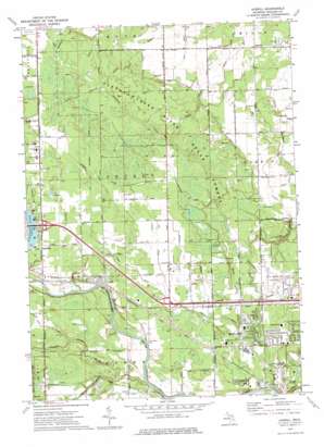
Averill Topo Map Michigan
To zoom in, hover over the map of Averill
USGS Topo Quad 43084f3 - 1:24,000 scale
| Topo Map Name: | Averill |
| USGS Topo Quad ID: | 43084f3 |
| Print Size: | ca. 21 1/4" wide x 27" high |
| Southeast Coordinates: | 43.625° N latitude / 84.25° W longitude |
| Map Center Coordinates: | 43.6875° N latitude / 84.3125° W longitude |
| U.S. State: | MI |
| Filename: | o43084f3.jpg |
| Download Map JPG Image: | Averill topo map 1:24,000 scale |
| Map Type: | Topographic |
| Topo Series: | 7.5´ |
| Map Scale: | 1:24,000 |
| Source of Map Images: | United States Geological Survey (USGS) |
| Alternate Map Versions: |
Averill MI 1973, updated 1976 Download PDF Buy paper map Averill MI 2011 Download PDF Buy paper map Averill MI 2014 Download PDF Buy paper map Averill MI 2016 Download PDF Buy paper map |
1:24,000 Topo Quads surrounding Averill
> Back to 43084e1 at 1:100,000 scale
> Back to 43084a1 at 1:250,000 scale
> Back to U.S. Topo Maps home
Averill topo map: Gazetteer
Averill: Airports
Jack Barstow Airport elevation 190m 623′Averill: Canals
Bensch Drain elevation 191m 626′Boyle Drain elevation 202m 662′
Clark Drain elevation 199m 652′
Dittmar Drain elevation 193m 633′
Hahn Drain elevation 189m 620′
Inman Drain elevation 190m 623′
Irish Reed Drain elevation 191m 626′
Kelly Drain elevation 202m 662′
School House Drain elevation 203m 666′
Sterns Drain elevation 192m 629′
Averill: Oilfields
Sanford Oil Field elevation 196m 643′Averill: Parks
Cook Elementary School Park elevation 189m 620′Glencoe Park elevation 188m 616′
Heritage Park elevation 187m 613′
Huron Park elevation 190m 623′
Lalkwood Park elevation 191m 626′
Northwest Park elevation 189m 620′
River Bend Park elevation 189m 620′
Saint Mary's Park elevation 189m 620′
Sturgeon Creek Park elevation 186m 610′
Valley Park elevation 188m 616′
Averill: Populated Places
Alpine Mobile Home Village elevation 189m 620′Averill elevation 194m 636′
Bombay elevation 204m 669′
Old Oak Trails Estates Mobile Home Park elevation 193m 633′
Averill: Post Offices
Averill Post Office (historical) elevation 194m 636′Gray Post Office (historical) elevation 199m 652′
Averill: Streams
Averill Creek elevation 186m 610′Carrol Creek Drain elevation 184m 603′
Dempski Drain elevation 191m 626′
Grass Creek elevation 192m 629′
Jacobs Drain elevation 188m 616′
Miller Drain elevation 198m 649′
Newell Drain elevation 188m 616′
Sturgeon Creek elevation 185m 606′
Averill digital topo map on disk
Buy this Averill topo map showing relief, roads, GPS coordinates and other geographical features, as a high-resolution digital map file on DVD:


