Alamando Topo Map Michigan
To zoom in, hover over the map of Alamando
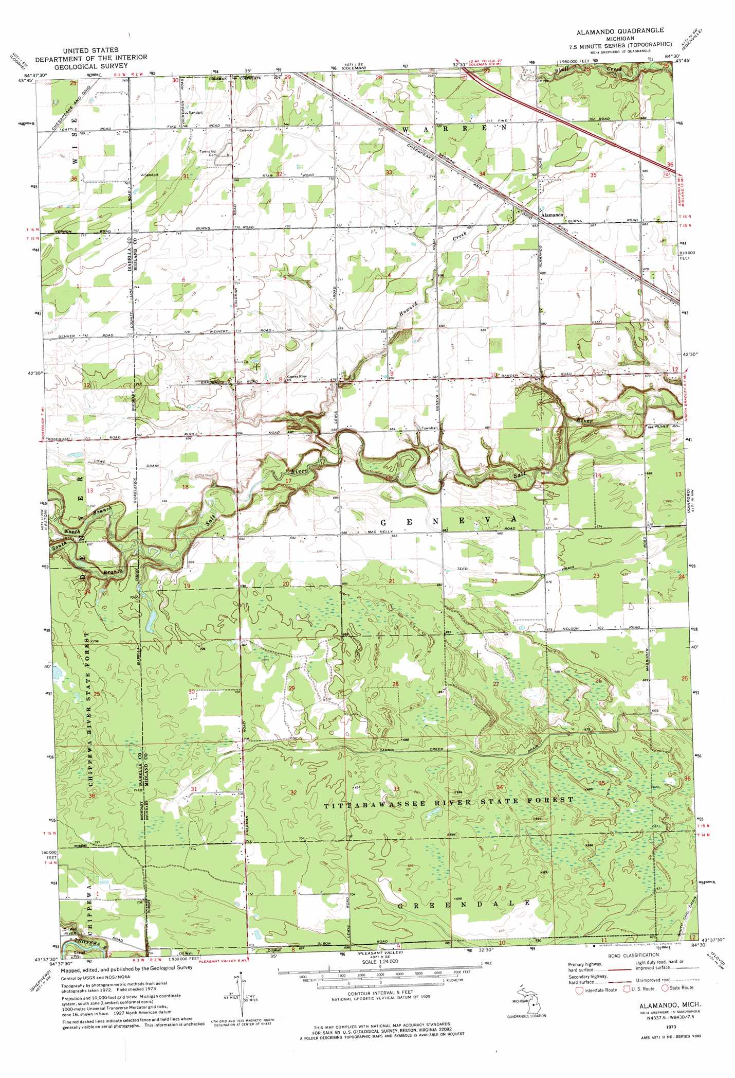
USGS Topo Quad 43084f5 - 1:24,000 scale
| Topo Map Name: | Alamando |
| USGS Topo Quad ID: | 43084f5 |
| Print Size: | ca. 21 1/4" wide x 27" high |
| Southeast Coordinates: | 43.625° N latitude / 84.5° W longitude |
| Map Center Coordinates: | 43.6875° N latitude / 84.5625° W longitude |
| U.S. State: | MI |
| Filename: | o43084f5.jpg |
| Download Map JPG Image: | Alamando topo map 1:24,000 scale |
| Map Type: | Topographic |
| Topo Series: | 7.5´ |
| Map Scale: | 1:24,000 |
| Source of Map Images: | United States Geological Survey (USGS) |
| Alternate Map Versions: |
Alamando MI 1973, updated 1976 Download PDF Buy paper map Alamando MI 2011 Download PDF Buy paper map Alamando MI 2014 Download PDF Buy paper map Alamando MI 2017 Download PDF Buy paper map |
1:24,000 Topo Quads surrounding Alamando
Hatton |
Browns Corners |
Coleman Ne |
Gladwin |
Wooden Shoe Village |
Clare |
Loomis |
Coleman |
Edenville |
Hope |
Rosebush |
Leaton |
Alamando |
Sanford |
Averill |
Mount Pleasant |
Shepherd |
Pleasant Valley |
Floyd |
Gordonville |
Riverdale |
Alma North |
Saint Louis |
Breckenridge |
Merrill |
> Back to 43084e1 at 1:100,000 scale
> Back to 43084a1 at 1:250,000 scale
> Back to U.S. Topo Maps home
Alamando topo map: Gazetteer
Alamando: Canals
South Carl Drain elevation 203m 666′Teed Drain elevation 203m 666′
Alamando: Populated Places
Alamando elevation 215m 705′Alamando: Post Offices
Alamando Post Office (historical) elevation 213m 698′Alamando: Streams
Howard Creek elevation 198m 649′North Branch Salt River elevation 203m 666′
South Branch Salt River elevation 204m 669′
Alamando digital topo map on disk
Buy this Alamando topo map showing relief, roads, GPS coordinates and other geographical features, as a high-resolution digital map file on DVD: