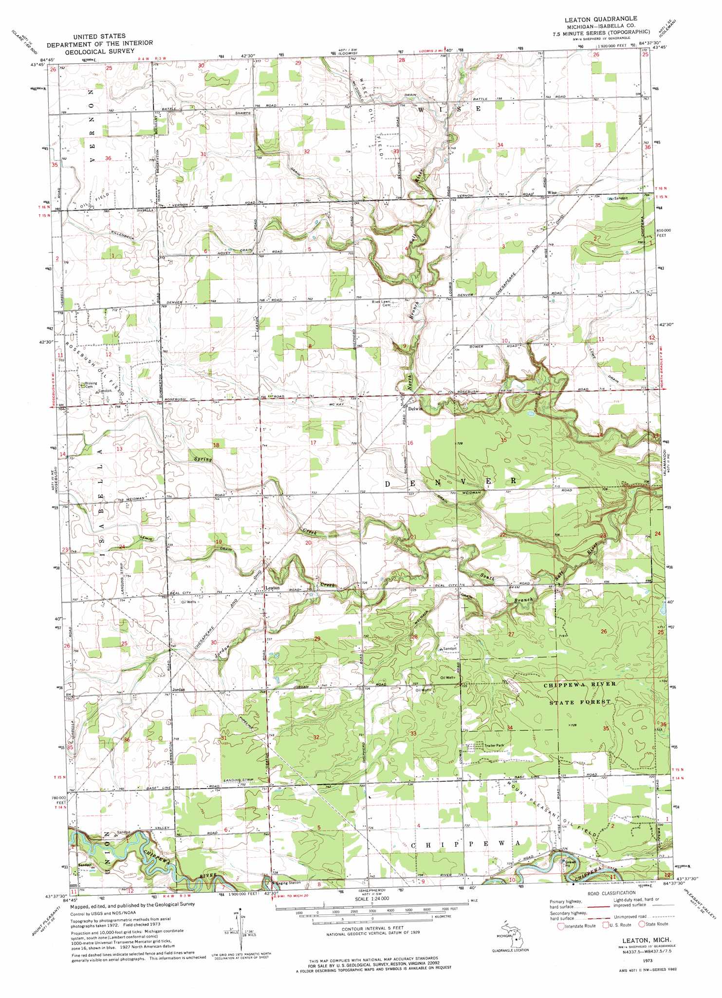
Leaton Topo Map Michigan
To zoom in, hover over the map of Leaton
USGS Topo Quad 43084f6 - 1:24,000 scale
| Topo Map Name: | Leaton |
| USGS Topo Quad ID: | 43084f6 |
| Print Size: | ca. 21 1/4" wide x 27" high |
| Southeast Coordinates: | 43.625° N latitude / 84.625° W longitude |
| Map Center Coordinates: | 43.6875° N latitude / 84.6875° W longitude |
| U.S. State: | MI |
| Filename: | o43084f6.jpg |
| Download Map JPG Image: | Leaton topo map 1:24,000 scale |
| Map Type: | Topographic |
| Topo Series: | 7.5´ |
| Map Scale: | 1:24,000 |
| Source of Map Images: | United States Geological Survey (USGS) |
| Alternate Map Versions: |
Leaton MI 1973, updated 1977 Download PDF Buy paper map Leaton MI 2011 Download PDF Buy paper map Leaton MI 2014 Download PDF Buy paper map Leaton MI 2016 Download PDF Buy paper map |
1:24,000 Topo Quads surrounding Leaton
Lake George |
Hatton |
Browns Corners |
Coleman Ne |
Gladwin |
Woods |
Clare |
Loomis |
Coleman |
Edenville |
Weidman |
Rosebush |
Leaton |
Alamando |
Sanford |
Winn |
Mount Pleasant |
Shepherd |
Pleasant Valley |
Floyd |
Vestaburg |
Riverdale |
Alma North |
Saint Louis |
Breckenridge |
> Back to 43084e1 at 1:100,000 scale
> Back to 43084a1 at 1:250,000 scale
> Back to U.S. Topo Maps home
Leaton topo map: Gazetteer
Leaton: Airports
D J Airport elevation 230m 754′Leaton: Canals
Killenbeck Drain elevation 231m 757′Lowe Drain elevation 216m 708′
McKay Drain elevation 221m 725′
Sharps Drain elevation 229m 751′
Welnack Drain elevation 218m 715′
Leaton: Oilfields
Rosebush Oil Field elevation 234m 767′Leaton: Populated Places
Delwin elevation 223m 731′Jordan elevation 227m 744′
Leaton elevation 226m 741′
Wise elevation 229m 751′
Leaton: Post Offices
Delwin Post Office (historical) elevation 223m 731′Isabella Centre Post Office (historical) elevation 232m 761′
Leaton Post Office (historical) elevation 226m 741′
Wise Post Office (historical) elevation 229m 751′
Leaton: Streams
Jordon Creek elevation 212m 695′Spring Creek elevation 212m 695′
Leaton digital topo map on disk
Buy this Leaton topo map showing relief, roads, GPS coordinates and other geographical features, as a high-resolution digital map file on DVD: