Bentley Topo Map Michigan
To zoom in, hover over the map of Bentley
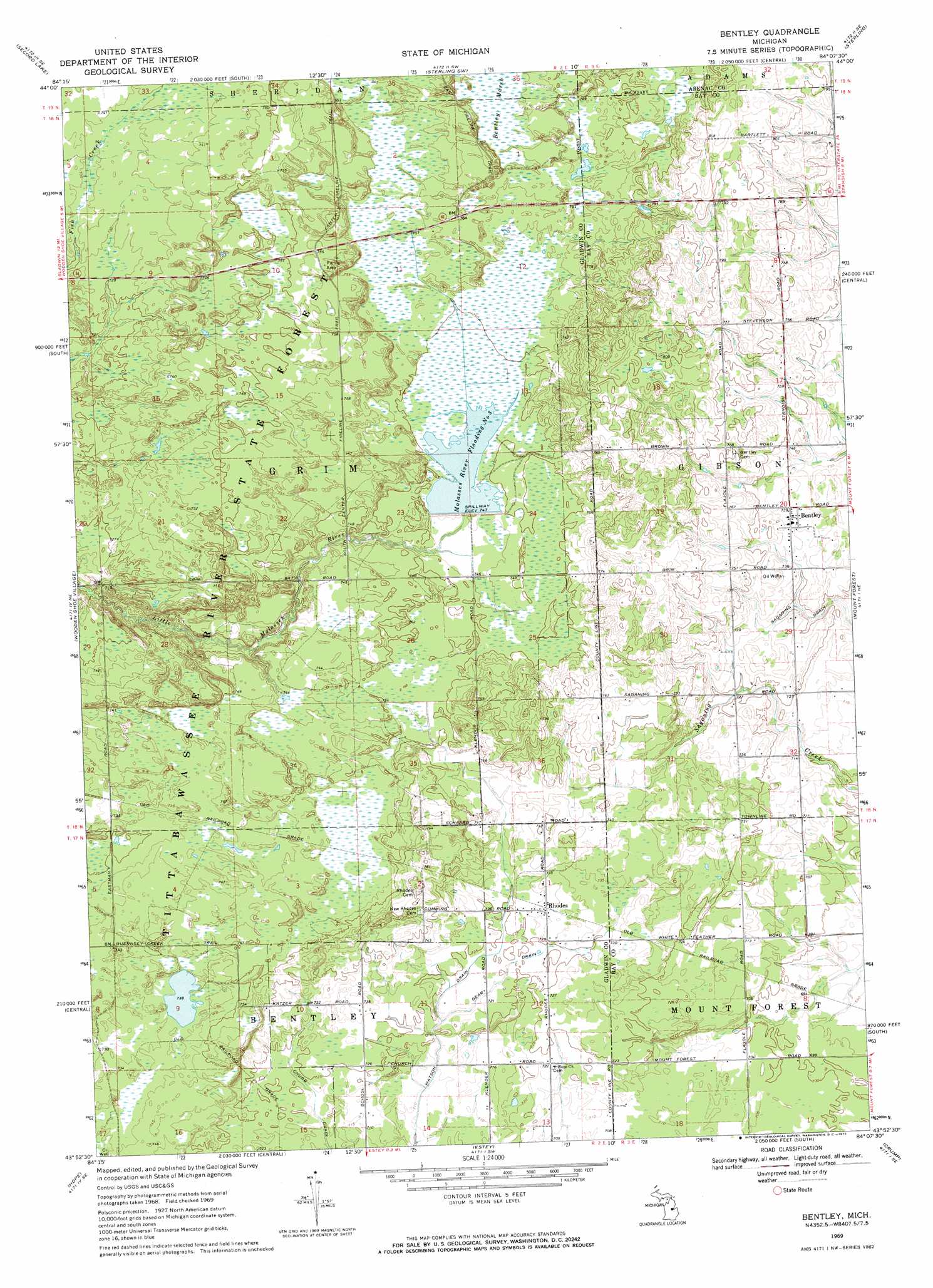
USGS Topo Quad 43084h2 - 1:24,000 scale
| Topo Map Name: | Bentley |
| USGS Topo Quad ID: | 43084h2 |
| Print Size: | ca. 21 1/4" wide x 27" high |
| Southeast Coordinates: | 43.875° N latitude / 84.125° W longitude |
| Map Center Coordinates: | 43.9375° N latitude / 84.1875° W longitude |
| U.S. State: | MI |
| Filename: | o43084h2.jpg |
| Download Map JPG Image: | Bentley topo map 1:24,000 scale |
| Map Type: | Topographic |
| Topo Series: | 7.5´ |
| Map Scale: | 1:24,000 |
| Source of Map Images: | United States Geological Survey (USGS) |
| Alternate Map Versions: |
Bentley MI 1969, updated 1972 Download PDF Buy paper map Bentley MI 2011 Download PDF Buy paper map Bentley MI 2014 Download PDF Buy paper map Bentley MI 2017 Download PDF Buy paper map |
1:24,000 Topo Quads surrounding Bentley
Butman |
Edwards |
Sterling Nw |
Skidway Lake |
Prescott |
Wagarville |
Secord Lake |
Sterling Sw |
Sterling |
Omer Sw |
Gladwin |
Wooden Shoe Village |
Bentley |
Mount Forest |
Standish |
Edenville |
Hope |
Estey |
Crump |
Pinconning |
Sanford |
Averill |
Midland North |
Willard |
Kawkawlin |
> Back to 43084e1 at 1:100,000 scale
> Back to 43084a1 at 1:250,000 scale
> Back to U.S. Topo Maps home
Bentley topo map: Gazetteer
Bentley: Canals
Chubb Drain elevation 218m 715′Gear Drain elevation 219m 718′
Bentley: Populated Places
Bentley elevation 225m 738′Rhodes elevation 223m 731′
Bentley: Post Offices
Bentley Post Office elevation 225m 738′Glover Post Office (historical) elevation 233m 764′
Rhodes Post Office elevation 223m 731′
Bentley: Reservoirs
Molasses River Flooding Number Three elevation 228m 748′Bentley: Trails
Center Fireline Trail elevation 231m 757′Bentley digital topo map on disk
Buy this Bentley topo map showing relief, roads, GPS coordinates and other geographical features, as a high-resolution digital map file on DVD: