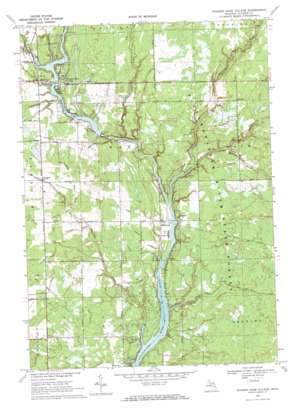
Wooden Shoe Village Topo Map Michigan
To zoom in, hover over the map of Wooden Shoe Village
USGS Topo Quad 43084h3 - 1:24,000 scale
| Topo Map Name: | Wooden Shoe Village |
| USGS Topo Quad ID: | 43084h3 |
| Print Size: | ca. 21 1/4" wide x 27" high |
| Southeast Coordinates: | 43.875° N latitude / 84.25° W longitude |
| Map Center Coordinates: | 43.9375° N latitude / 84.3125° W longitude |
| U.S. State: | MI |
| Filename: | o43084h3.jpg |
| Download Map JPG Image: | Wooden Shoe Village topo map 1:24,000 scale |
| Map Type: | Topographic |
| Topo Series: | 7.5´ |
| Map Scale: | 1:24,000 |
| Source of Map Images: | United States Geological Survey (USGS) |
| Alternate Map Versions: |
Wooden Shoe Village MI 1969, updated 1972 Download PDF Buy paper map Wooden Shoe Village MI 2011 Download PDF Buy paper map Wooden Shoe Village MI 2014 Download PDF Buy paper map Wooden Shoe Village MI 2017 Download PDF Buy paper map |
1:24,000 Topo Quads surrounding Wooden Shoe Village
> Back to 43084e1 at 1:100,000 scale
> Back to 43084a1 at 1:250,000 scale
> Back to U.S. Topo Maps home
Wooden Shoe Village topo map: Gazetteer
Wooden Shoe Village: Canals
Babcock Drain elevation 222m 728′Le Clear Drain elevation 216m 708′
McMahan Drain elevation 222m 728′
Oard Drain elevation 221m 725′
Robbins Drain elevation 216m 708′
Thompson Drain elevation 221m 725′
Van Horn Drain elevation 217m 711′
Wooden Shoe Village: Dams
Smallwood Dam elevation 214m 702′Wooden Shoe Village: Oilfields
Billings Oil Field elevation 214m 702′South Billings Oil Field elevation 217m 711′
South Buckeye Oil Field elevation 222m 728′
Wooden Shoe Village: Populated Places
Highwood elevation 213m 698′Key Mobile Home Court elevation 218m 715′
White Star elevation 221m 725′
Winegars elevation 222m 728′
Wooden Shoe Village elevation 219m 718′
Wooden Shoe Village: Post Offices
Highwood Post Office (historical) elevation 213m 698′Winegars Post Office (historical) elevation 222m 728′
Wooden Shoe Village: Reservoirs
Smallwood Lake elevation 215m 705′Wooden Shoe Village: Streams
Black Creek elevation 209m 685′Fish Creek elevation 209m 685′
Guernsey Creek elevation 206m 675′
Larrabee Creek elevation 209m 685′
Little Molasses River elevation 207m 679′
Little Tobacco River elevation 214m 702′
Molasses River elevation 207m 679′
Wooden Shoe Village: Trails
Guernsey Creek Trail elevation 216m 708′Wooden Shoe Village digital topo map on disk
Buy this Wooden Shoe Village topo map showing relief, roads, GPS coordinates and other geographical features, as a high-resolution digital map file on DVD:


