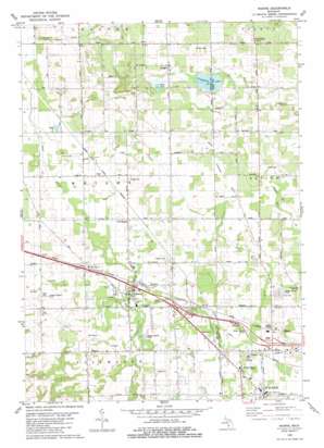
Marne Topo Map Michigan
To zoom in, hover over the map of Marne
USGS Topo Quad 43085a7 - 1:24,000 scale
| Topo Map Name: | Marne |
| USGS Topo Quad ID: | 43085a7 |
| Print Size: | ca. 21 1/4" wide x 27" high |
| Southeast Coordinates: | 43° N latitude / 85.75° W longitude |
| Map Center Coordinates: | 43.0625° N latitude / 85.8125° W longitude |
| U.S. State: | MI |
| Filename: | o43085a7.jpg |
| Download Map JPG Image: | Marne topo map 1:24,000 scale |
| Map Type: | Topographic |
| Topo Series: | 7.5´ |
| Map Scale: | 1:24,000 |
| Source of Map Images: | United States Geological Survey (USGS) |
| Alternate Map Versions: |
Marne MI 1980, updated 1980 Download PDF Buy paper map Marne MI 1980, updated 1980 Download PDF Buy paper map Marne MI 2011 Download PDF Buy paper map Marne MI 2014 Download PDF Buy paper map Marne MI 2017 Download PDF Buy paper map |
1:24,000 Topo Quads surrounding Marne
> Back to 43085a1 at 1:100,000 scale
> Back to 43084a1 at 1:250,000 scale
> Back to U.S. Topo Maps home
Marne topo map: Gazetteer
Marne: Canals
Kauff Dam elevation 214m 702′Laubach Inter-County Drain elevation 241m 790′
Wright and Alpine Drain elevation 234m 767′
Marne: Crossings
Interchange 23 elevation 204m 669′Interchange 24 elevation 211m 692′
Interchange 25 elevation 212m 695′
Interchange 26 elevation 226m 741′
Marne: Lakes
Cranberry Lake elevation 252m 826′Mud Lake elevation 251m 823′
Marne: Populated Places
Country Village Mobile Park elevation 217m 711′Fruit Ridge Center elevation 268m 879′
Herrington elevation 214m 702′
Kinney elevation 224m 734′
Marne elevation 205m 672′
Reno elevation 217m 711′
Walker elevation 228m 748′
Wright elevation 265m 869′
Marne: Post Offices
Big Spring Post Office (historical) elevation 236m 774′Herrington Post Office (historical) elevation 214m 702′
Kent City Post Office elevation 245m 803′
Kinney Post Office (historical) elevation 224m 734′
Marne Post Office elevation 205m 672′
Pleasant Post Office (historical) elevation 244m 800′
Reno Post Office (historical) elevation 217m 711′
Wright Post Office (historical) elevation 265m 869′
Marne digital topo map on disk
Buy this Marne topo map showing relief, roads, GPS coordinates and other geographical features, as a high-resolution digital map file on DVD:


