Coopersville Topo Map Michigan
To zoom in, hover over the map of Coopersville
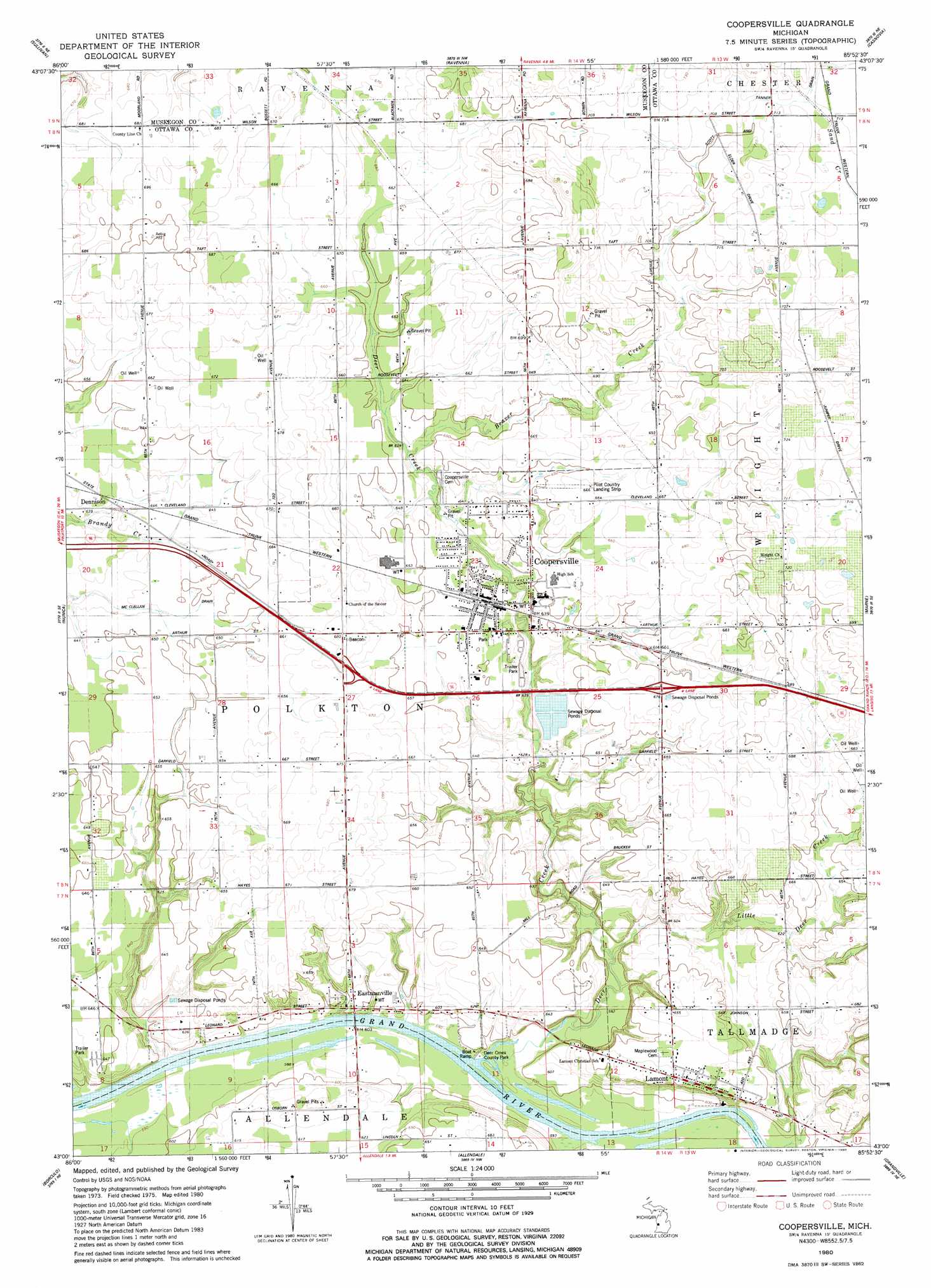
USGS Topo Quad 43085a8 - 1:24,000 scale
| Topo Map Name: | Coopersville |
| USGS Topo Quad ID: | 43085a8 |
| Print Size: | ca. 21 1/4" wide x 27" high |
| Southeast Coordinates: | 43° N latitude / 85.875° W longitude |
| Map Center Coordinates: | 43.0625° N latitude / 85.9375° W longitude |
| U.S. State: | MI |
| Filename: | o43085a8.jpg |
| Download Map JPG Image: | Coopersville topo map 1:24,000 scale |
| Map Type: | Topographic |
| Topo Series: | 7.5´ |
| Map Scale: | 1:24,000 |
| Source of Map Images: | United States Geological Survey (USGS) |
| Alternate Map Versions: |
Coopersville MI 1980, updated 1980 Download PDF Buy paper map Coopersville MI 2011 Download PDF Buy paper map Coopersville MI 2014 Download PDF Buy paper map Coopersville MI 2017 Download PDF Buy paper map |
1:24,000 Topo Quads surrounding Coopersville
Twin Lake |
Wolf Lake |
Bridgeton |
Grant |
Sand Lake Sw |
Muskegon East |
Sullivan |
Ravenna |
Casnovia |
Sparta |
Grand Haven |
Nunica |
Coopersville |
Marne |
Cedar Springs Sw |
Port Sheldon |
Borculo |
Allendale |
Grandville |
Grand Rapids West |
Holland West |
Holland East |
Hudsonville West |
Hudsonville East |
Cutlerville |
> Back to 43085a1 at 1:100,000 scale
> Back to 43084a1 at 1:250,000 scale
> Back to U.S. Topo Maps home
Coopersville topo map: Gazetteer
Coopersville: Airports
Coopersville Airport elevation 201m 659′Coopersville: Crossings
Interchange 16 elevation 204m 669′Interchange 19 elevation 201m 659′
Coopersville: Parks
Deer Creek County Park elevation 201m 659′Grove Street Park elevation 191m 626′
Interurban Depot Historical Marker elevation 206m 675′
Main Street Park elevation 190m 623′
Veterans Park elevation 196m 643′
Coopersville: Populated Places
Coopersville elevation 195m 639′Dennison elevation 195m 639′
Eastmanville elevation 183m 600′
Grand Country Mobile Home Village elevation 197m 646′
Lamont elevation 201m 659′
Timberline Estates Mobile Home Park elevation 191m 626′
Coopersville: Post Offices
Coopersville Post Office elevation 195m 639′Dennison Post Office (historical) elevation 195m 639′
Eastmanville Post Office (historical) elevation 183m 600′
Lamont Post Office elevation 200m 656′
Coopersville: Streams
Beaver Creek elevation 191m 626′Deer Creek elevation 177m 580′
Little Deer Creek elevation 179m 587′
Coopersville digital topo map on disk
Buy this Coopersville topo map showing relief, roads, GPS coordinates and other geographical features, as a high-resolution digital map file on DVD: