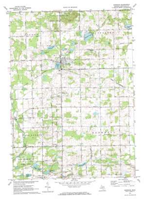
Sheridan Topo Map Michigan
To zoom in, hover over the map of Sheridan
USGS Topo Quad 43085b1 - 1:24,000 scale
| Topo Map Name: | Sheridan |
| USGS Topo Quad ID: | 43085b1 |
| Print Size: | ca. 21 1/4" wide x 27" high |
| Southeast Coordinates: | 43.125° N latitude / 85° W longitude |
| Map Center Coordinates: | 43.1875° N latitude / 85.0625° W longitude |
| U.S. State: | MI |
| Filename: | o43085b1.jpg |
| Download Map JPG Image: | Sheridan topo map 1:24,000 scale |
| Map Type: | Topographic |
| Topo Series: | 7.5´ |
| Map Scale: | 1:24,000 |
| Source of Map Images: | United States Geological Survey (USGS) |
| Alternate Map Versions: |
Sheridan MI 1972, updated 1974 Download PDF Buy paper map Sheridan MI 2011 Download PDF Buy paper map Sheridan MI 2014 Download PDF Buy paper map Sheridan MI 2017 Download PDF Buy paper map |
1:24,000 Topo Quads surrounding Sheridan
> Back to 43085a1 at 1:100,000 scale
> Back to 43084a1 at 1:250,000 scale
> Back to U.S. Topo Maps home
Sheridan topo map: Gazetteer
Sheridan: Canals
Baker Drain elevation 244m 800′Sheridan: Lakes
Baker Lake elevation 254m 833′Clear Lake elevation 248m 813′
Crooked Lake elevation 243m 797′
Grass Lake elevation 249m 816′
Hisington Lake elevation 251m 823′
Holland Lake elevation 251m 823′
Horseshoe Lake elevation 248m 813′
Lampman Lake elevation 254m 833′
Mann Lake elevation 251m 823′
Mitchell Lake elevation 253m 830′
Pearl Lake elevation 255m 836′
Rosa Lake elevation 253m 830′
Snow Lake elevation 246m 807′
Sheridan: Populated Places
Amsden elevation 256m 839′Fenwick elevation 255m 836′
Kings Corner elevation 259m 849′
Sheridan elevation 259m 849′
Sheridan: Post Offices
Amsden Post Office (historical) elevation 255m 836′Bushnell Centre Post Office (historical) elevation 250m 820′
Bushnell Post Office (historical) elevation 254m 833′
Dean's Mills Post Office (historical) elevation 245m 803′
Fenwick Post Office elevation 256m 839′
Sheridan digital topo map on disk
Buy this Sheridan topo map showing relief, roads, GPS coordinates and other geographical features, as a high-resolution digital map file on DVD:


