Stanton Topo Map Michigan
To zoom in, hover over the map of Stanton
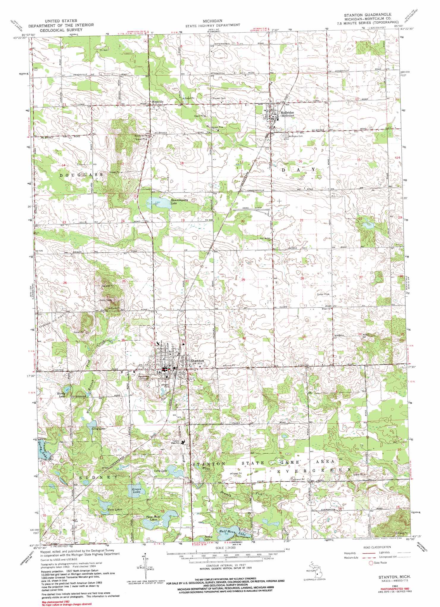
USGS Topo Quad 43085c1 - 1:24,000 scale
| Topo Map Name: | Stanton |
| USGS Topo Quad ID: | 43085c1 |
| Print Size: | ca. 21 1/4" wide x 27" high |
| Southeast Coordinates: | 43.25° N latitude / 85° W longitude |
| Map Center Coordinates: | 43.3125° N latitude / 85.0625° W longitude |
| U.S. State: | MI |
| Filename: | o43085c1.jpg |
| Download Map JPG Image: | Stanton topo map 1:24,000 scale |
| Map Type: | Topographic |
| Topo Series: | 7.5´ |
| Map Scale: | 1:24,000 |
| Source of Map Images: | United States Geological Survey (USGS) |
| Alternate Map Versions: |
Stanton MI 1964, updated 1966 Download PDF Buy paper map Stanton MI 1964, updated 1982 Download PDF Buy paper map Stanton MI 1964, updated 1982 Download PDF Buy paper map Stanton MI 1964, updated 1982 Download PDF Buy paper map Stanton MI 2011 Download PDF Buy paper map Stanton MI 2014 Download PDF Buy paper map Stanton MI 2017 Download PDF Buy paper map |
1:24,000 Topo Quads surrounding Stanton
Altona |
Mecosta |
Blanchard |
Winn |
Mount Pleasant |
Lakeview |
Six Lakes |
Edmore |
Vestaburg |
Riverdale |
Trufant |
Langston |
Stanton |
Crystal |
Sumner |
Greenville West |
Greenville East |
Sheridan |
Butternut |
Carson City |
Smyrna |
Belding |
Shiloh |
Palo |
Hubbardston |
> Back to 43085a1 at 1:100,000 scale
> Back to 43084a1 at 1:250,000 scale
> Back to U.S. Topo Maps home
Stanton topo map: Gazetteer
Stanton: Lakes
Colby Lake elevation 261m 856′Grass Lake elevation 260m 853′
Gray Lake elevation 260m 853′
Half Moon Lake elevation 256m 839′
Hardley Lake elevation 270m 885′
Hemmingway Lake elevation 281m 921′
Penny Lake elevation 258m 846′
Twin Lakes elevation 260m 853′
Twin Stone Lakes elevation 259m 849′
Stanton: Oilfields
Stanton Oil Field elevation 282m 925′Stanton: Parks
Stanton State Game Area elevation 262m 859′Stanton: Populated Places
McBride elevation 292m 958′Stanton elevation 280m 918′
Stanton Mobile Home Park elevation 277m 908′
Westville elevation 290m 951′
Stanton: Post Offices
Colby Post Office (historical) elevation 262m 859′McBrides Post Office elevation 293m 961′
Stanton Post Office elevation 277m 908′
Westville Post Office (historical) elevation 290m 951′
Stanton digital topo map on disk
Buy this Stanton topo map showing relief, roads, GPS coordinates and other geographical features, as a high-resolution digital map file on DVD: