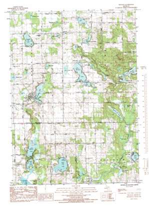
Trufant Topo Map Michigan
To zoom in, hover over the map of Trufant
USGS Topo Quad 43085c3 - 1:24,000 scale
| Topo Map Name: | Trufant |
| USGS Topo Quad ID: | 43085c3 |
| Print Size: | ca. 21 1/4" wide x 27" high |
| Southeast Coordinates: | 43.25° N latitude / 85.25° W longitude |
| Map Center Coordinates: | 43.3125° N latitude / 85.3125° W longitude |
| U.S. State: | MI |
| Filename: | o43085c3.jpg |
| Download Map JPG Image: | Trufant topo map 1:24,000 scale |
| Map Type: | Topographic |
| Topo Series: | 7.5´ |
| Map Scale: | 1:24,000 |
| Source of Map Images: | United States Geological Survey (USGS) |
| Alternate Map Versions: |
Trufant MI 1985, updated 1985 Download PDF Buy paper map Trufant MI 2011 Download PDF Buy paper map Trufant MI 2014 Download PDF Buy paper map Trufant MI 2017 Download PDF Buy paper map |
1:24,000 Topo Quads surrounding Trufant
> Back to 43085a1 at 1:100,000 scale
> Back to 43084a1 at 1:250,000 scale
> Back to U.S. Topo Maps home
Trufant topo map: Gazetteer
Trufant: Lakes
Barnard Lake elevation 278m 912′Bass Lake elevation 259m 849′
Black Lake elevation 255m 836′
Black Lake elevation 277m 908′
Blue Lake elevation 255m 836′
Cedar Lake elevation 255m 836′
Cowden Lake elevation 279m 915′
Cranberry Lake elevation 280m 918′
Dutchman Lakes elevation 268m 879′
Horseshoe Lake elevation 283m 928′
Hunter Lake elevation 257m 843′
Kendalville Lake elevation 284m 931′
Little Lake elevation 276m 905′
Little Norton Lake elevation 257m 843′
Lossin Lake elevation 279m 915′
Mahaney Lake elevation 283m 928′
Maston Lake elevation 256m 839′
Middle Lake elevation 277m 908′
Moore Lake elevation 276m 905′
Mosquito Lake elevation 284m 931′
Mud Lake elevation 256m 839′
Muskellunge Lake elevation 267m 875′
Norton Lake elevation 255m 836′
Paulson Lake elevation 280m 918′
Peterson Lake elevation 269m 882′
Rainbow Lake elevation 276m 905′
Rocky Lake elevation 283m 928′
Sawdust Lake elevation 277m 908′
School Section Lake elevation 253m 830′
Simmons Lake elevation 258m 846′
Spring Lake elevation 269m 882′
Tacoma Lake elevation 269m 882′
West Lake elevation 269m 882′
Trufant: Parks
Flat River Park elevation 262m 859′Little Denmark Evangelical Lutheran Church Historical Marker elevation 277m 908′
Trufant: Populated Places
Gowen elevation 264m 866′Trufant elevation 274m 898′
Turk Lake elevation 262m 859′
Trufant: Post Offices
Gowen Post Office elevation 258m 846′Trufant Post Office elevation 276m 905′
Trufant digital topo map on disk
Buy this Trufant topo map showing relief, roads, GPS coordinates and other geographical features, as a high-resolution digital map file on DVD:


