Bridgeton Topo Map Michigan
To zoom in, hover over the map of Bridgeton
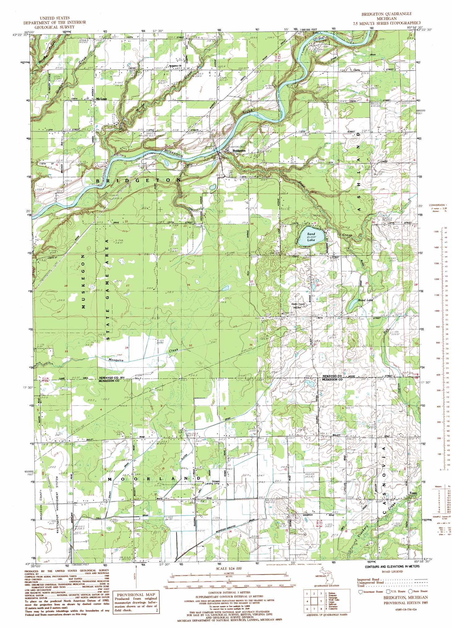
USGS Topo Quad 43085c8 - 1:24,000 scale
| Topo Map Name: | Bridgeton |
| USGS Topo Quad ID: | 43085c8 |
| Print Size: | ca. 21 1/4" wide x 27" high |
| Southeast Coordinates: | 43.25° N latitude / 85.875° W longitude |
| Map Center Coordinates: | 43.3125° N latitude / 85.9375° W longitude |
| U.S. State: | MI |
| Filename: | o43085c8.jpg |
| Download Map JPG Image: | Bridgeton topo map 1:24,000 scale |
| Map Type: | Topographic |
| Topo Series: | 7.5´ |
| Map Scale: | 1:24,000 |
| Source of Map Images: | United States Geological Survey (USGS) |
| Alternate Map Versions: |
Bridgeton MI 1985, updated 1985 Download PDF Buy paper map Bridgeton MI 2011 Download PDF Buy paper map Bridgeton MI 2014 Download PDF Buy paper map Bridgeton MI 2017 Download PDF Buy paper map |
1:24,000 Topo Quads surrounding Bridgeton
Ferry |
Hesperia |
Dayton Center |
White Cloud |
Big Prairie |
Big Blue Lake |
Holton |
Fremont |
Newaygo |
Croton |
Twin Lake |
Wolf Lake |
Bridgeton |
Grant |
Sand Lake Sw |
Muskegon East |
Sullivan |
Ravenna |
Casnovia |
Sparta |
Grand Haven |
Nunica |
Coopersville |
Marne |
Cedar Springs Sw |
> Back to 43085a1 at 1:100,000 scale
> Back to 43084a1 at 1:250,000 scale
> Back to U.S. Topo Maps home
Bridgeton topo map: Gazetteer
Bridgeton: Airports
Streams Airpark elevation 214m 702′Bridgeton: Canals
Dailey Drain elevation 213m 698′Lewis Drain elevation 218m 715′
Slater Drain elevation 216m 708′
Bridgeton: Lakes
Blood Lake elevation 224m 734′Sand Lake elevation 223m 731′
Bridgeton: Populated Places
Bridgeton elevation 193m 633′McLean elevation 218m 715′
Bridgeton: Post Offices
Bixby Post Office (historical) elevation 216m 708′Bridgeton Post Office (historical) elevation 197m 646′
Dickinson Post Office (historical) elevation 232m 761′
McLeans Post Office (historical) elevation 218m 715′
Trent Post Office (historical) elevation 219m 718′
Bridgeton: Streams
Indian Run elevation 222m 728′Minnie Creek elevation 186m 610′
Sand Creek elevation 186m 610′
Bridgeton digital topo map on disk
Buy this Bridgeton topo map showing relief, roads, GPS coordinates and other geographical features, as a high-resolution digital map file on DVD: