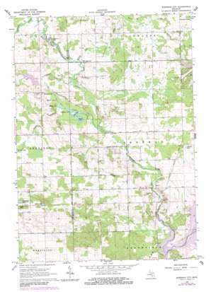
Sherman City Topo Map Michigan
To zoom in, hover over the map of Sherman City
USGS Topo Quad 43085f1 - 1:24,000 scale
| Topo Map Name: | Sherman City |
| USGS Topo Quad ID: | 43085f1 |
| Print Size: | ca. 21 1/4" wide x 27" high |
| Southeast Coordinates: | 43.625° N latitude / 85° W longitude |
| Map Center Coordinates: | 43.6875° N latitude / 85.0625° W longitude |
| U.S. State: | MI |
| Filename: | o43085f1.jpg |
| Download Map JPG Image: | Sherman City topo map 1:24,000 scale |
| Map Type: | Topographic |
| Topo Series: | 7.5´ |
| Map Scale: | 1:24,000 |
| Source of Map Images: | United States Geological Survey (USGS) |
| Alternate Map Versions: |
Sherman City MI 1964, updated 1965 Download PDF Buy paper map Sherman City MI 1964, updated 1982 Download PDF Buy paper map Sherman City MI 1964, updated 1983 Download PDF Buy paper map Sherman City MI 2011 Download PDF Buy paper map Sherman City MI 2014 Download PDF Buy paper map Sherman City MI 2017 Download PDF Buy paper map |
1:24,000 Topo Quads surrounding Sherman City
> Back to 43085e1 at 1:100,000 scale
> Back to 43084a1 at 1:250,000 scale
> Back to U.S. Topo Maps home
Sherman City topo map: Gazetteer
Sherman City: Airports
Ojibwa Airpark elevation 292m 958′Sherman City: Lakes
Grassy Lake elevation 314m 1030′Hammond Lake elevation 290m 951′
Hoffman Lake elevation 280m 918′
Indian Lake elevation 311m 1020′
Long Lake elevation 280m 918′
Markel Lake elevation 280m 918′
Randall Lake elevation 280m 918′
Round Lake elevation 280m 918′
Rounds Lake elevation 280m 918′
Six Lakes elevation 280m 918′
Strong Lake elevation 280m 918′
Thompson Lake elevation 319m 1046′
Sherman City: Oilfields
Coldwater Oil and Gas Field elevation 308m 1010′Sherman Oil Field elevation 292m 958′
Sherman City: Parks
Gilmore Park elevation 273m 895′Sherman City Historical Marker elevation 294m 964′
Sherman City Union Church Historical Marker elevation 294m 964′
Sherman City: Populated Places
Chippewa Vista elevation 289m 948′Drew elevation 281m 921′
Horr elevation 280m 918′
Sherman City elevation 292m 958′
Titus elevation 319m 1046′
Sherman City: Post Offices
Broomfield Post Office (historical) elevation 276m 905′Bundy Post Office (historical) elevation 279m 915′
Drew Post Office (historical) elevation 281m 921′
Fork Post Office (historical) elevation 294m 964′
Horr Post Office (historical) elevation 280m 918′
Rienza Post Office (historical) elevation 287m 941′
Sherman City Post Office (historical) elevation 293m 961′
Titus Post Office (historical) elevation 319m 1046′
Sherman City: Streams
Bamber Creek elevation 280m 918′Indian Creek elevation 275m 902′
Sherman Creek elevation 288m 944′
Squaw Creek elevation 272m 892′
Tanner Creek elevation 283m 928′
Sherman City digital topo map on disk
Buy this Sherman City topo map showing relief, roads, GPS coordinates and other geographical features, as a high-resolution digital map file on DVD:


