Reed City South Topo Map Michigan
To zoom in, hover over the map of Reed City South
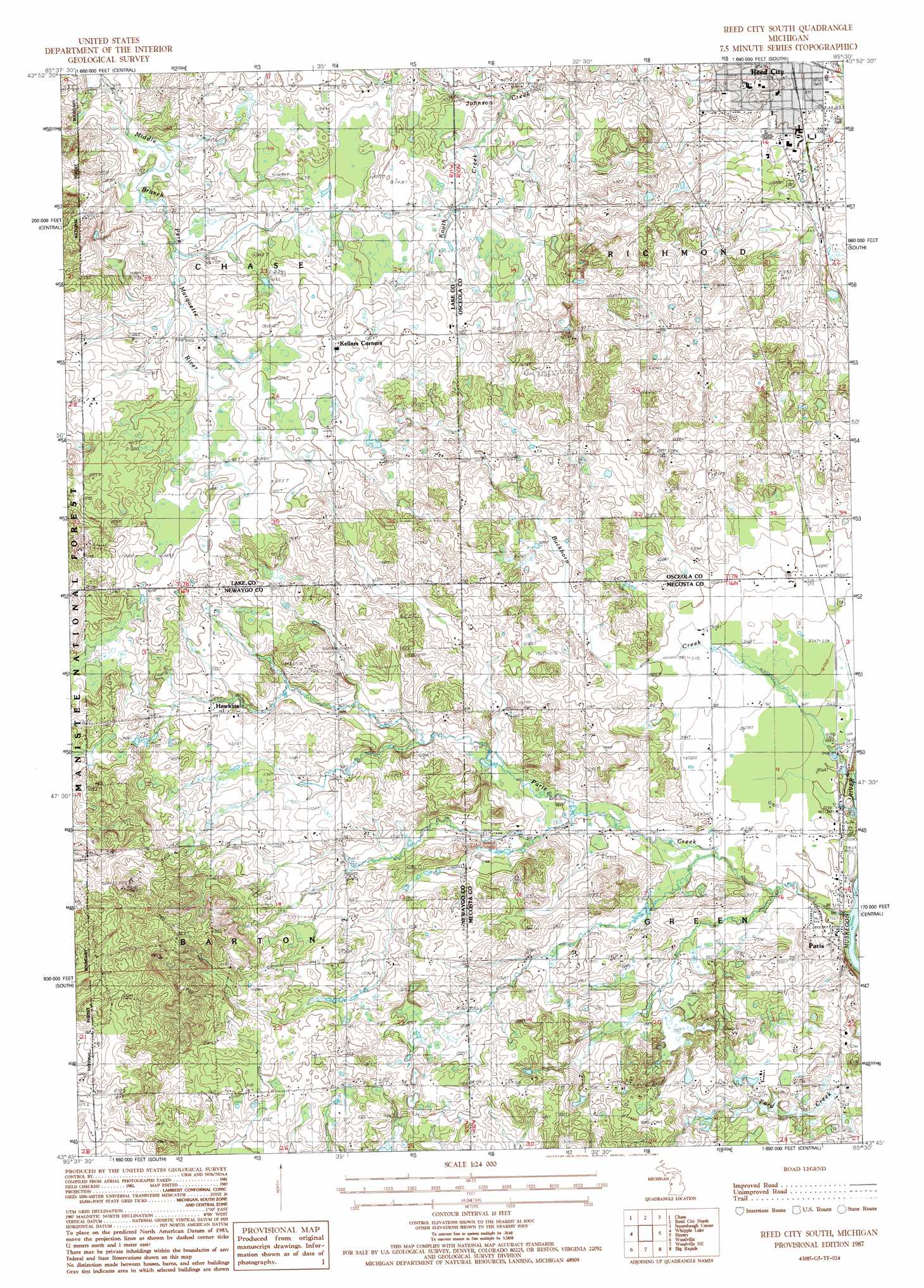
USGS Topo Quad 43085g5 - 1:24,000 scale
| Topo Map Name: | Reed City South |
| USGS Topo Quad ID: | 43085g5 |
| Print Size: | ca. 21 1/4" wide x 27" high |
| Southeast Coordinates: | 43.75° N latitude / 85.5° W longitude |
| Map Center Coordinates: | 43.8125° N latitude / 85.5625° W longitude |
| U.S. State: | MI |
| Filename: | o43085g5.jpg |
| Download Map JPG Image: | Reed City South topo map 1:24,000 scale |
| Map Type: | Topographic |
| Topo Series: | 7.5´ |
| Map Scale: | 1:24,000 |
| Source of Map Images: | United States Geological Survey (USGS) |
| Alternate Map Versions: |
Reed City South MI 1987, updated 1987 Download PDF Buy paper map Reed City South MI 2011 Download PDF Buy paper map Reed City South MI 2014 Download PDF Buy paper map Reed City South MI 2017 Download PDF Buy paper map |
| FStopo: | US Forest Service topo Reed City South is available: Download FStopo PDF Download FStopo TIF |
1:24,000 Topo Quads surrounding Reed City South
Peacock Se |
Luther Sw |
Luther Se |
Le Roy |
Dighton |
Baldwin |
Chase |
Reed City North |
Slaybaugh Corner |
Evart |
Marlborough |
Whipple Lake |
Reed City South |
Hersey |
Chippewa Lake North |
Woodland Park |
Woodville |
Woodville Ne |
Big Rapids |
Chippewa Lake South |
White Cloud |
Big Prairie |
Big Bend |
Stanwood |
Altona |
> Back to 43085e1 at 1:100,000 scale
> Back to 43084a1 at 1:250,000 scale
> Back to U.S. Topo Maps home
Reed City South topo map: Gazetteer
Reed City South: Parks
Barton Township Park elevation 347m 1138′Paris Fish Hatchery Historical Marker elevation 289m 948′
Paris Park elevation 287m 941′
Reed City South: Populated Places
Country Mobile Home Park elevation 287m 941′Hawkins elevation 344m 1128′
Paris elevation 283m 928′
White Birch Estates Mobile Home Park elevation 320m 1049′
Youngs Trailer Park elevation 312m 1023′
Reed City South: Post Offices
Hawkins Post Office (historical) elevation 344m 1128′Paris Post Office elevation 288m 944′
Reed City South: Streams
Buckhorn Creek elevation 281m 921′Knuth Creek elevation 339m 1112′
Paris Creek elevation 281m 921′
Sanders Creek elevation 298m 977′
Reed City South digital topo map on disk
Buy this Reed City South topo map showing relief, roads, GPS coordinates and other geographical features, as a high-resolution digital map file on DVD: