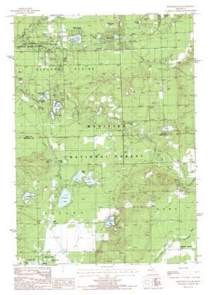
Marlborough Topo Map Michigan
To zoom in, hover over the map of Marlborough
USGS Topo Quad 43085g7 - 1:24,000 scale
| Topo Map Name: | Marlborough |
| USGS Topo Quad ID: | 43085g7 |
| Print Size: | ca. 21 1/4" wide x 27" high |
| Southeast Coordinates: | 43.75° N latitude / 85.75° W longitude |
| Map Center Coordinates: | 43.8125° N latitude / 85.8125° W longitude |
| U.S. State: | MI |
| Filename: | o43085g7.jpg |
| Download Map JPG Image: | Marlborough topo map 1:24,000 scale |
| Map Type: | Topographic |
| Topo Series: | 7.5´ |
| Map Scale: | 1:24,000 |
| Source of Map Images: | United States Geological Survey (USGS) |
| Alternate Map Versions: |
Marlborough MI 1987, updated 1987 Download PDF Buy paper map Marlborough MI 2012 Download PDF Buy paper map Marlborough MI 2014 Download PDF Buy paper map Marlborough MI 2017 Download PDF Buy paper map |
| FStopo: | US Forest Service topo Marlborough is available: Download FStopo PDF Download FStopo TIF |
1:24,000 Topo Quads surrounding Marlborough
> Back to 43085e1 at 1:100,000 scale
> Back to 43084a1 at 1:250,000 scale
> Back to U.S. Topo Maps home
Marlborough topo map: Gazetteer
Marlborough: Lakes
Conna-Mara Lake elevation 264m 866′Houseman Lake elevation 261m 856′
Lilley Lake elevation 261m 856′
Little Bullhead Lake elevation 260m 853′
Little Lake Number One elevation 249m 816′
Little Lake Number Three elevation 245m 803′
Little Lake Number Two elevation 245m 803′
Mowby Lake elevation 260m 853′
North Lake elevation 242m 793′
North Pond elevation 239m 784′
Pettibone Lake elevation 270m 885′
Pickerel Lake elevation 260m 853′
Railroad Lake elevation 262m 859′
Rattlesnake Lake elevation 253m 830′
Schultz Lake elevation 262m 859′
Sisson Lake elevation 261m 856′
South Lake elevation 249m 816′
Spruce Lake elevation 245m 803′
Stevens Lake elevation 242m 793′
Switzer Lake elevation 258m 846′
Watermill Lake elevation 249m 816′
Woods Lake elevation 262m 859′
Marlborough: Parks
Brown Trout Historical Marker elevation 249m 816′Pettibone Lake Park elevation 271m 889′
Shrine of the Pines elevation 248m 813′
Marlborough: Populated Places
Lilley elevation 263m 862′Marlborough elevation 247m 810′
Marlborough: Post Offices
Alderson Post Office (historical) elevation 258m 846′Jewell Post Office (historical) elevation 257m 843′
Lilley Post Office (historical) elevation 263m 862′
Marlboro Post Office (historical) elevation 247m 810′
Marlborough: Streams
Blood Creek elevation 250m 820′Little South Branch Pere Marquette River elevation 241m 790′
Middle Branch Pere Marquette River elevation 241m 790′
Pease Creek elevation 271m 889′
Sanborn Creek elevation 234m 767′
Marlborough: Swamps
Spring Lake elevation 252m 826′Marlborough digital topo map on disk
Buy this Marlborough topo map showing relief, roads, GPS coordinates and other geographical features, as a high-resolution digital map file on DVD:


