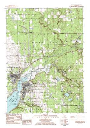
Montague Topo Map Michigan
To zoom in, hover over the map of Montague
USGS Topo Quad 43086d3 - 1:25,000 scale
| Topo Map Name: | Montague |
| USGS Topo Quad ID: | 43086d3 |
| Print Size: | ca. 21 1/4" wide x 27" high |
| Southeast Coordinates: | 43.375° N latitude / 86.25° W longitude |
| Map Center Coordinates: | 43.4375° N latitude / 86.3125° W longitude |
| U.S. State: | MI |
| Filename: | l43086d3.jpg |
| Download Map JPG Image: | Montague topo map 1:25,000 scale |
| Map Type: | Topographic |
| Topo Series: | 7.5´ |
| Map Scale: | 1:25,000 |
| Source of Map Images: | United States Geological Survey (USGS) |
| Alternate Map Versions: |
Montague MI 1983, updated 1983 Download PDF Buy paper map |
| FStopo: | US Forest Service topo Montague is available: Download FStopo PDF Download FStopo TIF |
1:24,000 Topo Quads surrounding Montague
> Back to 43086a1 at 1:100,000 scale
> Back to 43086a1 at 1:250,000 scale
> Back to U.S. Topo Maps home
Montague topo map: Gazetteer
Montague: Airports
Ottiger Airport elevation 207m 679′Montague: Lakes
Austin Lake elevation 197m 646′Browns Pond elevation 184m 603′
Dalton Lake elevation 192m 629′
Fogg Lake elevation 197m 646′
Hiscuit Lake elevation 185m 606′
Mill Pond elevation 192m 629′
Owasippe Lake elevation 194m 636′
Schneider Lake elevation 181m 593′
Silver Creek Pond elevation 177m 580′
Montague: Parks
Covell Park elevation 177m 580′Cullen Field elevation 191m 626′
Durham Road Playground elevation 205m 672′
Ellenwood Park elevation 197m 646′
Funnel Field elevation 191m 626′
Gee Park elevation 189m 620′
Goodrich Park elevation 177m 580′
Hilt's Landing elevation 194m 636′
Lebanon Lutheran Church Historical Marker elevation 191m 626′
Lions Park elevation 180m 590′
Lumbering on White Lake Historical Marker elevation 177m 580′
Maple Grove Park elevation 177m 580′
Mill Pond Park elevation 177m 580′
Norman Park elevation 179m 587′
Ruth Thompson Historical Marker elevation 193m 633′
Slocum Park elevation 194m 636′
Staples and Covell Mill Historical Marker elevation 177m 580′
Svensson Park elevation 177m 580′
White Lake Yacht Club Historical Marker elevation 191m 626′
Montague: Populated Places
Crystal Downs Mobile Village elevation 205m 672′Maple Grove elevation 192m 629′
Montague elevation 192m 629′
South Whitehall elevation 189m 620′
Wayside Mobile Court elevation 207m 679′
Whitehall elevation 187m 613′
Montague: Post Offices
Montague Post Office elevation 182m 597′Sweet's Station Post Office (historical) elevation 206m 675′
Whitehall Post Office elevation 191m 626′
Montague: Streams
Bush Creek elevation 180m 590′Carleton Creek elevation 175m 574′
Carlton Creek elevation 177m 580′
Mill Pond Creek elevation 177m 580′
Mud Creek elevation 184m 603′
Sand Creek elevation 179m 587′
Silver Creek elevation 175m 574′
Thomas Creek elevation 176m 577′
White River elevation 175m 574′
Wildcat Creek elevation 178m 583′
Montague: Swamps
Grass Lake elevation 202m 662′Montague digital topo map on disk
Buy this Montague topo map showing relief, roads, GPS coordinates and other geographical features, as a high-resolution digital map file on DVD:


