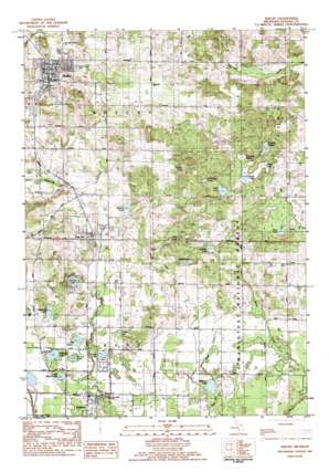
Shelby Topo Map Michigan
To zoom in, hover over the map of Shelby
USGS Topo Quad 43086e3 - 1:25,000 scale
| Topo Map Name: | Shelby |
| USGS Topo Quad ID: | 43086e3 |
| Print Size: | ca. 21 1/4" wide x 27" high |
| Southeast Coordinates: | 43.5° N latitude / 86.25° W longitude |
| Map Center Coordinates: | 43.5625° N latitude / 86.3125° W longitude |
| U.S. State: | MI |
| Filename: | l43086e3.jpg |
| Download Map JPG Image: | Shelby topo map 1:25,000 scale |
| Map Type: | Topographic |
| Topo Series: | 7.5´ |
| Map Scale: | 1:25,000 |
| Source of Map Images: | United States Geological Survey (USGS) |
| Alternate Map Versions: |
Shelby MI 1983, updated 1983 Download PDF Buy paper map |
| FStopo: | US Forest Service topo Shelby is available: Download FStopo PDF Download FStopo TIF |
1:24,000 Topo Quads surrounding Shelby
> Back to 43086e1 at 1:100,000 scale
> Back to 43086a1 at 1:250,000 scale
> Back to U.S. Topo Maps home
Shelby topo map: Gazetteer
Shelby: Lakes
Bear Lake elevation 227m 744′Bragg Lake elevation 236m 774′
Bunker Lake elevation 211m 692′
Carpenter Lake elevation 220m 721′
Chase Lake elevation 215m 705′
Dressler Lake elevation 236m 774′
Heitman Lake elevation 202m 662′
Inman Lake elevation 235m 770′
Lake Sixteen elevation 211m 692′
Little Wildcat Lake elevation 210m 688′
Lucky Lake elevation 208m 682′
Round Lake elevation 211m 692′
Schmidt Lake elevation 229m 751′
Weber Lake elevation 235m 770′
Wildcat Lake elevation 208m 682′
Zeek Lake elevation 238m 780′
Shelby: Parks
Hart-Montague Trail State Park elevation 226m 741′Shelby: Populated Places
New Era elevation 231m 757′Rothbury elevation 210m 688′
Shelby elevation 249m 816′
Shelby: Post Offices
Alice Post Office (historical) elevation 230m 754′New Era Post Office elevation 230m 754′
Rothbury Post Office elevation 210m 688′
Shelby Post Office elevation 250m 820′
Shelby: Swamps
Browns Pond elevation 240m 787′Helldiver Lake elevation 238m 780′
Pigeon Lake elevation 243m 797′
Potters Marsh elevation 235m 770′
Smith Lake elevation 233m 764′
Townline Marsh elevation 239m 784′
Shelby digital topo map on disk
Buy this Shelby topo map showing relief, roads, GPS coordinates and other geographical features, as a high-resolution digital map file on DVD:


