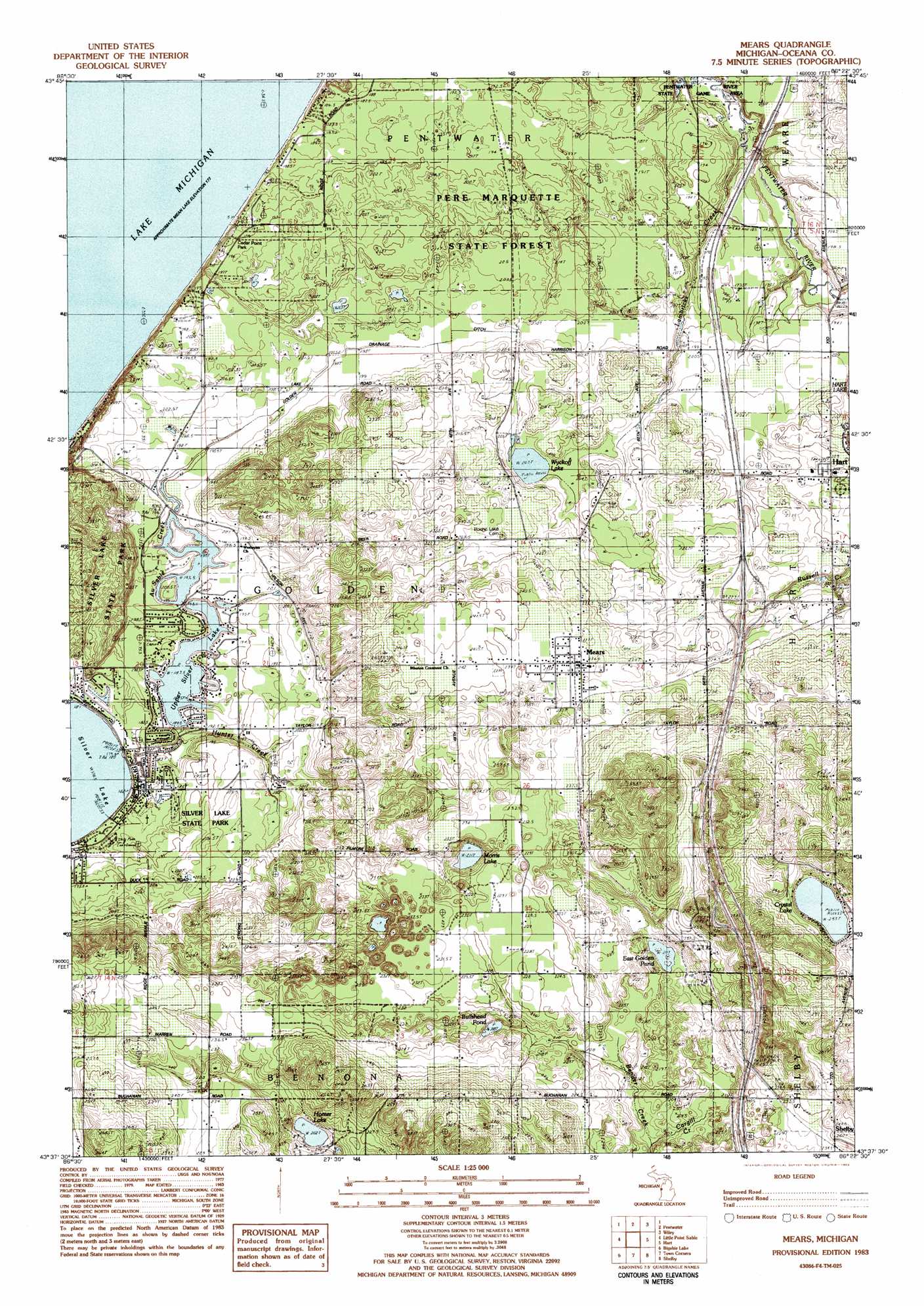
Mears Topo Map Michigan
To zoom in, hover over the map of Mears
USGS Topo Quad 43086f4 - 1:25,000 scale
| Topo Map Name: | Mears |
| USGS Topo Quad ID: | 43086f4 |
| Print Size: | ca. 21 1/4" wide x 27" high |
| Southeast Coordinates: | 43.625° N latitude / 86.375° W longitude |
| Map Center Coordinates: | 43.6875° N latitude / 86.4375° W longitude |
| U.S. State: | MI |
| Filename: | l43086f4.jpg |
| Download Map JPG Image: | Mears topo map 1:25,000 scale |
| Map Type: | Topographic |
| Topo Series: | 7.5´ |
| Map Scale: | 1:25,000 |
| Source of Map Images: | United States Geological Survey (USGS) |
| Alternate Map Versions: |
Mears MI 1983, updated 1983 Download PDF Buy paper map |
1:24,000 Topo Quads surrounding Mears
Ludington Nw |
Ludington Ne |
Custer Nw |
||
Pentwater |
Wiley |
Custer Sw |
||
Little Point Sable |
Mears |
Hart Ne |
Walkerville West |
|
Bigsbie Lake |
Town Corners |
Shelby |
Ferry |
|
Flower Creek |
Montague |
Big Blue Lake |
> Back to 43086e1 at 1:100,000 scale
> Back to 43086a1 at 1:250,000 scale
> Back to U.S. Topo Maps home
Mears topo map: Gazetteer
Mears: Airports
Silver Lake Airport elevation 233m 764′Mears: Canals
Golden Drainage Ditch elevation 198m 649′Mears: Lakes
Crystal Lake elevation 253m 830′Homer Lake elevation 202m 662′
Morris Lake elevation 211m 692′
Upper Silver Lake elevation 187m 613′
Wyckoff Lake elevation 203m 666′
Mears: Parks
Cedar Point Park elevation 195m 639′Mears: Populated Places
Mears elevation 237m 777′Pines Mobile Home Park elevation 208m 682′
Mears: Post Offices
East Golden Post Office (historical) elevation 236m 774′Golding Post Office (historical) elevation 196m 643′
Mears Post Office elevation 237m 777′
Mears: Streams
Au Sable Creek elevation 179m 587′Cargill Creek elevation 199m 652′
Hunter Creek elevation 185m 606′
Lambricks Creek elevation 188m 616′
Mears: Swamps
Bullhead Pond elevation 209m 685′East Golden Pond elevation 212m 695′
Mears digital topo map on disk
Buy this Mears topo map showing relief, roads, GPS coordinates and other geographical features, as a high-resolution digital map file on DVD: