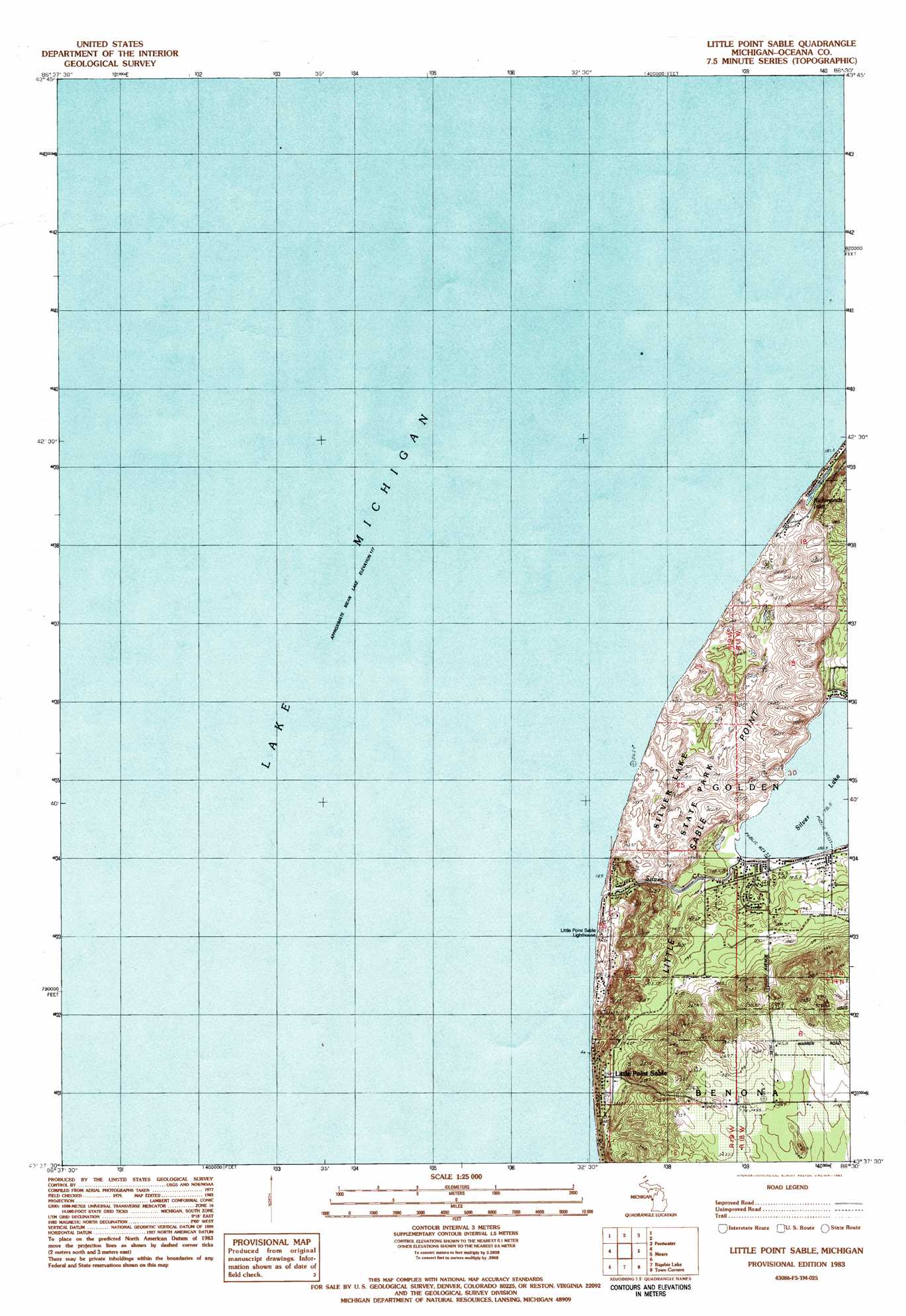
Little Point Sable Topo Map Michigan
To zoom in, hover over the map of Little Point Sable
USGS Topo Quad 43086f5 - 1:25,000 scale
| Topo Map Name: | Little Point Sable |
| USGS Topo Quad ID: | 43086f5 |
| Print Size: | ca. 21 1/4" wide x 27" high |
| Southeast Coordinates: | 43.625° N latitude / 86.5° W longitude |
| Map Center Coordinates: | 43.6875° N latitude / 86.5625° W longitude |
| U.S. State: | MI |
| Filename: | l43086f5.jpg |
| Download Map JPG Image: | Little Point Sable topo map 1:25,000 scale |
| Map Type: | Topographic |
| Topo Series: | 7.5´ |
| Map Scale: | 1:25,000 |
| Source of Map Images: | United States Geological Survey (USGS) |
| Alternate Map Versions: |
Little Point Sable MI 1983, updated 1983 Download PDF Buy paper map |
1:24,000 Topo Quads surrounding Little Point Sable
Ludington Nw |
Ludington Ne |
|||
Pentwater |
Wiley |
|||
Little Point Sable |
Mears |
Hart Ne |
||
Bigsbie Lake |
Town Corners |
Shelby |
||
Flower Creek |
Montague |
> Back to 43086e1 at 1:100,000 scale
> Back to 43086a1 at 1:250,000 scale
> Back to U.S. Topo Maps home
Little Point Sable topo map: Gazetteer
Little Point Sable: Capes
Little Sable Point elevation 185m 606′Little Point Sable: Lakes
Lake Michigan elevation 176m 577′Richmonds Inlet elevation 180m 590′
Silver Lake elevation 178m 583′
Little Point Sable: Parks
Charles Mears Silver Lake Boarding House Historical Marker elevation 179m 587′Golden Township Park elevation 180m 590′
Silver Lake State Park elevation 200m 656′
Little Point Sable: Populated Places
Little Point Sable elevation 202m 662′Little Point Sable: Post Offices
Little Point Sable Post Office (historical) elevation 202m 662′Little Point Sable: Streams
Silver Creek elevation 176m 577′Little Point Sable digital topo map on disk
Buy this Little Point Sable topo map showing relief, roads, GPS coordinates and other geographical features, as a high-resolution digital map file on DVD: