Custer Ne Topo Map Michigan
To zoom in, hover over the map of Custer Ne
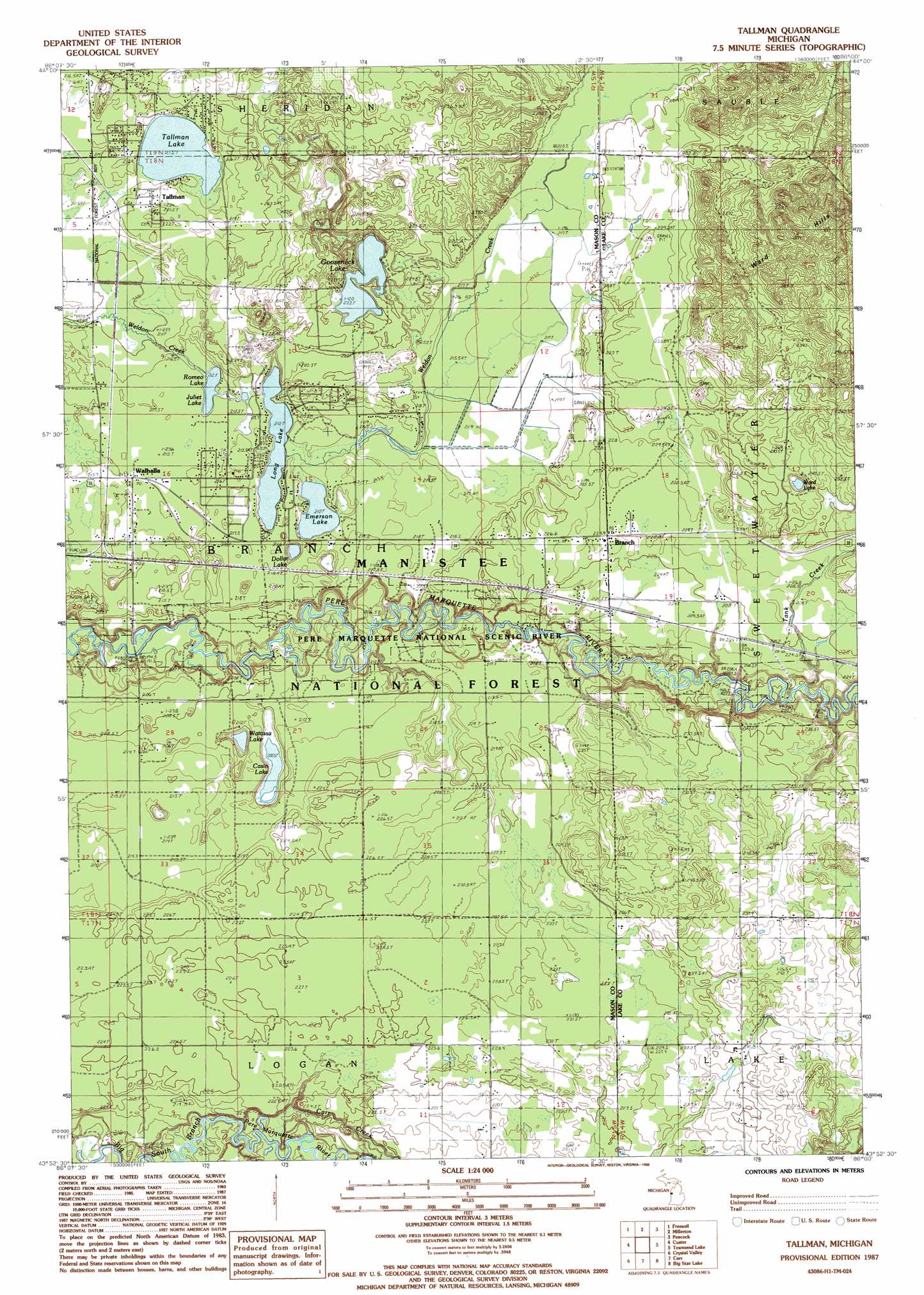
USGS Topo Quad 43086h1 - 1:24,000 scale
| Topo Map Name: | Custer Ne |
| USGS Topo Quad ID: | 43086h1 |
| Print Size: | ca. 21 1/4" wide x 27" high |
| Southeast Coordinates: | 43.875° N latitude / 86° W longitude |
| Map Center Coordinates: | 43.9375° N latitude / 86.0625° W longitude |
| U.S. State: | MI |
| Filename: | o43086h1.jpg |
| Download Map JPG Image: | Custer Ne topo map 1:24,000 scale |
| Map Type: | Topographic |
| Topo Series: | 7.5´ |
| Map Scale: | 1:24,000 |
| Source of Map Images: | United States Geological Survey (USGS) |
| Alternate Map Versions: |
Tallman MI 1987, updated 1988 Download PDF Buy paper map Tallman MI 2012 Download PDF Buy paper map Tallman MI 2014 Download PDF Buy paper map Tallman MI 2017 Download PDF Buy paper map |
| FStopo: | US Forest Service topo Tallman is available: Download FStopo PDF Download FStopo TIF |
1:24,000 Topo Quads surrounding Custer Ne
Manistee Ne |
Freesoil Nw |
Freesoil Ne |
Peacock Nw |
Peacock Ne |
Kings Corners |
Freesoil Sw |
Freesoil Se |
Peacock Sw |
Peacock Se |
Ludington Ne |
Custer Nw |
Custer Ne |
Townsend Lake |
Baldwin |
Wiley |
Custer Sw |
Custer Se |
Big Star Lake |
Marlborough |
Hart Ne |
Walkerville West |
Walkerville East |
Walkup Lake |
Woodland Park |
> Back to 43086e1 at 1:100,000 scale
> Back to 43086a1 at 1:250,000 scale
> Back to U.S. Topo Maps home
Custer Ne topo map: Gazetteer
Custer Ne: Bridges
Campbell Bridge elevation 204m 669′Custer Ne: Lakes
Casin Lake elevation 205m 672′Dollar Lake elevation 209m 685′
Emerson Lake elevation 212m 695′
Gooseneck Lake elevation 220m 721′
Juliet Lake elevation 212m 695′
Long Lake elevation 212m 695′
Romeo Lake elevation 212m 695′
Tallman Lake elevation 215m 705′
Ward Lake elevation 235m 770′
Watassa Lake elevation 211m 692′
Custer Ne: Populated Places
Tallman elevation 220m 721′Walhalla elevation 213m 698′
Custer Ne: Post Offices
Branch Post Office elevation 229m 751′Tallman Post Office (historical) elevation 220m 721′
Walhalla Post Office elevation 213m 698′
Custer Ne: Streams
Carr Creek elevation 205m 672′Tank Creek elevation 214m 702′
Custer Ne digital topo map on disk
Buy this Custer Ne topo map showing relief, roads, GPS coordinates and other geographical features, as a high-resolution digital map file on DVD: