Port Washington West Topo Map Wisconsin
To zoom in, hover over the map of Port Washington West
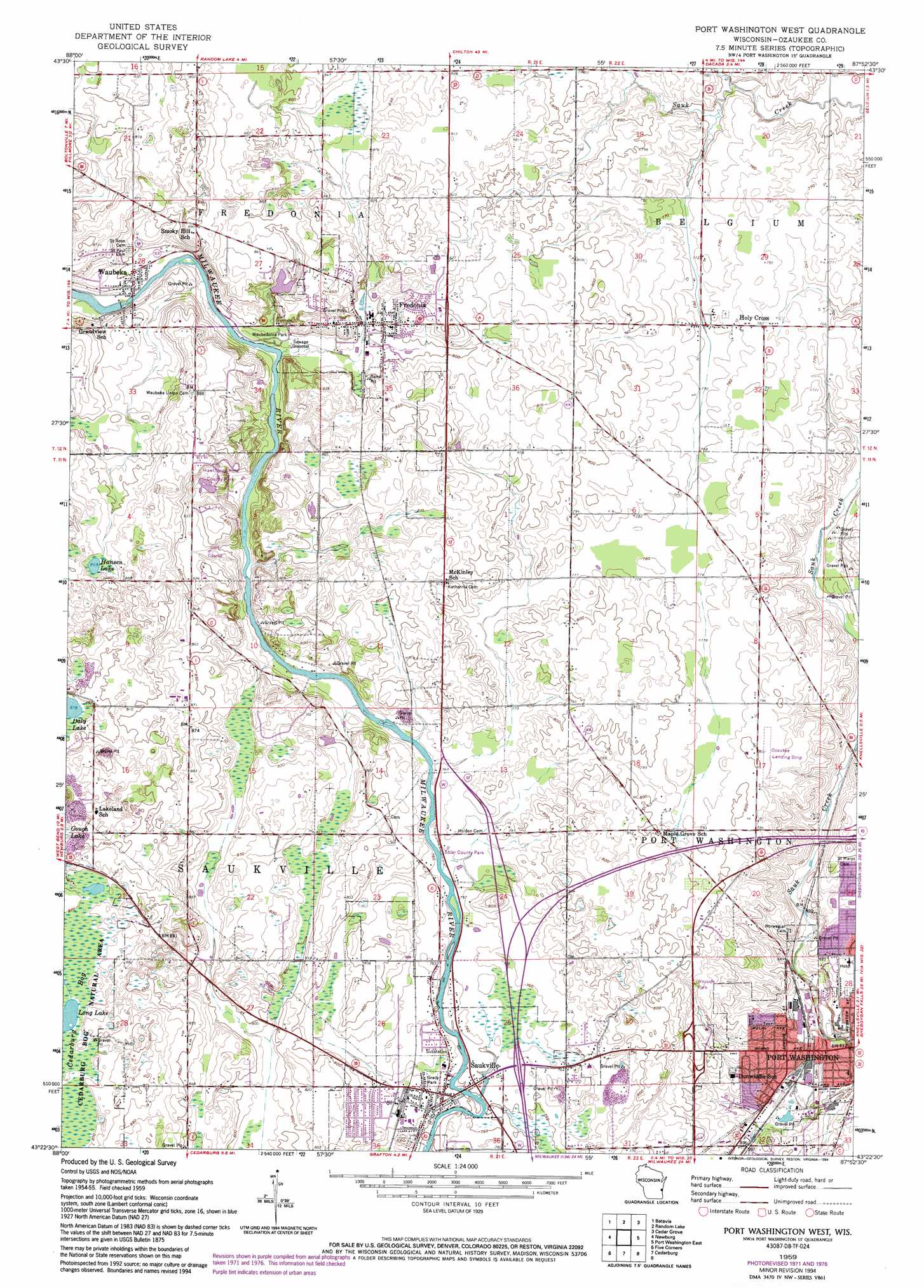
USGS Topo Quad 43087d8 - 1:24,000 scale
| Topo Map Name: | Port Washington West |
| USGS Topo Quad ID: | 43087d8 |
| Print Size: | ca. 21 1/4" wide x 27" high |
| Southeast Coordinates: | 43.375° N latitude / 87.875° W longitude |
| Map Center Coordinates: | 43.4375° N latitude / 87.9375° W longitude |
| U.S. State: | WI |
| Filename: | o43087d8.jpg |
| Download Map JPG Image: | Port Washington West topo map 1:24,000 scale |
| Map Type: | Topographic |
| Topo Series: | 7.5´ |
| Map Scale: | 1:24,000 |
| Source of Map Images: | United States Geological Survey (USGS) |
| Alternate Map Versions: |
Port Washington West WI 1959, updated 1960 Download PDF Buy paper map Port Washington West WI 1959, updated 1973 Download PDF Buy paper map Port Washington West WI 1959, updated 1994 Download PDF Buy paper map Port Washington West WI 2010 Download PDF Buy paper map Port Washington West WI 2013 Download PDF Buy paper map Port Washington West WI 2016 Download PDF Buy paper map |
1:24,000 Topo Quads surrounding Port Washington West
Dundee |
Cascade |
Plymouth South |
Sheboygan Falls |
Sheboygan South |
Kewaskum |
Batavia |
Random Lake |
Cedar Grove |
|
West Bend |
Newburg |
Port Washington West |
Port Washington East |
|
Jackson |
Five Corners |
Cedarburg |
||
Sussex |
Menomonee Falls |
Thiensville |
> Back to 43087a1 at 1:100,000 scale
> Back to 43086a1 at 1:250,000 scale
> Back to U.S. Topo Maps home
Port Washington West topo map: Gazetteer
Port Washington West: Airports
Ozaukee Airport elevation 241m 790′Saint Marys Hospital Ozaukee Heliport elevation 216m 708′
Port Washington West: Crossings
Interchange 96 elevation 231m 757′Interchange 97 elevation 234m 767′
Port Washington West: Dams
Waubeka Dam elevation 238m 780′Port Washington West: Lakes
Daly Lake elevation 268m 879′Hansen Lake elevation 263m 862′
Port Washington West: Parks
Ehler County Park elevation 233m 764′Grady Park elevation 231m 757′
Hawthorne Hills County Park elevation 253m 830′
Waubedonia Park elevation 238m 780′
Port Washington West: Populated Places
Fredonia elevation 248m 813′Holy Cross elevation 236m 774′
Port Washington elevation 183m 600′
Saukville elevation 231m 757′
Waubeka elevation 243m 797′
Port Washington West: Reservoirs
Waubeka Millpond 412 elevation 238m 780′Port Washington West digital topo map on disk
Buy this Port Washington West topo map showing relief, roads, GPS coordinates and other geographical features, as a high-resolution digital map file on DVD: