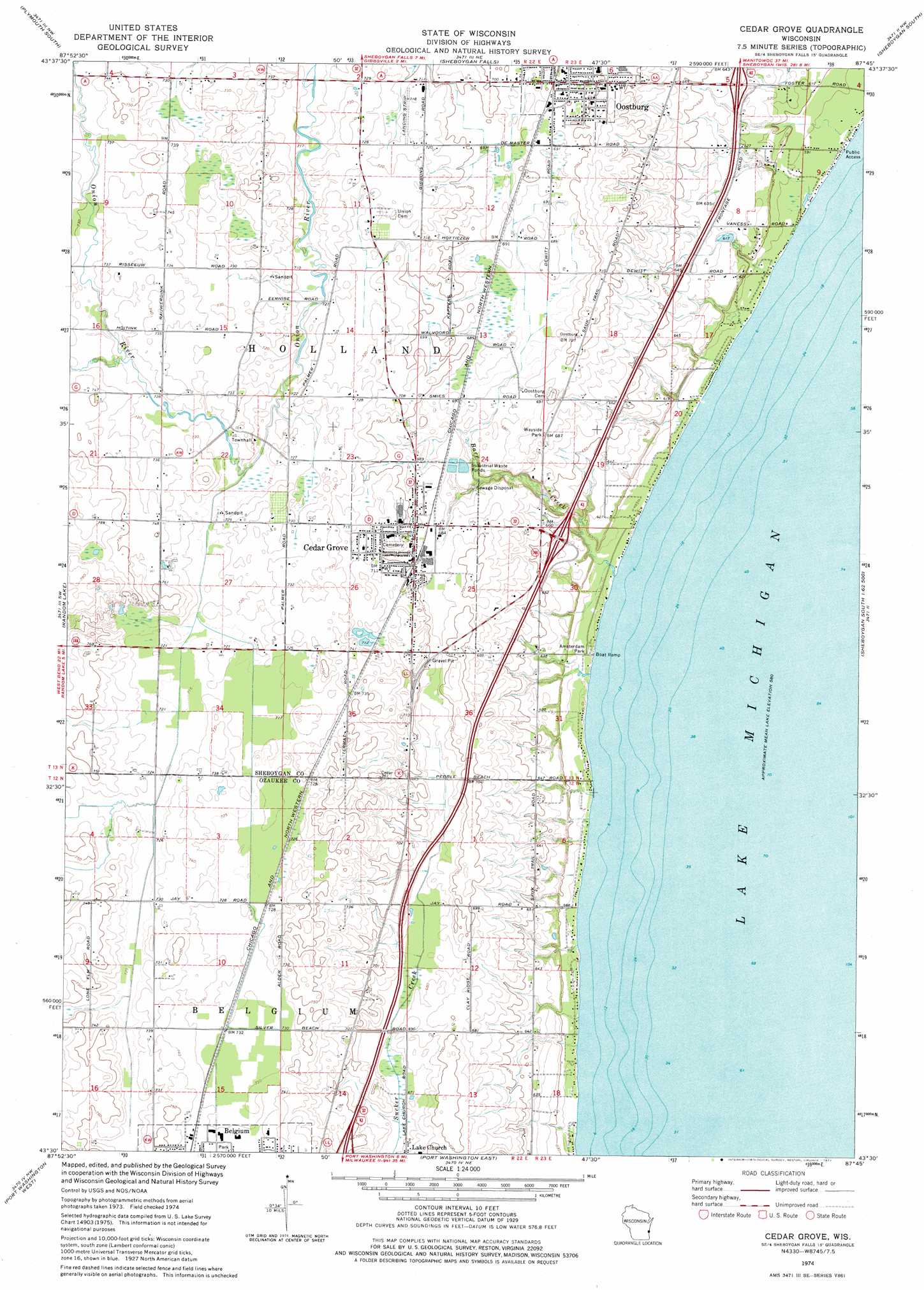
Cedar Grove Topo Map Wisconsin
To zoom in, hover over the map of Cedar Grove
USGS Topo Quad 43087e7 - 1:24,000 scale
| Topo Map Name: | Cedar Grove |
| USGS Topo Quad ID: | 43087e7 |
| Print Size: | ca. 21 1/4" wide x 27" high |
| Southeast Coordinates: | 43.5° N latitude / 87.75° W longitude |
| Map Center Coordinates: | 43.5625° N latitude / 87.8125° W longitude |
| U.S. State: | WI |
| Filename: | o43087e7.jpg |
| Download Map JPG Image: | Cedar Grove topo map 1:24,000 scale |
| Map Type: | Topographic |
| Topo Series: | 7.5´ |
| Map Scale: | 1:24,000 |
| Source of Map Images: | United States Geological Survey (USGS) |
| Alternate Map Versions: |
Cedar Grove WI 1974, updated 1977 Download PDF Buy paper map Cedar Grove WI 2010 Download PDF Buy paper map Cedar Grove WI 2013 Download PDF Buy paper map Cedar Grove WI 2016 Download PDF Buy paper map |
1:24,000 Topo Quads surrounding Cedar Grove
Elkhart Lake |
Franklin |
Howards Grove |
Sheboygan North |
|
Cascade |
Plymouth South |
Sheboygan Falls |
Sheboygan South |
|
Batavia |
Random Lake |
Cedar Grove |
||
Newburg |
Port Washington West |
Port Washington East |
||
Five Corners |
Cedarburg |
> Back to 43087e1 at 1:100,000 scale
> Back to 43086a1 at 1:250,000 scale
> Back to U.S. Topo Maps home
Cedar Grove topo map: Gazetteer
Cedar Grove: Airports
Dulmes Field elevation 217m 711′Smies Airport elevation 196m 643′
Cedar Grove: Crossings
Interchange 113 elevation 195m 639′Interchange 116 elevation 191m 626′
Cedar Grove: Parks
Amsterdam Park elevation 180m 590′Cedar Grove Hawk Research Station State Natural Area elevation 180m 590′
Millpond Park elevation 176m 577′
Cedar Grove: Populated Places
Cedar Grove elevation 219m 718′Idlewood Beach elevation 179m 587′
Oostburg elevation 213m 698′
Sauk Trail Beach elevation 178m 583′
Cedar Grove: Streams
Barr Creek elevation 178m 583′Cedar Grove digital topo map on disk
Buy this Cedar Grove topo map showing relief, roads, GPS coordinates and other geographical features, as a high-resolution digital map file on DVD: