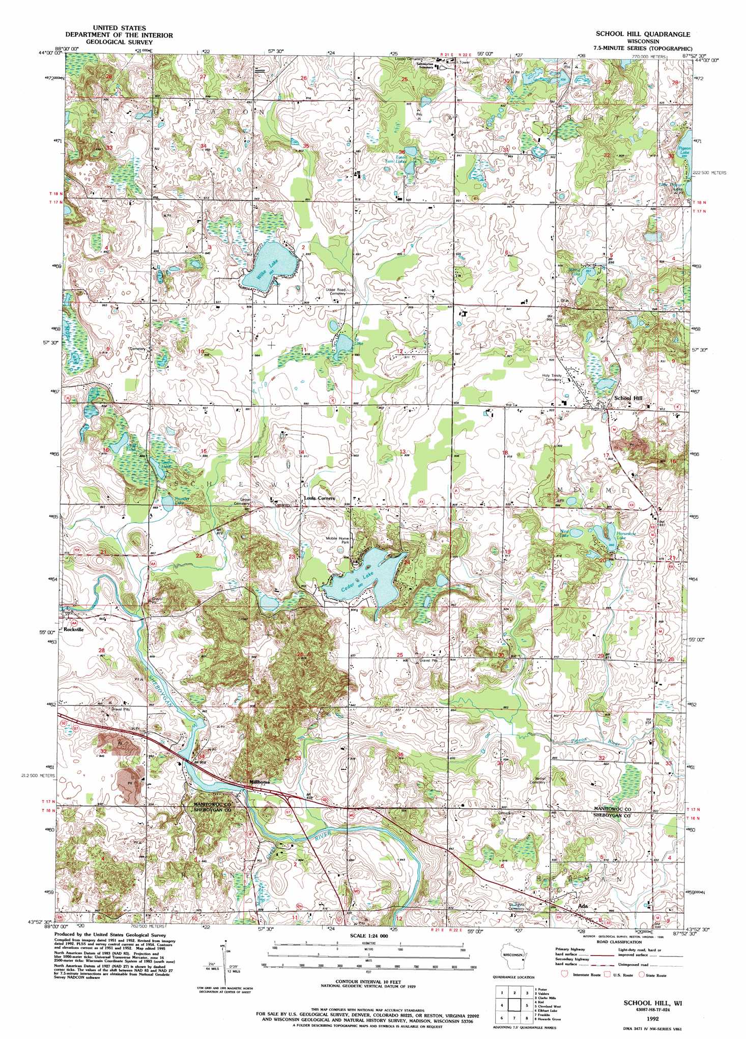
School Hill Topo Map Wisconsin
To zoom in, hover over the map of School Hill
USGS Topo Quad 43087h8 - 1:24,000 scale
| Topo Map Name: | School Hill |
| USGS Topo Quad ID: | 43087h8 |
| Print Size: | ca. 21 1/4" wide x 27" high |
| Southeast Coordinates: | 43.875° N latitude / 87.875° W longitude |
| Map Center Coordinates: | 43.9375° N latitude / 87.9375° W longitude |
| U.S. State: | WI |
| Filename: | o43087h8.jpg |
| Download Map JPG Image: | School Hill topo map 1:24,000 scale |
| Map Type: | Topographic |
| Topo Series: | 7.5´ |
| Map Scale: | 1:24,000 |
| Source of Map Images: | United States Geological Survey (USGS) |
| Alternate Map Versions: |
School Hill WI 1954, updated 1956 Download PDF Buy paper map School Hill WI 1954, updated 1974 Download PDF Buy paper map School Hill WI 1992, updated 1996 Download PDF Buy paper map School Hill WI 2010 Download PDF Buy paper map School Hill WI 2013 Download PDF Buy paper map School Hill WI 2016 Download PDF Buy paper map |
1:24,000 Topo Quads surrounding School Hill
Hilbert |
Brillion |
Reedsville |
Whitelaw |
Mishicot |
Chilton |
Potter |
Valders |
Clarks Mills |
Manitowoc |
Marytown |
Kiel |
School Hill |
Cleveland West |
Cleveland East |
Saint Cloud |
Elkhart Lake |
Franklin |
Howards Grove |
Sheboygan North |
Dundee |
Cascade |
Plymouth South |
Sheboygan Falls |
Sheboygan South |
> Back to 43087e1 at 1:100,000 scale
> Back to 43086a1 at 1:250,000 scale
> Back to U.S. Topo Maps home
School Hill topo map: Gazetteer
School Hill: Dams
Millhome WP396 Dam elevation 261m 856′Rockville Dam elevation 268m 879′
School Hill: Lakes
Cedar Lake elevation 271m 889′Eaton Twin Lakes elevation 278m 912′
Graf Lake elevation 265m 869′
Horseshoe Lake elevation 268m 879′
Mud Lake elevation 270m 885′
Prueder Lake elevation 264m 866′
Shoe Lake elevation 267m 875′
Spring Lake elevation 273m 895′
Sy Lake elevation 267m 875′
West Lake elevation 269m 882′
Wilke Lake elevation 272m 892′
School Hill: Parks
Vanderbloemen Bog State Natural Area elevation 288m 944′School Hill: Populated Places
Ada elevation 272m 892′Louis Corners elevation 278m 912′
Millhome elevation 268m 879′
Rockville elevation 266m 872′
School Hill elevation 281m 921′
School Hill: Reservoirs
Millhome Flowage 168 elevation 261m 856′Rockville Flowage 153 elevation 268m 879′
School Hill: Streams
Millhome Creek elevation 253m 830′School Hill digital topo map on disk
Buy this School Hill topo map showing relief, roads, GPS coordinates and other geographical features, as a high-resolution digital map file on DVD: