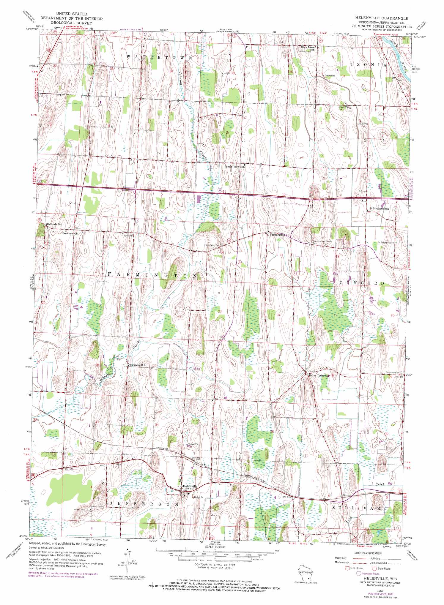
Helenville Topo Map Wisconsin
To zoom in, hover over the map of Helenville
USGS Topo Quad 43088a6 - 1:24,000 scale
| Topo Map Name: | Helenville |
| USGS Topo Quad ID: | 43088a6 |
| Print Size: | ca. 21 1/4" wide x 27" high |
| Southeast Coordinates: | 43° N latitude / 88.625° W longitude |
| Map Center Coordinates: | 43.0625° N latitude / 88.6875° W longitude |
| U.S. State: | WI |
| Filename: | o43088a6.jpg |
| Download Map JPG Image: | Helenville topo map 1:24,000 scale |
| Map Type: | Topographic |
| Topo Series: | 7.5´ |
| Map Scale: | 1:24,000 |
| Source of Map Images: | United States Geological Survey (USGS) |
| Alternate Map Versions: |
Helenville WI 1959, updated 1961 Download PDF Buy paper map Helenville WI 1959, updated 1972 Download PDF Buy paper map Helenville WI 2010 Download PDF Buy paper map Helenville WI 2013 Download PDF Buy paper map Helenville WI 2015 Download PDF Buy paper map |
1:24,000 Topo Quads surrounding Helenville
Astigo |
Reeseville |
Clyman |
Hustisford |
Hartford West |
Waterloo |
Richwood |
Watertown |
Ixonia |
Stonebank |
Lake Mills |
Jefferson |
Helenville |
Oconomowoc West |
Oconomowoc East |
Busseyville |
Fort Atkinson |
Rome |
Palmyra |
Eagle |
Milton |
Lima Center |
Whitewater |
Little Prairie |
East Troy |
> Back to 43088a1 at 1:100,000 scale
> Back to 43088a1 at 1:250,000 scale
> Back to U.S. Topo Maps home
Helenville topo map: Gazetteer
Helenville: Airports
J-3 Cub Field elevation 264m 866′Helenville: Populated Places
Farmington elevation 267m 875′Helenville elevation 257m 843′
Helenville digital topo map on disk
Buy this Helenville topo map showing relief, roads, GPS coordinates and other geographical features, as a high-resolution digital map file on DVD: