Sussex Topo Map Wisconsin
To zoom in, hover over the map of Sussex
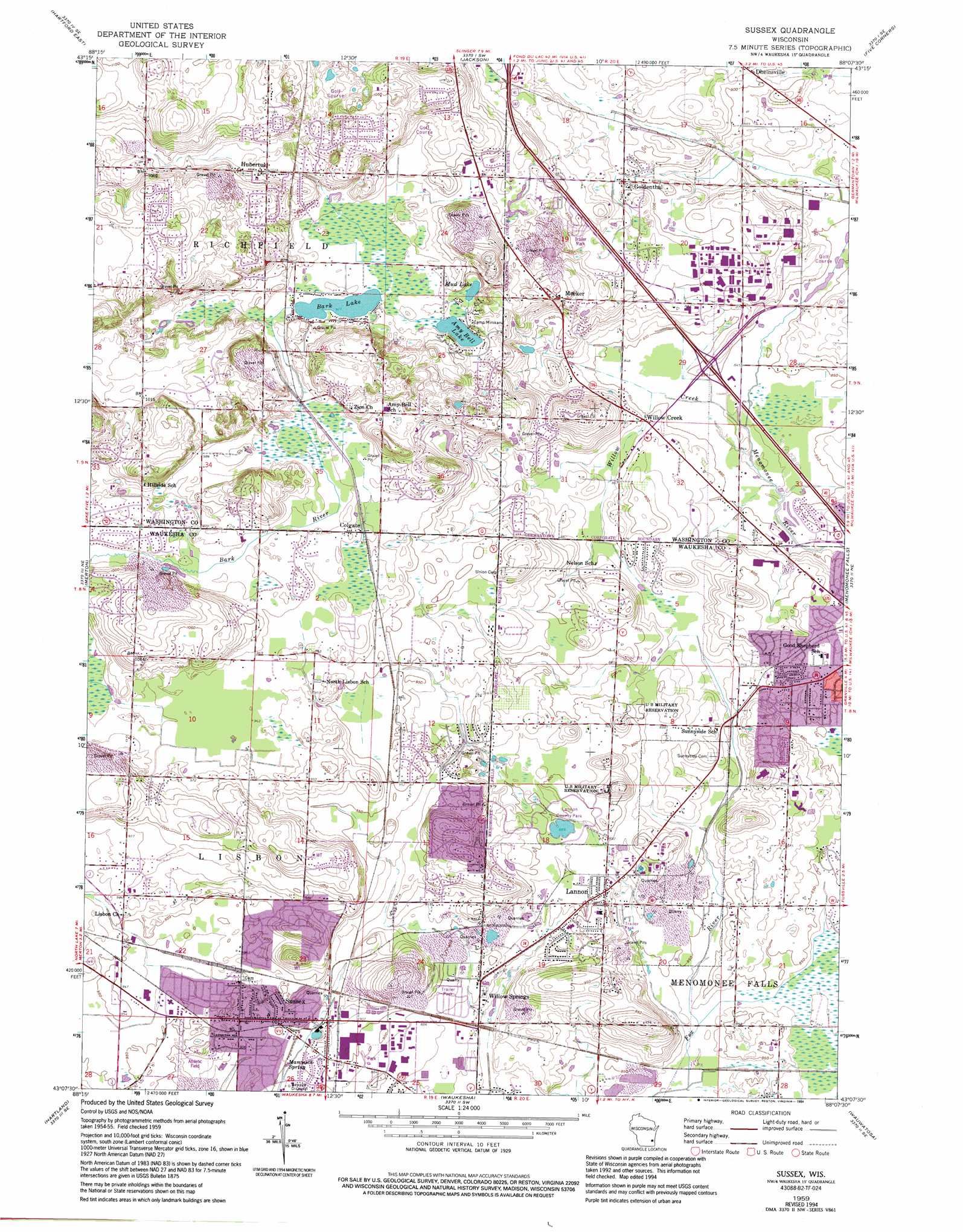
USGS Topo Quad 43088b2 - 1:24,000 scale
| Topo Map Name: | Sussex |
| USGS Topo Quad ID: | 43088b2 |
| Print Size: | ca. 21 1/4" wide x 27" high |
| Southeast Coordinates: | 43.125° N latitude / 88.125° W longitude |
| Map Center Coordinates: | 43.1875° N latitude / 88.1875° W longitude |
| U.S. State: | WI |
| Filename: | o43088b2.jpg |
| Download Map JPG Image: | Sussex topo map 1:24,000 scale |
| Map Type: | Topographic |
| Topo Series: | 7.5´ |
| Map Scale: | 1:24,000 |
| Source of Map Images: | United States Geological Survey (USGS) |
| Alternate Map Versions: |
Sussex WI 1959, updated 1961 Download PDF Buy paper map Sussex WI 1959, updated 1973 Download PDF Buy paper map Sussex WI 1959, updated 1982 Download PDF Buy paper map Sussex WI 1959, updated 1994 Download PDF Buy paper map Sussex WI 2010 Download PDF Buy paper map Sussex WI 2013 Download PDF Buy paper map Sussex WI 2015 Download PDF Buy paper map |
1:24,000 Topo Quads surrounding Sussex
Nenno |
Allenton |
West Bend |
Newburg |
Port Washington West |
Hartford West |
Hartford East |
Jackson |
Five Corners |
Cedarburg |
Stonebank |
Merton |
Sussex |
Menomonee Falls |
Thiensville |
Oconomowoc East |
Hartland |
Waukesha |
Wauwatosa |
Milwaukee |
Eagle |
Genesee |
Muskego |
Hales Corners |
Greendale |
> Back to 43088a1 at 1:100,000 scale
> Back to 43088a1 at 1:250,000 scale
> Back to U.S. Topo Maps home
Sussex topo map: Gazetteer
Sussex: Airports
Willow Creek Airport elevation 265m 869′Sussex: Crossings
Interchange 54 elevation 260m 853′Sussex: Lakes
Amy Bell Lake elevation 297m 974′Bark Lake elevation 296m 971′
Mud Lake elevation 298m 977′
Trout Lake elevation 271m 889′
Sussex: Parks
Homestead Hollow Park elevation 276m 905′Kiwanis Park elevation 257m 843′
Lannon County Park elevation 274m 898′
Lannon Village Park elevation 268m 879′
Schoenlaufen Park elevation 258m 846′
Spring Green Park elevation 271m 889′
Sussex Village Park elevation 282m 925′
Weidenbach Park elevation 264m 866′
Sussex: Populated Places
Colgate elevation 299m 980′Goldenthal elevation 275m 902′
Hubertus elevation 308m 1010′
Lannon elevation 279m 915′
Meeker elevation 304m 997′
Sussex elevation 280m 918′
Willow Creek elevation 259m 849′
Willow Springs elevation 274m 898′
Sussex: Post Offices
Lannon Post Office elevation 278m 912′Sussex Post Office elevation 277m 908′
Sussex: Springs
Mammoth Spring elevation 272m 892′Sussex: Streams
Willow Creek elevation 256m 839′Sussex digital topo map on disk
Buy this Sussex topo map showing relief, roads, GPS coordinates and other geographical features, as a high-resolution digital map file on DVD: