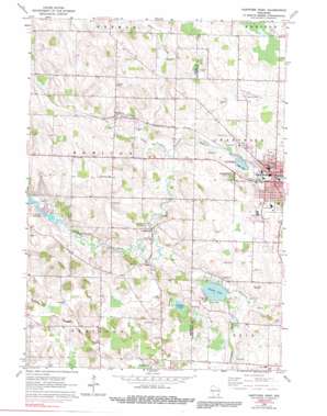
Hartford West Topo Map Wisconsin
To zoom in, hover over the map of Hartford West
USGS Topo Quad 43088c4 - 1:24,000 scale
| Topo Map Name: | Hartford West |
| USGS Topo Quad ID: | 43088c4 |
| Print Size: | ca. 21 1/4" wide x 27" high |
| Southeast Coordinates: | 43.25° N latitude / 88.375° W longitude |
| Map Center Coordinates: | 43.3125° N latitude / 88.4375° W longitude |
| U.S. State: | WI |
| Filename: | o43088c4.jpg |
| Download Map JPG Image: | Hartford West topo map 1:24,000 scale |
| Map Type: | Topographic |
| Topo Series: | 7.5´ |
| Map Scale: | 1:24,000 |
| Source of Map Images: | United States Geological Survey (USGS) |
| Alternate Map Versions: |
Hartford West WI 1959, updated 1964 Download PDF Buy paper map Hartford West WI 1959, updated 1973 Download PDF Buy paper map Hartford West WI 1959, updated 1991 Download PDF Buy paper map Hartford West WI 2010 Download PDF Buy paper map Hartford West WI 2013 Download PDF Buy paper map Hartford West WI 2015 Download PDF Buy paper map |
1:24,000 Topo Quads surrounding Hartford West
> Back to 43088a1 at 1:100,000 scale
> Back to 43088a1 at 1:250,000 scale
> Back to U.S. Topo Maps home
Hartford West topo map: Gazetteer
Hartford West: Airports
Hartford Municipal Airport elevation 321m 1053′Hartford West: Bridges
Bridge 900 elevation 272m 892′Hartford West: Dams
Hartford 1855C14 Dam elevation 300m 984′Hartford West: Lakes
Collins Lake elevation 287m 941′Hartford West: Parks
West Park elevation 293m 961′Hartford West: Populated Places
Hartford elevation 299m 980′Rubicon elevation 307m 1007′
Saylesville elevation 282m 925′
Hartford West: Post Offices
Hartford Post Office elevation 303m 994′Hartford West: Reservoirs
Druid Lake elevation 296m 971′Hartford Millpond 32 elevation 300m 984′
Hartford West: Streams
Butler Creek elevation 283m 928′Hartford West digital topo map on disk
Buy this Hartford West topo map showing relief, roads, GPS coordinates and other geographical features, as a high-resolution digital map file on DVD:


