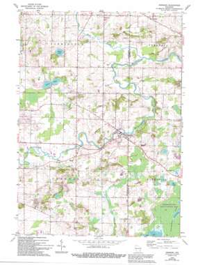
Newburg Topo Map Wisconsin
To zoom in, hover over the map of Newburg
USGS Topo Quad 43088d1 - 1:24,000 scale
| Topo Map Name: | Newburg |
| USGS Topo Quad ID: | 43088d1 |
| Print Size: | ca. 21 1/4" wide x 27" high |
| Southeast Coordinates: | 43.375° N latitude / 88° W longitude |
| Map Center Coordinates: | 43.4375° N latitude / 88.0625° W longitude |
| U.S. State: | WI |
| Filename: | o43088d1.jpg |
| Download Map JPG Image: | Newburg topo map 1:24,000 scale |
| Map Type: | Topographic |
| Topo Series: | 7.5´ |
| Map Scale: | 1:24,000 |
| Source of Map Images: | United States Geological Survey (USGS) |
| Alternate Map Versions: |
Newburg WI 1959, updated 1964 Download PDF Buy paper map Newburg WI 1959, updated 1972 Download PDF Buy paper map Newburg WI 1959, updated 1990 Download PDF Buy paper map Newburg WI 1959, updated 1994 Download PDF Buy paper map Newburg WI 2010 Download PDF Buy paper map Newburg WI 2013 Download PDF Buy paper map Newburg WI 2015 Download PDF Buy paper map |
1:24,000 Topo Quads surrounding Newburg
> Back to 43088a1 at 1:100,000 scale
> Back to 43088a1 at 1:250,000 scale
> Back to U.S. Topo Maps home
Newburg topo map: Gazetteer
Newburg: Dams
Newburg Dam elevation 263m 862′Newburg: Lakes
Erler Lake elevation 253m 830′Gough Lake elevation 266m 872′
Green Lake elevation 264m 866′
Horn Lake elevation 264m 866′
Long Lake elevation 264m 866′
Newburg: Parks
Cedarburg Beech Woods State Natural Area elevation 286m 938′Cedarburg Bog State Natural Area elevation 265m 869′
Riveredge Creek And Ephemeral Pond State Nature Preserve elevation 259m 849′
Sapa Spruce Bog State Natural Area elevation 267m 875′
Newburg: Populated Places
Cheeseville elevation 272m 892′Fillmore elevation 257m 843′
Kohler elevation 264m 866′
Myra elevation 266m 872′
Newburg elevation 258m 846′
Newburg: Reservoirs
Newburg Pond 243 elevation 263m 862′Newburg: Streams
North Branch Milwaukee River elevation 241m 790′Newburg: Swamps
Cedarburg Bog elevation 264m 866′Newburg digital topo map on disk
Buy this Newburg topo map showing relief, roads, GPS coordinates and other geographical features, as a high-resolution digital map file on DVD:


