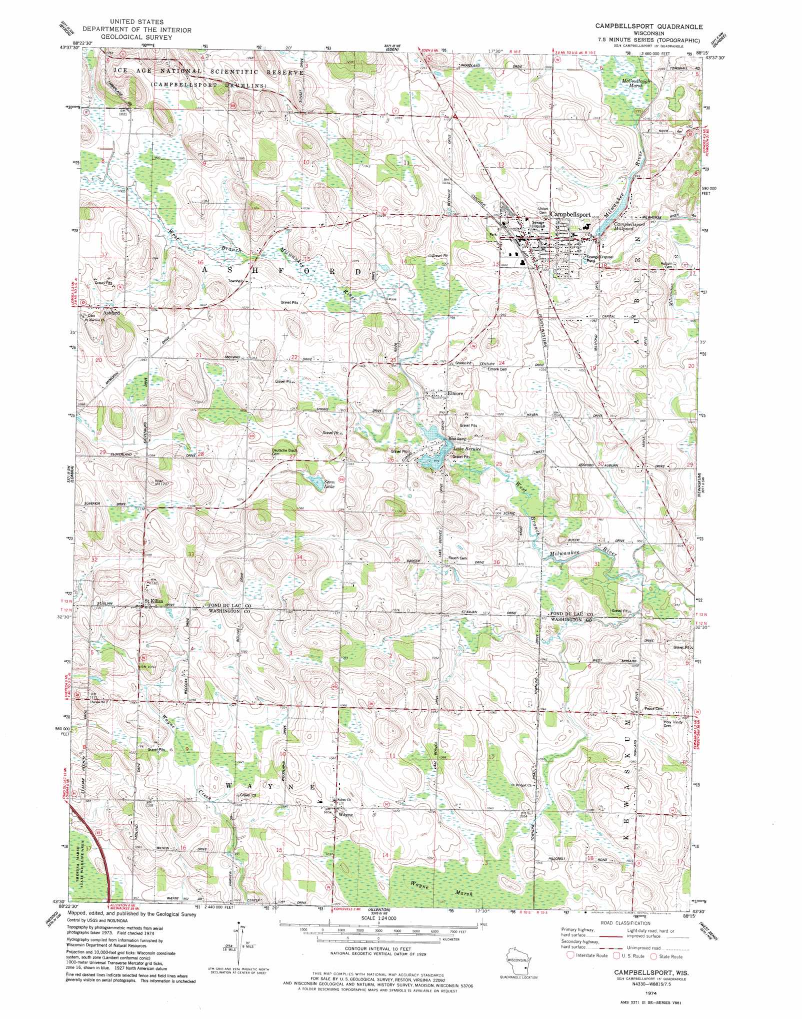
Campbellsport Topo Map Wisconsin
To zoom in, hover over the map of Campbellsport
USGS Topo Quad 43088e3 - 1:24,000 scale
| Topo Map Name: | Campbellsport |
| USGS Topo Quad ID: | 43088e3 |
| Print Size: | ca. 21 1/4" wide x 27" high |
| Southeast Coordinates: | 43.5° N latitude / 88.25° W longitude |
| Map Center Coordinates: | 43.5625° N latitude / 88.3125° W longitude |
| U.S. State: | WI |
| Filename: | o43088e3.jpg |
| Download Map JPG Image: | Campbellsport topo map 1:24,000 scale |
| Map Type: | Topographic |
| Topo Series: | 7.5´ |
| Map Scale: | 1:24,000 |
| Source of Map Images: | United States Geological Survey (USGS) |
| Alternate Map Versions: |
Campbellsport WI 1974, updated 1978 Download PDF Buy paper map Campbellsport WI 2010 Download PDF Buy paper map Campbellsport WI 2013 Download PDF Buy paper map Campbellsport WI 2015 Download PDF Buy paper map |
1:24,000 Topo Quads surrounding Campbellsport
Eldorado |
Fond Du Lac |
Saint Peter |
Saint Cloud |
Elkhart Lake |
Oakfield |
Byron |
Eden |
Dundee |
Cascade |
Mayville North |
Lomira |
Campbellsport |
Kewaskum |
Batavia |
Mayville South |
Nenno |
Allenton |
West Bend |
Newburg |
Hustisford |
Hartford West |
Hartford East |
Jackson |
Five Corners |
> Back to 43088e1 at 1:100,000 scale
> Back to 43088a1 at 1:250,000 scale
> Back to U.S. Topo Maps home
Campbellsport topo map: Gazetteer
Campbellsport: Dams
Campbellsport Dam elevation 299m 980′Schrauths Mill Dam elevation 297m 974′
Campbellsport: Lakes
Senn Lake elevation 315m 1033′Campbellsport: Parks
Columbus Park elevation 302m 990′Firemans Park elevation 319m 1046′
Campbellsport: Populated Places
Ashford elevation 319m 1046′Campbellsport elevation 314m 1030′
Elmore elevation 313m 1026′
Saint Kilian elevation 346m 1135′
Wayne elevation 320m 1049′
Campbellsport: Reservoirs
Bernice Lake 31 elevation 297m 974′Campbellsport Millpond elevation 299m 980′
Campbellsport Millpond 54 elevation 305m 1000′
Lake Bernice elevation 296m 971′
Campbellsport digital topo map on disk
Buy this Campbellsport topo map showing relief, roads, GPS coordinates and other geographical features, as a high-resolution digital map file on DVD: