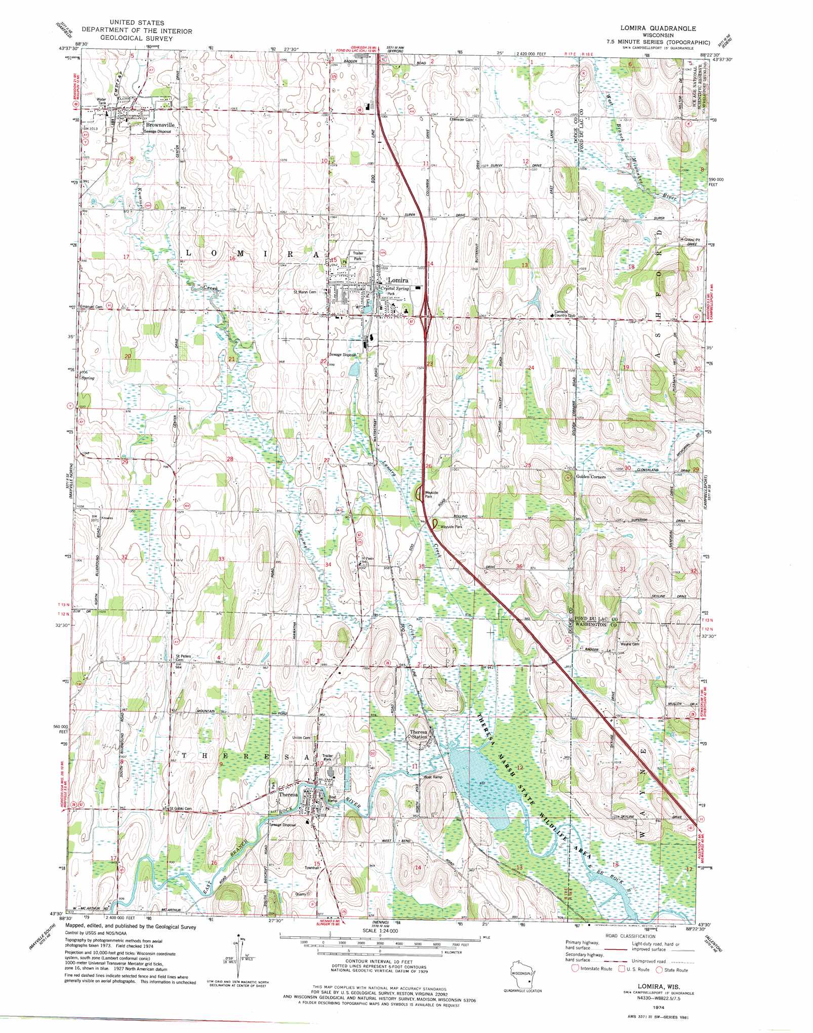
Lomira Topo Map Wisconsin
To zoom in, hover over the map of Lomira
USGS Topo Quad 43088e4 - 1:24,000 scale
| Topo Map Name: | Lomira |
| USGS Topo Quad ID: | 43088e4 |
| Print Size: | ca. 21 1/4" wide x 27" high |
| Southeast Coordinates: | 43.5° N latitude / 88.375° W longitude |
| Map Center Coordinates: | 43.5625° N latitude / 88.4375° W longitude |
| U.S. State: | WI |
| Filename: | o43088e4.jpg |
| Download Map JPG Image: | Lomira topo map 1:24,000 scale |
| Map Type: | Topographic |
| Topo Series: | 7.5´ |
| Map Scale: | 1:24,000 |
| Source of Map Images: | United States Geological Survey (USGS) |
| Alternate Map Versions: |
Lomira WI 1974, updated 1978 Download PDF Buy paper map Lomira WI 2010 Download PDF Buy paper map Lomira WI 2013 Download PDF Buy paper map Lomira WI 2015 Download PDF Buy paper map |
1:24,000 Topo Quads surrounding Lomira
Rosendale |
Eldorado |
Fond Du Lac |
Saint Peter |
Saint Cloud |
Waupun North |
Oakfield |
Byron |
Eden |
Dundee |
Waupun South |
Mayville North |
Lomira |
Campbellsport |
Kewaskum |
Horicon |
Mayville South |
Nenno |
Allenton |
West Bend |
Clyman |
Hustisford |
Hartford West |
Hartford East |
Jackson |
> Back to 43088e1 at 1:100,000 scale
> Back to 43088a1 at 1:250,000 scale
> Back to U.S. Topo Maps home
Lomira topo map: Gazetteer
Lomira: Crossings
Interchange 81 elevation 293m 961′Interchange 85 elevation 312m 1023′
Interchange 87 elevation 324m 1062′
Lomira: Dams
Theresa Marsh 2WP2537 Dam elevation 285m 935′Lomira: Parks
Sterr Park elevation 314m 1030′Theresa Marsh State Wildlife Area elevation 284m 931′
Lomira: Populated Places
Brownsville elevation 304m 997′Lomira elevation 321m 1053′
Theresa elevation 294m 964′
Theresa Station elevation 287m 941′
Lomira: Reservoirs
144 Reservoir elevation 285m 935′Lomira: Springs
Crystal Spring elevation 310m 1017′Lomira: Streams
Kummel Creek elevation 284m 931′Lomira Creek elevation 284m 931′
Lomira digital topo map on disk
Buy this Lomira topo map showing relief, roads, GPS coordinates and other geographical features, as a high-resolution digital map file on DVD: