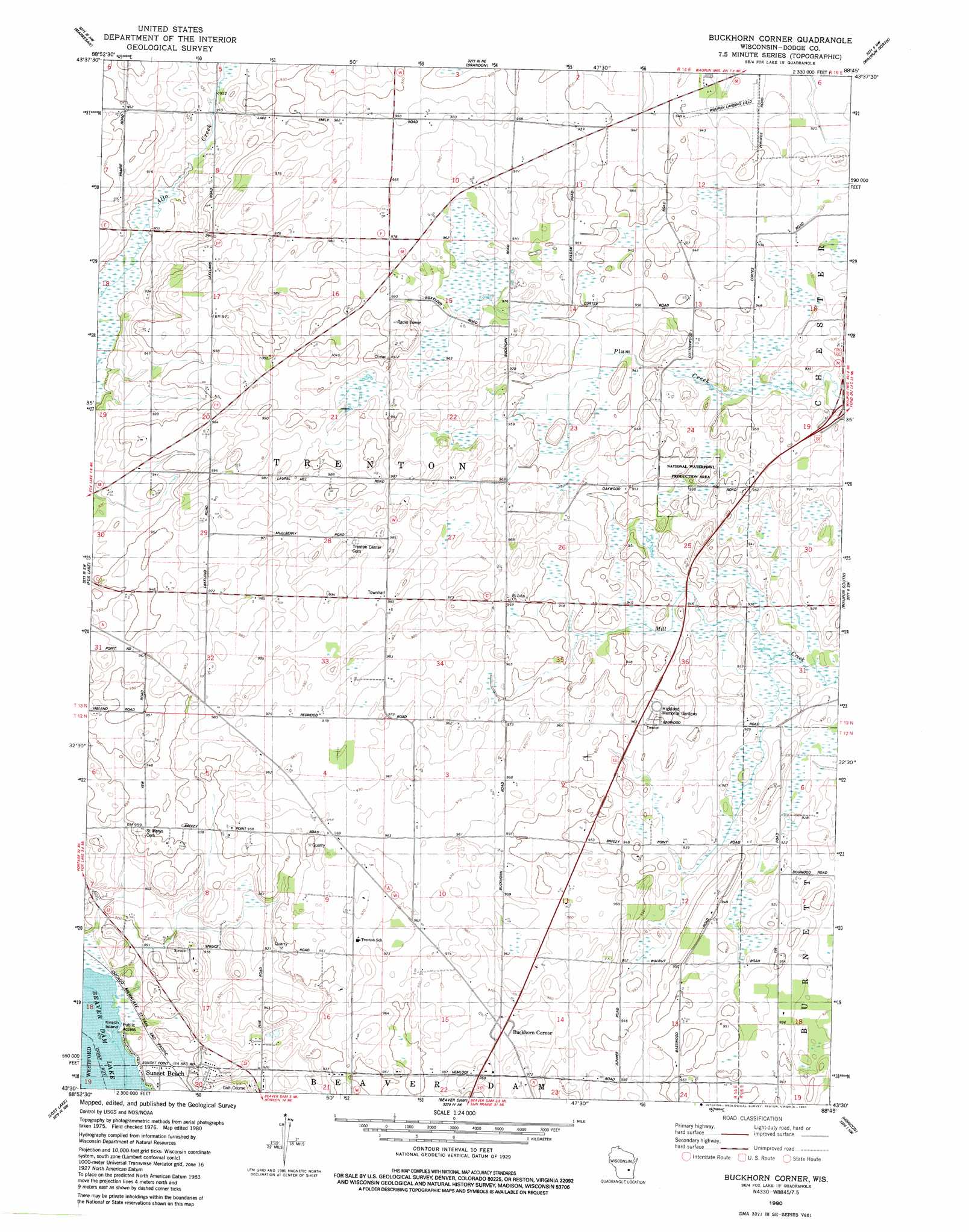
Buckhorn Corner Topo Map Wisconsin
To zoom in, hover over the map of Buckhorn Corner
USGS Topo Quad 43088e7 - 1:24,000 scale
| Topo Map Name: | Buckhorn Corner |
| USGS Topo Quad ID: | 43088e7 |
| Print Size: | ca. 21 1/4" wide x 27" high |
| Southeast Coordinates: | 43.5° N latitude / 88.75° W longitude |
| Map Center Coordinates: | 43.5625° N latitude / 88.8125° W longitude |
| U.S. State: | WI |
| Filename: | o43088e7.jpg |
| Download Map JPG Image: | Buckhorn Corner topo map 1:24,000 scale |
| Map Type: | Topographic |
| Topo Series: | 7.5´ |
| Map Scale: | 1:24,000 |
| Source of Map Images: | United States Geological Survey (USGS) |
| Alternate Map Versions: |
Buckhorn Corner WI 1980, updated 1981 Download PDF Buy paper map Buckhorn Corner WI 2010 Download PDF Buy paper map Buckhorn Corner WI 2013 Download PDF Buy paper map Buckhorn Corner WI 2015 Download PDF Buy paper map |
1:24,000 Topo Quads surrounding Buckhorn Corner
Princeton East |
Green Lake |
Ripon |
Rosendale |
Eldorado |
Manchester |
Markesan |
Brandon |
Waupun North |
Oakfield |
Randolph |
Fox Lake |
Buckhorn Corner |
Waupun South |
Mayville North |
Fall River |
Lost Lake |
Beaver Dam |
Horicon |
Mayville South |
Columbus |
Astigo |
Reeseville |
Clyman |
Hustisford |
> Back to 43088e1 at 1:100,000 scale
> Back to 43088a1 at 1:250,000 scale
> Back to U.S. Topo Maps home
Buckhorn Corner topo map: Gazetteer
Buckhorn Corner: Airports
Waupun Airport elevation 284m 931′Buckhorn Corner: Islands
Kirsch Island elevation 267m 875′Buckhorn Corner: Populated Places
Buckhorn Corner elevation 293m 961′Sunset Beach elevation 265m 869′
Buckhorn Corner digital topo map on disk
Buy this Buckhorn Corner topo map showing relief, roads, GPS coordinates and other geographical features, as a high-resolution digital map file on DVD: