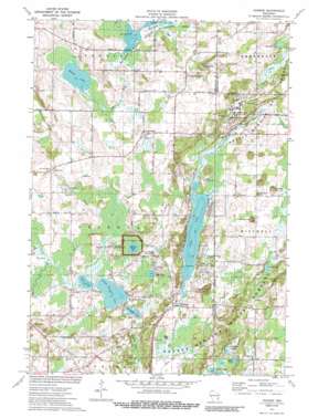
Dundee Topo Map Wisconsin
To zoom in, hover over the map of Dundee
USGS Topo Quad 43088f2 - 1:24,000 scale
| Topo Map Name: | Dundee |
| USGS Topo Quad ID: | 43088f2 |
| Print Size: | ca. 21 1/4" wide x 27" high |
| Southeast Coordinates: | 43.625° N latitude / 88.125° W longitude |
| Map Center Coordinates: | 43.6875° N latitude / 88.1875° W longitude |
| U.S. State: | WI |
| Filename: | o43088f2.jpg |
| Download Map JPG Image: | Dundee topo map 1:24,000 scale |
| Map Type: | Topographic |
| Topo Series: | 7.5´ |
| Map Scale: | 1:24,000 |
| Source of Map Images: | United States Geological Survey (USGS) |
| Alternate Map Versions: |
Dundee WI 1974, updated 1977 Download PDF Buy paper map Dundee WI 1974, updated 1989 Download PDF Buy paper map Dundee WI 1999, updated 2001 Download PDF Buy paper map Dundee WI 2010 Download PDF Buy paper map Dundee WI 2013 Download PDF Buy paper map Dundee WI 2015 Download PDF Buy paper map |
1:24,000 Topo Quads surrounding Dundee
> Back to 43088e1 at 1:100,000 scale
> Back to 43088a1 at 1:250,000 scale
> Back to U.S. Topo Maps home
Dundee topo map: Gazetteer
Dundee: Airports
Kettle Moraine Airport elevation 316m 1036′Dundee: Dams
Dundee Dam elevation 308m 1010′Dundee: Lakes
Bear Lake elevation 315m 1033′Birchwood Lake elevation 310m 1017′
Butler Lake elevation 317m 1040′
Camp Long Lake elevation 316m 1036′
Cedar Lake elevation 313m 1026′
Cedar Lake elevation 308m 1010′
Kellings Lakes elevation 309m 1013′
Kettle Moraine Lake elevation 312m 1023′
Little Round Lake elevation 316m 1036′
Mud Lake elevation 312m 1023′
Mullet Lake elevation 314m 1030′
Spruce Lake elevation 312m 1023′
Dundee: Parks
Butler Lake and Flynn's Spring State Natural Area elevation 320m 1049′Crooked Lake Wetlands State Natural Area elevation 308m 1010′
Long Lake Recreation Area elevation 320m 1049′
Milwaukee River Tamarack Lowlands and Dundee Kame State Natural Area elevation 302m 990′
Mullet River State Wildlife Area elevation 309m 1013′
Spruce Lake Bog State Natural Area elevation 312m 1023′
Dundee: Populated Places
Armstrong elevation 328m 1076′Dundee elevation 375m 1230′
Graham Corners elevation 320m 1049′
Dundee: Reservoirs
Long Lake elevation 307m 1007′Long Lake 13.4 elevation 308m 1010′
Dundee: Ridges
Parnell Esker elevation 320m 1049′Dundee: Springs
Flynns Spring elevation 317m 1040′Dundee: Streams
Watercress Creek elevation 307m 1007′Dundee: Summits
Conner Hill elevation 361m 1184′Dundee Mountain elevation 374m 1227′
Garriety Hill elevation 344m 1128′
McMullen Hill elevation 355m 1164′
Dundee digital topo map on disk
Buy this Dundee topo map showing relief, roads, GPS coordinates and other geographical features, as a high-resolution digital map file on DVD:


