Pickett Topo Map Wisconsin
To zoom in, hover over the map of Pickett
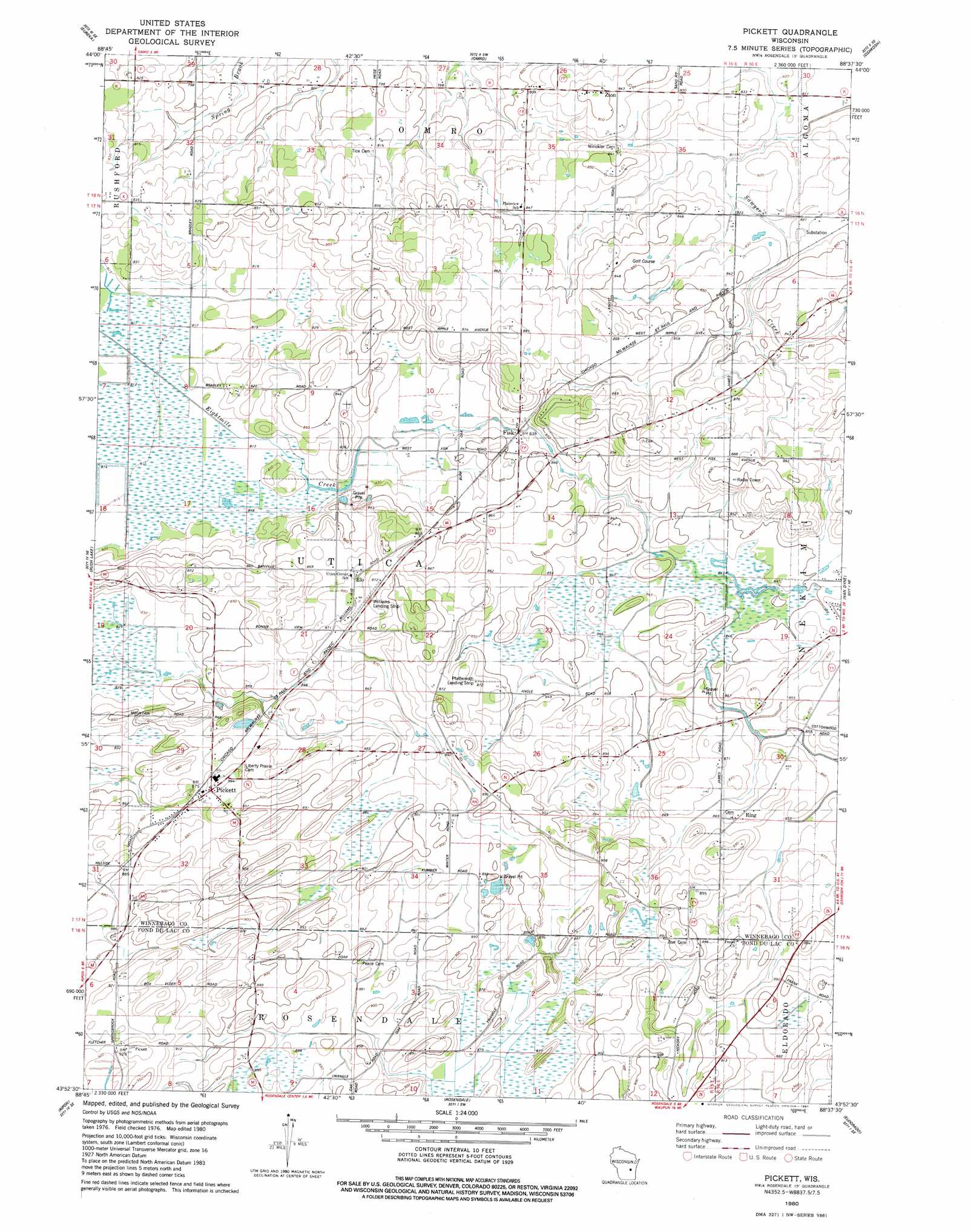
USGS Topo Quad 43088h6 - 1:24,000 scale
| Topo Map Name: | Pickett |
| USGS Topo Quad ID: | 43088h6 |
| Print Size: | ca. 21 1/4" wide x 27" high |
| Southeast Coordinates: | 43.875° N latitude / 88.625° W longitude |
| Map Center Coordinates: | 43.9375° N latitude / 88.6875° W longitude |
| U.S. State: | WI |
| Filename: | o43088h6.jpg |
| Download Map JPG Image: | Pickett topo map 1:24,000 scale |
| Map Type: | Topographic |
| Topo Series: | 7.5´ |
| Map Scale: | 1:24,000 |
| Source of Map Images: | United States Geological Survey (USGS) |
| Alternate Map Versions: |
Pickett WI 1980, updated 1981 Download PDF Buy paper map Pickett WI 2010 Download PDF Buy paper map Pickett WI 2013 Download PDF Buy paper map Pickett WI 2015 Download PDF Buy paper map |
1:24,000 Topo Quads surrounding Pickett
Poy Sippi |
Lake Poygan |
Oshkosh Nw |
Oshkosh Ne |
Neenah |
Auroraville |
Eureka |
Omro |
Oshkosh |
Indian Point |
Berlin |
Rush Lake |
Pickett |
Van Dyne |
Fahrney Point |
Green Lake |
Ripon |
Rosendale |
Eldorado |
Fond Du Lac |
Markesan |
Brandon |
Waupun North |
Oakfield |
Byron |
> Back to 43088e1 at 1:100,000 scale
> Back to 43088a1 at 1:250,000 scale
> Back to U.S. Topo Maps home
Pickett topo map: Gazetteer
Pickett: Airports
Pfaffenroth Private Airport elevation 258m 846′Williams Airport elevation 267m 875′
Pickett: Populated Places
Elo elevation 269m 882′Fisk elevation 253m 830′
Pickett elevation 271m 889′
Ring elevation 266m 872′
Zion elevation 258m 846′
Pickett digital topo map on disk
Buy this Pickett topo map showing relief, roads, GPS coordinates and other geographical features, as a high-resolution digital map file on DVD: