Deerfield Topo Map Wisconsin
To zoom in, hover over the map of Deerfield
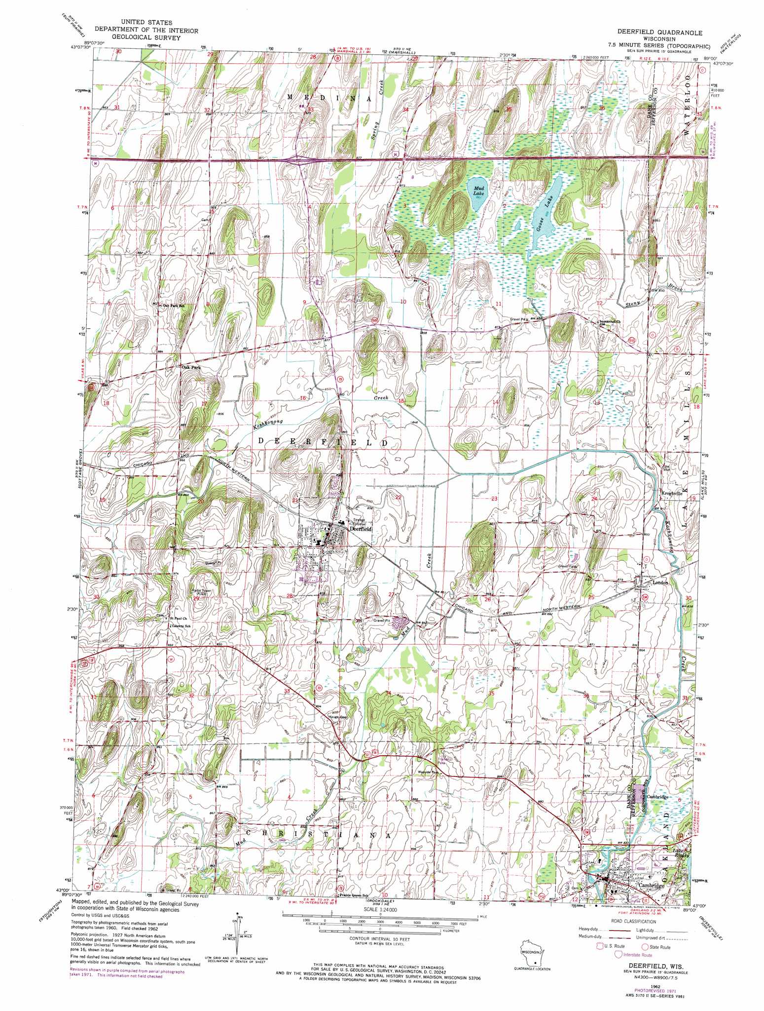
USGS Topo Quad 43089a1 - 1:24,000 scale
| Topo Map Name: | Deerfield |
| USGS Topo Quad ID: | 43089a1 |
| Print Size: | ca. 21 1/4" wide x 27" high |
| Southeast Coordinates: | 43° N latitude / 89° W longitude |
| Map Center Coordinates: | 43.0625° N latitude / 89.0625° W longitude |
| U.S. State: | WI |
| Filename: | o43089a1.jpg |
| Download Map JPG Image: | Deerfield topo map 1:24,000 scale |
| Map Type: | Topographic |
| Topo Series: | 7.5´ |
| Map Scale: | 1:24,000 |
| Source of Map Images: | United States Geological Survey (USGS) |
| Alternate Map Versions: |
Deerfield WI 1962, updated 1964 Download PDF Buy paper map Deerfield WI 1962, updated 1972 Download PDF Buy paper map Deerfield WI 2010 Download PDF Buy paper map Deerfield WI 2013 Download PDF Buy paper map Deerfield WI 2016 Download PDF Buy paper map |
1:24,000 Topo Quads surrounding Deerfield
Morrisonville |
North Bristol |
Columbus |
Astigo |
Reeseville |
De Forest |
Sun Prairie |
Marshall |
Waterloo |
Richwood |
Madison East |
Cottage Grove |
Deerfield |
Lake Mills |
Jefferson |
Rutland |
Stoughton |
Rockdale |
Busseyville |
Fort Atkinson |
Evansville |
Cooksville |
Edgerton |
Milton |
Lima Center |
> Back to 43089a1 at 1:100,000 scale
> Back to 43088a1 at 1:250,000 scale
> Back to U.S. Topo Maps home
Deerfield topo map: Gazetteer
Deerfield: Lakes
Goose Lake elevation 261m 856′Mud Lake elevation 262m 859′
Deerfield: Parks
Goose Lake Drumlins State Natural Area elevation 267m 875′Goose Lake State Wildlife Area elevation 265m 869′
Deerfield: Populated Places
Cambridge elevation 259m 849′Deerfield elevation 267m 875′
Kroghville elevation 261m 856′
London elevation 266m 872′
Old Deerfield elevation 267m 875′
Deerfield: Streams
Mud Creek elevation 256m 839′Deerfield digital topo map on disk
Buy this Deerfield topo map showing relief, roads, GPS coordinates and other geographical features, as a high-resolution digital map file on DVD: