Sun Prairie Topo Map Wisconsin
To zoom in, hover over the map of Sun Prairie
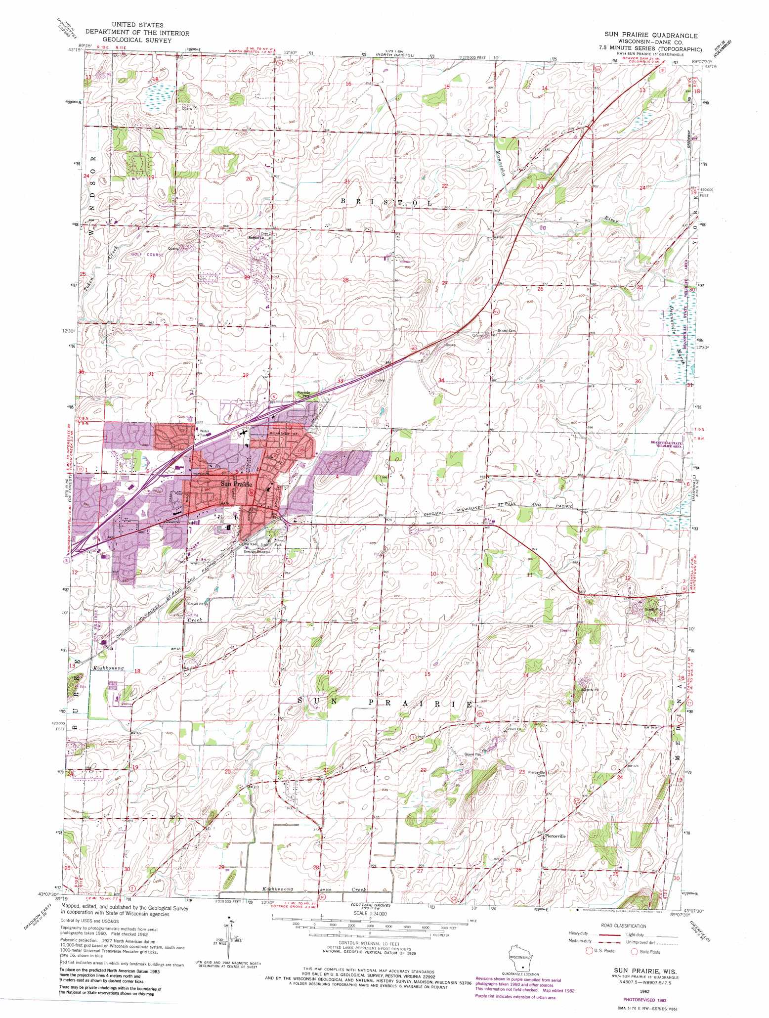
USGS Topo Quad 43089b2 - 1:24,000 scale
| Topo Map Name: | Sun Prairie |
| USGS Topo Quad ID: | 43089b2 |
| Print Size: | ca. 21 1/4" wide x 27" high |
| Southeast Coordinates: | 43.125° N latitude / 89.125° W longitude |
| Map Center Coordinates: | 43.1875° N latitude / 89.1875° W longitude |
| U.S. State: | WI |
| Filename: | o43089b2.jpg |
| Download Map JPG Image: | Sun Prairie topo map 1:24,000 scale |
| Map Type: | Topographic |
| Topo Series: | 7.5´ |
| Map Scale: | 1:24,000 |
| Source of Map Images: | United States Geological Survey (USGS) |
| Alternate Map Versions: |
Sun Prairie WI 1962, updated 1964 Download PDF Buy paper map Sun Prairie WI 1962, updated 1970 Download PDF Buy paper map Sun Prairie WI 1962, updated 1975 Download PDF Buy paper map Sun Prairie WI 1962, updated 1983 Download PDF Buy paper map Sun Prairie WI 1962, updated 1983 Download PDF Buy paper map Sun Prairie WI 2010 Download PDF Buy paper map Sun Prairie WI 2013 Download PDF Buy paper map Sun Prairie WI 2016 Download PDF Buy paper map |
1:24,000 Topo Quads surrounding Sun Prairie
Poynette |
Wyocena |
Rio |
Fall River |
Lost Lake |
Arlington |
Morrisonville |
North Bristol |
Columbus |
Astigo |
Waunakee |
De Forest |
Sun Prairie |
Marshall |
Waterloo |
Madison West |
Madison East |
Cottage Grove |
Deerfield |
Lake Mills |
Oregon |
Rutland |
Stoughton |
Rockdale |
Busseyville |
> Back to 43089a1 at 1:100,000 scale
> Back to 43088a1 at 1:250,000 scale
> Back to U.S. Topo Maps home
Sun Prairie topo map: Gazetteer
Sun Prairie: Lakes
Brazee Lake elevation 295m 967′Sun Prairie: Parks
Angel Park elevation 292m 958′Sun Prairie: Populated Places
Burgess Corners elevation 297m 974′Buss's Corners elevation 289m 948′
City View Heights elevation 302m 990′
Drovers Woods elevation 279m 915′
Hilton Estates elevation 304m 997′
Pebble Valley elevation 293m 961′
Pierceville elevation 292m 958′
Prairie View Heights elevation 315m 1033′
Schey Acres elevation 284m 931′
Sherwood Forest Heights elevation 305m 1000′
Sun Prairie elevation 292m 958′
Sun Prairie: Swamps
Brazee Swamp (historical) elevation 293m 961′Sun Prairie digital topo map on disk
Buy this Sun Prairie topo map showing relief, roads, GPS coordinates and other geographical features, as a high-resolution digital map file on DVD: