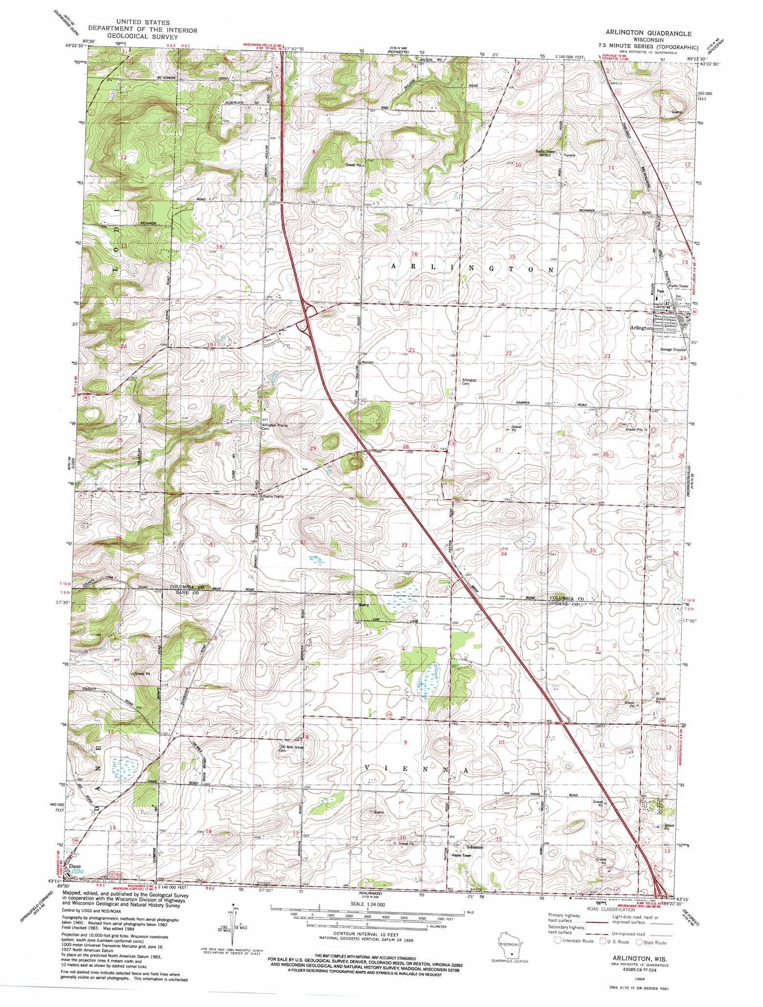
Arlington Topo Map Wisconsin
To zoom in, hover over the map of Arlington
USGS Topo Quad 43089c4 - 1:24,000 scale
| Topo Map Name: | Arlington |
| USGS Topo Quad ID: | 43089c4 |
| Print Size: | ca. 21 1/4" wide x 27" high |
| Southeast Coordinates: | 43.25° N latitude / 89.375° W longitude |
| Map Center Coordinates: | 43.3125° N latitude / 89.4375° W longitude |
| U.S. State: | WI |
| Filename: | o43089c4.jpg |
| Download Map JPG Image: | Arlington topo map 1:24,000 scale |
| Map Type: | Topographic |
| Topo Series: | 7.5´ |
| Map Scale: | 1:24,000 |
| Source of Map Images: | United States Geological Survey (USGS) |
| Alternate Map Versions: |
Arlington WI 1984, updated 1984 Download PDF Buy paper map Arlington WI 2010 Download PDF Buy paper map Arlington WI 2013 Download PDF Buy paper map Arlington WI 2016 Download PDF Buy paper map |
1:24,000 Topo Quads surrounding Arlington
Lewiston |
Pine Island |
Portage |
Pardeeville |
Sand Spring Creek |
Baraboo |
Durwards Glen |
Poynette |
Wyocena |
Rio |
Sauk City |
Lodi |
Arlington |
Morrisonville |
North Bristol |
Black Earth |
Springfield Corners |
Waunakee |
De Forest |
Sun Prairie |
Cross Plains |
Middleton |
Madison West |
Madison East |
Cottage Grove |
> Back to 43089a1 at 1:100,000 scale
> Back to 43088a1 at 1:250,000 scale
> Back to U.S. Topo Maps home
Arlington digital topo map on disk
Buy this Arlington topo map showing relief, roads, GPS coordinates and other geographical features, as a high-resolution digital map file on DVD: